Loynton Moss

Last updated
Loynton Moss
Reed bed, formerly Blakemere Pool - geograph.org.uk - 254655.jpg
Reed bed (formerly Blakemerly Pool) in Loynton Moss
Staffordshire UK location map.svg
Red pog.svg
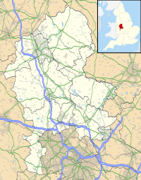
Location in Staffordshire
Locationnear Woodseaves, Staffordshire
OS grid SJ 788 246
Coordinates 52°49′08″N2°18′50″W / 52.819°N 2.314°W / 52.819; -2.314
Area13 hectares (32 acres)
Operated by Staffordshire Wildlife Trust
Designation Site of Special Scientific Interest
Website www.staffs-wildlife.org.uk/nature-reserves/loynton-moss

Loynton Moss is a nature reserve of the Staffordshire Wildlife Trust, near the village of Woodseaves, in Staffordshire, England. It is adjacent to the Shropshire Union Canal, as it runs from nearby Norbury to High Offley.

Contents

Description

The area of the reserve is 13 hectares (32 acres), and it is designated a Site of Special Scientific Interest. There are walking trails, except in the mostly inaccessible areas of reedbed and wet woodland. There are mosquitoes in the wetter areas during the summer, which may deter visitors. [1]

Geology

The particular landscape is a result of a process after the last ice age. A kettle hole was formed by dead ice left by retreating glaciers, which became a lake when the ice finally melted. The former lake is now an area of peaty, boggy land, known as a Moss. [1]

Environments

Woodland in Loynton Moss Path through the woods - geograph.org.uk - 1274916.jpg
Woodland in Loynton Moss

There are dry wooded areas, where bluebells can be seen in the spring. [1]

Grassland, acquired by the Trust in 2000, is a large part of the reserve. It is former wetland, drained for agriculture in 1970. [1]

There are areas of reedbed, and wet woodland including an alder carr. Uncommon plants found here include marsh cinquefoil and cowbane. Moths, butterflies and many species of rare insects can be found in the wetland. Birds such as willow warbler and reed bunting are attracted by the particular insects in this habitat. [1]

Birch trees consume much water during the summer and can affect ground water levels of the wetland, so some have been felled in places. Ditches and land drains are monitored. [1]

Related Research Articles

<span class="mw-page-title-main">Ouse Washes</span> Nature reserve in the United Kingdom

Ouse Washes is a linear 2,513.6-hectare (6,211-acre) biological Site of Special Scientific Interest stretching from near St Ives in Cambridgeshire to Downham Market in Norfolk. It is also a Ramsar internationally important wetland site, a Special Protection Area for birds, a Special Area of Conservation and a Nature Conservation Review site, Grade I. An area of 186 hectares between March and Ely is managed by the Wildlife Trust for Bedfordshire, Cambridgeshire and Northamptonshire and another area near Chatteris is managed by the Royal Society for the Protection of Birds. The Wildfowl & Wetlands Trust manages another area near Welney.

<span class="mw-page-title-main">Staffordshire Wildlife Trust</span> Wildlife trust in Staffordshire, England

The Staffordshire Wildlife Trust (SWT) is a wildlife trust covering the county of Staffordshire, England.

<span class="mw-page-title-main">Grafham Water</span> Reservoir in Cambridgeshire

Grafham Water is an 806.3-hectare (1,992-acre) biological Site of Special Scientific Interest (SSSI) north of Perry, Huntingdonshire. It was designated an SSSI in 1986. It is a reservoir with a circumference of about 16 km (10 mi), is 21 m (69 ft) deep at maximum, and is the eighth largest reservoir in England by volume and the third largest by area at 6.27 km2. An area of 114 ha at the western end is a nature reserve managed by the Wildlife Trust for Bedfordshire, Cambridgeshire and Northamptonshire.

<span class="mw-page-title-main">Cotswold Water Park</span> Lake system and park in England

The Cotswold Water Park is the United Kingdom's largest marl lake system, straddling the Wiltshire–Gloucestershire border, north-west of Cricklade and south of Cirencester. There are 180 lakes, spread over 42 square miles (110 km2).

<span class="mw-page-title-main">Reed bed</span> Habitats formed by reed colonies in floodplains and estuaries

A reedbed or reed bed is a natural habitat found in floodplains, waterlogged depressions and estuaries. Reedbeds are part of a succession from young reeds colonising open water or wet ground through a gradation of increasingly dry ground. As reedbeds age, they build up a considerable litter layer that eventually rises above the water level and that ultimately provides opportunities in the form of new areas for larger terrestrial plants such as shrubs and trees to colonise.

<span class="mw-page-title-main">Delamere Forest</span>

Delamere Forest is a large wood in the village of Delamere in Cheshire, England. The woodland, which is managed by Forestry England, covers an area of 972 hectares making it the largest area of woodland in the county. It contains a mixture of deciduous and evergreen trees.

<span class="mw-page-title-main">Great Fen</span> Habitat restoration project in England

The Great Fen is a habitat restoration project being undertaken on The Fens in the county of Cambridgeshire in England. It is one of the largest restoration projects in the country, and aims to create a 3,700 hectare wetland and aims to connect Woodwalton Fen National Nature Reserve (NNR), Holme Fen NNR and other nature reserves to create a larger site with conservation benefits for wildlife and socio-economic benefits for people.

<span class="mw-page-title-main">Hydrosere</span>

A hydrosere is a plant succession which occurs in an area of fresh water such as in oxbow lakes and kettle lakes. In time, an area of open freshwater will naturally dry out, ultimately becoming woodland. During this change, a range of different landtypes such as swamp and marsh will succeed each other.

Ashford Green Corridor is a green space that runs through the town of Ashford in Kent, England. The Green Corridor is made up of parks, recreation grounds and other green spaces alongside the rivers that flow through Ashford. It is a Local Nature Reserve.

<span class="mw-page-title-main">Westhay Moor</span> Site of Special Scientific Interest

Westhay Moor is a 513.7-hectare (1,269-acre) biological Site of Special Scientific Interest 2.5 kilometres (1.6 mi) north-east of Westhay village and 4 kilometres (2.5 mi) from Wedmore in Somerset, England, notified in 1971. Westhay Moor is also notified as part of the Somerset Levels and Moors Special Protection Area under the EU Birds Directive and as a Ramsar site, and a National Nature Reserve.

<span class="mw-page-title-main">Sevenoaks Gravel Pits</span>

Sevenoaks Gravel Pits is a 73.7-hectare (182-acre) biological Site of Special Scientific Interest on the northern outskirts of Sevenoaks in Kent. It is managed by Kent Wildlife Trust as the Sevenoaks Wildlife Reserve and Jeffery Harrison Visitor Centre.

<span class="mw-page-title-main">Cardiff Bay Wetlands Reserve</span> Tidal marsh preserve in Wales

Cardiff Bay Wetlands Reserve is located in Cardiff Bay in the city of Cardiff. It covers an area of approximately 8 hectares. The area was officially opened as a wildlife reserve on 25 July 2002 in what was previously an area of Site of Special Scientific Interest (SSSI) up until the opening of the Cardiff Bay Barrage in April 2001. The area had previously been salt marsh, but the Barrage created 200 hectares of freshwater lake, and from this the reserve was developed.

Lowland heath is a Biodiversity Action Plan habitat as it is a type of ancient wild landscape. Natural England's Environmental Stewardship scheme describes lowland heath as containing dry heath, wet heath and valley mire communities, usually below 250 metres (820 ft) in altitude, on acidic soils and shallow peat, typically comprising heathers, gorses, fine grasses, wild flowers and lichens in a complex mosaic. Heathers and other dwarf shrubs usually account for at least 25% of the ground cover. By contrast, upland heath, which is above 300 metres (980 ft) in altitude, is called moorland, Dartmoor being an example.

<span class="mw-page-title-main">Croxall Lakes</span> Quarry lake in Staffordshire, United Kingdom

Croxall Lakes is a nature reserve located between the villages of Croxall and Alrewas, Staffordshire, in the United Kingdom. The nature reserve comprises two lakes and grassland between them. The lakes were formed through the quarrying of sand and gravel deposits, these excavations subsequently flooded and were then restored to create the nature reserve. The site is managed by Staffordshire Wildlife Trust and owned by the National Forest Company. The reserve is an important stop off point for a wide variety of migrating birds due to its location at the meeting point of three rivers, the Trent, Tame and Mease.

<span class="mw-page-title-main">Ham Wall</span> Wetland nature reserve in Somerset, England

Ham Wall is an English wetland National Nature Reserve (NNR) 4 kilometres (2.5 mi) west of Glastonbury on the Somerset Levels. It is managed by the Royal Society for the Protection of Birds (RSPB). Since the last Ice Age, decomposing plants in the marshes of the Brue valley in Somerset have accumulated as deep layers of peat that were commercially exploited on a large scale in the twentieth century. Consumer demand eventually declined, and in 1994 the landowners, Fisons, gave their old workings to what is now Natural England, who passed the management of the 260 hectares Ham Wall section to the RSPB.

<span class="mw-page-title-main">Cley Marshes</span> Nature reserve on the North Sea coast of England

Cley Marshes is a 176-hectare (430-acre) nature reserve on the North Sea coast of England just outside the village of Cley next the Sea, Norfolk. A reserve since 1926, it is the oldest of the reserves belonging to the Norfolk Wildlife Trust (NWT), which is itself the oldest county Wildlife Trust in the United Kingdom. Cley Marshes protects an area of reed beds, freshwater marsh, pools and wet meadows and is part of the North Norfolk Coast Site of Special Scientific Interest (SSSI), Special Area of Conservation (SAC), Special Protection Area (SPA), and Ramsar Site due to the large numbers of birds it attracts.

<span class="mw-page-title-main">Sapperton Valley</span>

Sapperton Valley is a 3.7-hectare (9.1-acre) nature reserve near Chalford in the Stroud district of Gloucestershire, England. The site is managed by the Gloucestershire Wildlife Trust under leasing arrangements with the Bathurst Estate, in place since 1964.

<span class="mw-page-title-main">Suffolk Coast National Nature Reserve</span>

Suffolk Coast National Nature Reserve is a wildlife reserve on the North Sea coast of the English county of Suffolk. It is located around the village of Walberswick to the south of the town of Southwold. The reserve was designated in 2003, combining the existing Walberswick National Nature Reserve with reserves at Dingle Marshes and Hen Reedbeds to create a 1,340 hectares reserve.

The Avalon Marshes Partnership is a group of conservation organisations working together in the Somerset Levels. The members are Natural England, the Royal Society for the Protection of Birds (RSPB), the Somerset Wildlife Trust, the Hawk and Owl Trust, Historic England, South West Heritage Trust and the Environment Agency. Between 2012 and 2016 the scheme was supported by a Heritage Lottery Fund grant of £1,772,500 with additional investment of £920,080 from other sources. The Avalon Marshes Centre, run by Natural England, is near the Shapwick Heath reserve. The network of reserves and private land managed for conservation in the Avalon marshes means that wetland management can be carried out on a landscape scale.

<span class="mw-page-title-main">Black Firs and Cranberry Bog</span> Nature reserve in Staffordshire

Black Firs and Cranberry Bog is a nature reserve of the Staffordshire Wildlife Trust, adjacent to Balterley Heath and about 1 mile (1.6 km) north of the village of Betley, in Staffordshire, England.

References

  1. 1 2 3 4 5 6 "Loynton Moss" Staffordshire Wildlife Trust. Retrieved 28 February 2021.