Ložane

Last updated
Ložane
Slovenia location map.svg
Red pog.svg
Ložane
Location in Slovenia
Coordinates: 46°34′16.91″N15°44′14.96″E / 46.5713639°N 15.7374889°E / 46.5713639; 15.7374889 Coordinates: 46°34′16.91″N15°44′14.96″E / 46.5713639°N 15.7374889°E / 46.5713639; 15.7374889
Country Flag of Slovenia.svg Slovenia
Traditional region Styria
Statistical region Drava
Municipality Pesnica
Area
  Total 2.07 km2 (0.80 sq mi)
Elevation 248.8 m (816.3 ft)
Population (2002)
  Total 89
[1]

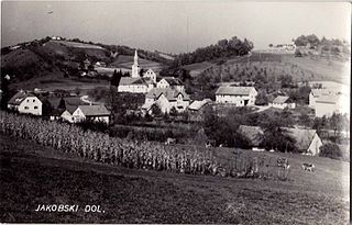
Ložane (pronounced  [ˈloːʒanɛ] ) is a settlement in the Municipality of Pesnica in northeastern Slovenia. It is part of the traditional region of Styria. The entire municipality is now included in the Drava Statistical Region. [2]

Municipality An administrative division having corporate status and usually some powers of self-government or jurisdiction

A municipality is usually a single administrative division having corporate status and powers of self-government or jurisdiction as granted by national and regional laws to which it is subordinate. It is to be distinguished (usually) from the county, which may encompass rural territory or numerous small communities such as towns, villages and hamlets.

Municipality of Pesnica Municipality in Slovenia

The Municipality of Pesnica is a municipality in northeastern Slovenia. The center of the municipality is Pesnica pri Mariboru, a suburb near Maribor. It lies at the western end of the Slovene Hills in the Upper Pesnica Valley. The area was part of the traditional region of Styria. It is now included in the Drava Statistical Region as part of the Pesnica Administrative Unit. The main economic activities in the area are tourism, transportation, viticulture, vinemaking, craftsmanship and farming.

Slovenia republic in Central Europe

Slovenia, officially the Republic of Slovenia, is a sovereign state located in southern Central Europe at a crossroads of important European cultural and trade routes. It is bordered by Italy to the west, Austria to the north, Hungary to the northeast, Croatia to the southeast, and the Adriatic Sea to the southwest. It covers 20,273 square kilometers (7,827 sq mi) and has a population of 2.07 million. One of the successor states of the former Yugoslavia, Slovenia is a parliamentary republic and a member of the United Nations, of the European Union, and of NATO. The capital and largest city is Ljubljana.

Four intact Roman-period burial mounds have been identified near the settlement. [3]

Ancient Rome History of Rome from the 8th-century BC to the 5th-century

In historiography, ancient Rome is Roman civilization from the founding of the Italian city of Rome in the 8th century BC to the collapse of the Western Roman Empire in the 5th century AD, encompassing the Roman Kingdom, Roman Republic and Roman Empire until the fall of the western empire. The civilization began as an Italic settlement in the Italian Peninsula, conventionally founded in 753 BC, that grew into the city of Rome and which subsequently gave its name to the empire over which it ruled and to the widespread civilisation the empire developed. The Roman Empire expanded to become one of the largest empires in the ancient world, though still ruled from the city, with an estimated 50 to 90 million inhabitants and covering 5.0 million square kilometres at its height in AD 117.

Tumulus Mound of earth and stones raised over graves

A tumulus is a mound of earth and stones raised over a grave or graves. Tumuli are also known as barrows, burial mounds or kurgans, and may be found throughout much of the world. A cairn, which is a mound of stones built for various purposes, may also originally have been a tumulus.

Related Research Articles

Dolnja Počehova in Styria, Slovenia

Dolnja Počehova is a settlement in the Municipality of Pesnica in northeastern Slovenia. It lies in the Upper Pesnica Valley. The area was part of the traditional region of Styria. It is now included in the Drava Statistical Region.

Dragučova in Styria, Slovenia

Dragučova is a settlement in the Municipality of Pesnica in northeastern Slovenia. It lies in the hills northeast of Maribor on the edge of the Pesnica Valley. The area was part of the traditional region of Styria. It is now included in the Drava Statistical Region.

Drankovec Place in Styria, Slovenia

Drankovec is a small settlement in the Municipality of Pesnica in northeastern Slovenia. It lies in the western part of the Slovene Hills. The area was part of the traditional region of Styria. It is now included in the Drava Statistical Region.

Gačnik Place in Styria, Slovenia

Gačnik is a settlement in the Municipality of Pesnica in northeastern Slovenia. It lies in the western part of the Slovene Hills in the valley of Gačnik Creek, a minor tributary of the Pesnica River. The area was part of the traditional region of Styria. It is now included in the Drava Statistical Region.

Jelenče Place in Styria, Slovenia

Jelenče is a small settlement in the Municipality of Pesnica in northeastern Slovenia. It lies in the western part of the Slovene Hills. Traditionally the area was part of Styria. The entire municipality is now included in the Drava Statistical Region.

Kušernik Place in Styria, Slovenia

Kušernik is a small settlement in the Municipality of Pesnica in northeastern Slovenia. It lies in the Slovene Hills, part of the traditional region of Styria. The municipality is now included in the Drava Statistical Region.

Mali Dol, Pesnica Place in Styria, Slovenia

Mali Dol is a small settlement in the Slovene Hills in northeastern Slovenia. It lies in the Municipality of Pesnica, part of the traditional region of Styria. The municipality is now included in the Drava Statistical Region.

Pesniški Dvor Place in Styria, Slovenia

Pesniški Dvor is a settlement in the Municipality of Pesnica in northeastern Slovenia. It lies in the Pesnica Valley in the traditional region of Styria. The entire municipality is now included in the Drava Statistical Region.

Počenik Place in Styria, Slovenia

Počenik is a settlement in the Municipality of Pesnica in northeastern Slovenia. It lies in the Slovene Hills and was traditionally part of the Styria region. The municipality is now included in the Drava Statistical Region.

Polička Vas Place in Styria, Slovenia

Polička Vas is a settlement in the Slovene Hills in northeastern Slovenia. It lies in the Municipality of Pesnica. Traditionally the area was part of Styria. The municipality is now included in the Drava Statistical Region.

Polički Vrh Place in Styria, Slovenia

Polički Vrh is a settlement in the Municipality of Pesnica in northeastern Slovenia. It lies in the Slovene Hills, part of the traditional region of Styria. The municipality is now included in the Drava Statistical Region.

Ranca, Pesnica Place in Styria, Slovenia

Ranca is a settlement in the Municipality of Pesnica in northeastern Slovenia. It lies in the Slovene Hills just west of the old regional road from Maribor to Šentilj. The A1 motorway bypasses the settlement to the west and the main railway line runs along the eastern boundary of the settlement. Traditionally, the area was part of Styria. The municipality is now included in the Drava Statistical Region.

Ročica Place in Styria, Slovenia

Ročica is a settlement in the Slovene Hills in northeastern Slovenia. It lies in the Municipality of Pesnica. The area was part of the traditional region of Styria. The entire Municipality of Pesnica is now included in the Drava Statistical Region.

Spodnje Dobrenje Place in Styria, Slovenia

Spodnje Dobrenje is a dispersed settlement in the Municipality of Pesnica in northeastern Slovenia. It lies in the Slovene Hills. The area was part of the traditional region of Styria. The municipality is now included in the Drava Statistical Region.

Spodnje Hlapje Place in Styria, Slovenia

Spodnje Hlapje is a settlement in the Slovene Hills in the Municipality of Pesnica in northeastern Slovenia. Traditionally the area was part of Styria. The municipality is now included in the Drava Statistical Region.

Spodnji Jakobski Dol Place in Styria, Slovenia

Spodnji Jakobski Dol is a settlement in the Municipality of Pesnica in northeastern Slovenia. It lies in the Slovene Hills, part of the traditional region of Styria. The municipality is now included in the Drava Statistical Region.

Vajgen Place in Styria, Slovenia

Vajgen is a dispersed settlement in the Municipality of Pesnica in northeastern Slovenia. It lies in the Slovene Hills, north of Jareninski Dol. Traditionally the area was part of the Styria region. The municipality is now included in the Drava Statistical Region.

Vosek, Pesnica Place in Styria, Slovenia

Vosek is a settlement in the Municipality of Pesnica in northeastern Slovenia. It lies on the left bank of the Pesnica River. The area was traditionally part of Styria. The municipality is now included in the Drava Statistical Region. Jarenina Creek empties into Lake Pernica in the northeastern part of the settlement.

Vukovje Place in Styria, Slovenia

Vukovje is a settlement in the Municipality of Pesnica in northeastern Slovenia. It lies north and east of the Pernica Reservoir in the Slovene Hills. The area was traditionally part of Styria. The municipality is now included in the Drava Statistical Region.

Vukovski Dol Place in Styria, Slovenia

Vukovski Dol is a settlement in the Slovene Hills in northeastern Slovenia. It lies in the Municipality of Pesnica, part of the traditional region of Styria. The municipality is now included in the Drava Statistical Region.

References