Related Research Articles

The Luvua River is a river in the Katanga Province of the Democratic Republic of the Congo (DRC). It flows from the northern end of Lake Mweru on the Zambia-Congo border in a northwesterly direction for 350 kilometres (220 mi) to its confluence with the Lualaba River opposite the town of Ankoro. The Lualaba becomes the Congo River below the Boyoma Falls.

The Lukuga River is a tributary of the Lualaba River in the Democratic Republic of the Congo (DRC) that drains Lake Tanganyika. It is unusual in that its flow varies not just seasonally but also due to longer term climate fluctuations.

The Albertine Rift is the western branch of the East African Rift, covering parts of Uganda, the Democratic Republic of the Congo (DRC), Rwanda, Burundi and Tanzania. It extends from the northern end of Lake Albert to the southern end of Lake Tanganyika. The geographical term includes the valley and the surrounding mountains.
The Apostolic Vicariate of Tanganyika was a Catholic apostolic vicariate of the White Fathers missionary order at first centered on the mission of Karema in what is now Tanzania, that included parts of what are now Rwanda, Burundi, Democratic Republic of the Congo, Zambia and Malawi. As the number of missions, schools and converts grew, different regions became distinct vicariates covering portions of the original territory.
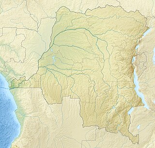
The Marungu highlands are in the Katanga Province of the Democratic Republic of the Congo, to the west of the southern half of Lake Tanganyika.
The Hemba people are a Bantu ethnic group in the Democratic Republic of the Congo (DRC).
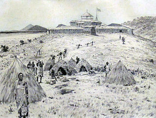
Paul Reichard was a German explorer who traveled extensively in Africa. His discoveries led to the establishment of the German East Africa Protectorate.
The Itombwe Mountains are a range of mountains in the South Kivu province of the Democratic Republic of the Congo (DRC). They run along the west shore of the northern part of Lake Tanganyika. They contain a vast area of contiguous montane forest and are home to a rich diversity of wildlife.
Glover Allen's dasymys is a species of shaggy marsh rat described in 1953, and indigenous to Mount Rungwe in south-western Tanzania. Contemporary studies of the taxonomy diverge, with the International Union for Conservation of Nature recognising D. alleni as a subspecies of the more widespread D. incomtus, whereas Wilson and Reeder observe the reinstatement of the species as unique in Mammal Species of the World. In their recent analysis, Verheyen et al. describe the distribution of D. alleni as encompassing the Eastern Arc Mountains and the mountainous, volcanic regions around Lake Tanganyika, and potentially the Marungu highlands, in the Democratic Republic of the Congo.

Mpala is the location of an early Catholic mission in the Belgian Congo. A military station was established at Mpala on the shores of Lake Tanganyika in May 1883. It was transferred to the White Fathers missionaries in 1885. At one time it was hoped that it would form the nucleus of a Christian kingdom in the heart of Africa. However, after a military expedition had to be sent to protect the mission from destruction by local warlords in 1892, civil control returned to the Belgian colonial authorities. The first seminary in the Congo was established at Mpala, and later the mission played an important role in providing practical education to the people of the region.
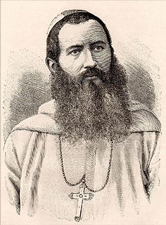
Jean-Baptiste-Frézal Charbonnier, M.Afr. was a Catholic White Fathers missionary who was Vicar Apostolic of Tanganyika from January 1887 to March 1888.

Émile Pierre Joseph Storms was a Belgian soldier, explorer, and official for the Congo Free State. He is known for his work between 1882 and 1885 in establishing a European presence in the regions around Lake Tanganyika, during which he supported the White Fathers missionaries and attempted to suppress the East African slave trade.
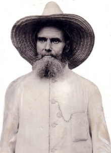
Léopold Louis Joubert was a French soldier and lay missionary. He fought for the Papal States between 1860 and 1870 during the Italian unification, which he opposed. He later assisted the White Fathers missionaries in East Africa and played an important role in the suppression of the slave trade between 1885 and 1892. He married a local woman and settled by the shore of Lake Tanganyika, where he lived until his death at the age of eighty five.

Muhammad bin Khalfan bin Khamis al-Barwani, commonly known as Rumaliza, was an Arab trader of slaves and ivory active in Central and East Africa in the last part of the nineteenth century. He was a member of the Arabian Barwani tribe. With the help of Tippu Tip he became Sultan of Ujiji. At one time he dominated the trade of Tanganyika, before being defeated by Belgian forces under Baron Francis Dhanis in January 1894.
Karema is a settlement in Tanzania, on the east shore of Lake Tanganyika, once the location of a White Fathers mission station.

Adolphe Lechaptois, M. Afr. was a priest of the White Fathers missionary society who was Vicar Apostolic of Tangyanika from 1891 until his death in 1917, in what is now Tanzania. He took responsibility for the vicariate at a time of great danger, when the missions were insecure havens for people fleeing slavers. As the country settled down, he oversaw expansion in the number of missions and schools. He was the author of a book on the ethnography of the local people that won a prize from the French Société de Géographie.
Lusinga Iwa Ng'ombe was a slave trader in the region to the west of Lake Tanganyika in the 1870s and early 1880s.
Cape Tembwe is a promontory on the west shore of Lake Tanganyika, in the Democratic Republic of the Congo.
Mathurin Guillemé was a Catholic White Fathers missionary who was Vicar Apostolic of Nyassa in today's Malawi from 1911 until his resignation in 1934.

The Congo-Nile Divide is the continental divide that separates the drainage basins of the Nile and Congo rivers. It is about 2,000 kilometres (1,200 mi) long.
References
Citations
- ↑ Marungu highlands: Birdlife Int.
- ↑ Kassner 1911, p. 86.
- 1 2 Bailey & Stewart 1984, p. 7.
- 1 2 Roberts 1984, p. 49.
- ↑ Royal Geographical Society 1884, p. 88.
- ↑ Roberts 2012, p. 9.
Sources
- Bailey, Reeve M.; Stewart, Donald J. (6 September 1984). "Bagrid Catfishes from Lake Tanganyika, with a Key and Descriptions of New Taxa" (PDF). Ann Arbor: MUSEUM OF ZOOLOGY, UNIVERSITY OF MICHIGAN. Retrieved 2013-04-10.CS1 maint: ref=harv (link)
- "Marungu highlands". BirdLife International. 2013. Retrieved 10 July 2016.
- Kassner, Theo (1911). My journey from Rhodesia to Egypt. London: Hutchinson & Co. p. 86.CS1 maint: ref=harv (link)
- Roberts, Allen F. (1984). "'Fishers of Men': religion and political economy among colonized Tabwa". Africa. 54 (2): 49–70. doi:10.2307/1159910. JSTOR 1159910.CS1 maint: ref=harv (link)
- Roberts, Allen F. (2012-12-20). A Dance of Assassins: Performing Early Colonial Hegemony in the Congo. Indiana University Press. p. 1. ISBN 978-0-253-00743-8 . Retrieved 2013-04-09.CS1 maint: ref=harv (link)
- Royal Geographical Society (1884). Proceedings of the Royal Geographical Society and monthly record of geography. Edward Stanford. p. 88 . Retrieved 2013-04-09.CS1 maint: ref=harv (link)