Lunag Ri

Last updated
Lunag Ri
NangpaLa.jpg
View of Nangpa La and the Lunag Ri-massif, seen from the Cho Oyu base camp. The top of Lunag Ri is on the far right of the picture, half right in the background is the Lunag Ri IV, behind on the far left is the Jobo Rinjang.
Highest point
Elevation 6,895 m (22,621 ft)
Prominence 1,179 m (3,868 ft)
Coordinates 28°03′11″N86°33′06″E / 28.05306°N 86.55167°E / 28.05306; 86.55167
Geography
Nepal rel location map.svg
Red triangle with thick white border.svg
Lunag Ri
China Tibet Autonomous Region rel location map.svg
Red triangle with thick white border.svg
Lunag Ri
Lunag Ri (Tibet)
Parent range Rolwaling Himal
Climbing
First ascent October 25, 2018 by David Lama (solo)

Lunag Ri is a mountain in the Rolwaling Himal mountain range of the Himalayas.

Contents

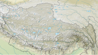
The 6,895 metres (22,621 ft) high Lunag Ri is located on the Himalayan main ridge on the border between Nepal and Tibet. Lunag Ri is 11.7 km (7.3 miles) west of Cho Oyu (8,188 m (26,864 ft)). The Jobo Rinjang (6,778 m (22,238 ft)) forms a southeastern secondary summit of Lunag Ri. On the southern flank of the Lunag Ri runs the Lunag glacier. In the east flows the Nangpa glacier. On the northern slope lies the feeding area of the Shalong glacier.

History

Lunag Ri was first climbed on October 25, 2018, by the Austrian climber David Lama, for which he won a 2019 Piolet d'Or. [1] Lama ascended the mountain solo. Lama and the American climber Conrad Anker had failed to make the summit at two previous attempts in November 2015 and fall 2016. During the second attempt, Anker suffered a heart attack. A first solo attempt by Lama, which got him up to 6,700 metres (21,982 ft), the highest attempt to that date, had also been unsuccessful. [2] [3] [4]

Related Research Articles

<span class="mw-page-title-main">K2</span> 2nd-highest mountain on Earth

K2, at 8,611 metres (28,251 ft) above sea level, is the second-highest mountain on Earth, after Mount Everest at 8,849 metres (29,032 ft). It lies in the Karakoram range, partially in the Gilgit-Baltistan region of Pakistan-administered Kashmir and partially in the China-administered Trans-Karakoram Tract in the Taxkorgan Tajik Autonomous County of Xinjiang.

<span class="mw-page-title-main">Mount Everest</span> Earths highest mountain

Mount Everest, known locally as Sagarmatha or Qomolangma, is Earth's highest mountain above sea level, located in the Mahalangur Himal sub-range of the Himalayas. The China–Nepal border runs across its summit point. Its elevation of 8,848.86 m was most recently established in 2020 by the Chinese and Nepali authorities.

<span class="mw-page-title-main">Lenin Peak</span> Mountain on the Kyrgyzstan–Tajikistan border

Lenin Peak or Ibn Sina (Avicenna) Peak, rises to 7,134 metres (23,406 ft) in Gorno-Badakhshan (GBAO) on the Kyrgyzstan–Tajikistan border, and is the second-highest point of both countries. It is considered one of the less technical 7,000 m peaks in the world to climb and it has by far the most ascents of any 7,000 m or higher peak on Earth, with every year seeing hundreds of mountaineers make their way to the summit. Lenin Peak is the highest mountain in the Trans-Alay Range of Central Asia, and in the Pamir Mountains in Tajikistan it is exceeded only by Ismoil Somoni Peak. It was thought to be the highest point in the Pamirs in Tajikistan until 1933, when Ismoil Somoni Peak was climbed and found to be more than 300 metres higher. Two mountains in the Pamirs in China, Kongur Tagh and Muztagh Ata, are higher than the Tajik summits.

<span class="mw-page-title-main">Annapurna</span> Eight-thousander and 10th-highest mountain on Earth, located in Nepal

Annapurna is a mountain situated in the Annapurna mountain range of Gandaki Province, north-central Nepal. It is the 10th highest mountain in the world at 8,091 metres (26,545 ft) above sea level and is well known for the difficulty and danger involved in its ascent.

<span class="mw-page-title-main">Lhotse</span> Eight-thousander and 4th-highest mountain on Earth, located in Nepal and China

Lhotse is the fourth-highest mountain on Earth, after Mount Everest, K2, and Kangchenjunga. At an elevation of 8,516 metres (27,940 ft) above sea level, the main summit is on the border between Tibet Autonomous Region of China and the Khumbu region of Nepal.

<span class="mw-page-title-main">Cho Oyu</span> 6th-highest mountain on Earth, located in Nepal and China

Cho Oyu is the sixth-highest mountain in the world at 8,188 metres (26,864 ft) above sea level. Cho Oyu means "Turquoise Goddess" in Tibetan. The mountain is the westernmost major peak of the Khumbu sub-section of the Mahalangur Himalaya 20 km west of Mount Everest. The mountain stands on the China–Nepal border, between the Tibet Autonomous Region and Koshi Province.

<span class="mw-page-title-main">Rakaposhi</span> Mountain in Pakistan

Rakaposhi also known as Dumani is a mountain within the Karakoram range in Gilgit-Baltistan in Pakistan. It is situated in the middle of the Nagar Valley and the Bagrote Valley. The mountain is extremely broad, measuring almost 20 km from east to west. It is the only peak on earth that descends directly and without interruption for almost 6,000 meters from its summit to its base.

<span class="mw-page-title-main">Ama Dablam</span> Mountain in Nepal

Ama Dablam is a mountain in the eastern Himalayan range of Koshi Province, Nepal. The main peak is 6,812 metres (22,349 ft), the lower western peak is 6,170 metres (20,243 ft). Ama Dablam means "mother's necklace"; the long ridges on each side like the arms of a mother (ama) protecting her child, and the hanging glacier thought of as the dablam, the traditional double-pendant containing pictures of the gods, worn by Sherpa women. For several days, Ama Dablam dominates the eastern sky for anyone trekking to Mount Everest Base Camp. For its soaring ridges and steep faces Ama Dablam is sometimes referred as the "Matterhorn of the Himalayas." The mountain is featured on the one rupee Nepalese banknote.

<span class="mw-page-title-main">Eiger</span> Mountain in the Bernese Alps, Switzerland

The Eiger is a 3,967-metre (13,015 ft) mountain of the Bernese Alps, overlooking Grindelwald and Lauterbrunnen in the Bernese Oberland of Switzerland, just north of the main watershed and border with Valais. It is the easternmost peak of a ridge crest that extends across the Mönch to the Jungfrau at 4,158 m (13,642 ft), constituting one of the most emblematic sights of the Swiss Alps. While the northern side of the mountain rises more than 3,000 m (10,000 ft) above the two valleys of Grindelwald and Lauterbrunnen, the southern side faces the large glaciers of the Jungfrau-Aletsch area, the most glaciated region in the Alps. The most notable feature of the Eiger is its nearly 1,800-metre-high (5,900 ft) north face of rock and ice, named Eiger-Nordwand, Eigerwand or just Nordwand, which is the biggest north face in the Alps. This substantial face towers over the resort of Kleine Scheidegg at its base, on the eponymous pass connecting the two valleys.

<span class="mw-page-title-main">Mount Tyree</span> Mountain in Ellsworth Land, Antarctica

Mount Tyree (4852m) is the second highest mountain of Antarctica located 13 kilometres northwest of Mount Vinson (4,892 m), the highest peak on the continent. It surmounts Patton Glacier to the north and Cervellati Glacier to the southeast.

<span class="mw-page-title-main">Alex Lowe (mountaineer)</span> American mountaineer (1958-1999)

Stewart Alexander Lowe was an American mountaineer. He has been described as inspiring "...a whole generation of climbers and explorers with his uncontainable enthusiasm, legendary training routines, and significant ascents of rock climbs, ice climbs, and mountains all over the world...". He died in an avalanche on Shishapangma, in Tibet. The Alex Lowe Charitable Foundation honors his legacy.

<span class="mw-page-title-main">Langtang Lirung</span> Highest peak of Langtang Himal

Langtang Lirung is the highest peak of the Langtang Himal, which is a subrange of the Nepalese Himalayas, southwest of the Eight-thousander Shishapangma. It is listed as the 99th highest mountain in the world.

<span class="mw-page-title-main">Conrad Anker</span> American rock climber, mountaineer, and author

Conrad Anker is an American rock climber, mountaineer, and author. He was the team leader of The North Face climbing team for 26 years until 2018. In 1999, he located George Mallory's body on Everest as a member of a search team looking for the remains of the British climber who was last seen in 1924. Anker had a heart attack in 2016 during an attempted ascent of Lunag Ri with David Lama. He was flown via helicopter to Kathmandu where he underwent emergency coronary angioplasty with a stent placed in his proximal left anterior descending artery. Afterwards he retired from high altitude mountaineering, but otherwise he continues his work. He lives in Bozeman, Montana.

<span class="mw-page-title-main">Latok group</span> Mountain group in the Karakoram range

The Latok group is a cluster of large and dramatic rock peaks in the Panmah Muztagh, part of the central Karakoram mountain range in Pakistan. They lie just to the east of the Ogre group, dominated by Baintha Brakk. To the immediate south of the Latok group lies the Baintha Lukpar Glacier, a small tributary of the Biafo Glacier, one of the main glaciers of the Karakoram. On the north side, lies the Choktoi Glacier.

<span class="mw-page-title-main">Jimmy Chin</span> American mountain climber, film director, and skier (born 1973)

Jimmy Chin is an American professional mountain athlete, photographer, skier, film director, and author.

<span class="mw-page-title-main">1924 British Mount Everest expedition</span> Attempt at first ascent of Mount Everest in 1924

The 1924 British Mount Everest expedition was—after the 1922 British Mount Everest expedition—the 2nd expedition with the goal of achieving the first ascent of Mount Everest. After two summit attempts in which Edward Norton set a world altitude record of 8,572.8 metres (28,126 ft), the mountaineers George Mallory and Andrew "Sandy" Irvine disappeared on the third attempt. Their disappearance has given rise to the long-standing speculation of whether or not the pair might – under a narrow set of assumptions – have reached the summit. Mallory's body was found in 1999 at 8,156 metres (26,760 ft), but the resulting clues did not provide any conclusive evidence as to whether the summit was reached. Irvine's partial remains were later found in 2024 by a National Geographic team during a descent of the Rongbuk Glacier by the north face.

<span class="mw-page-title-main">1922 British Mount Everest expedition</span> First attempt to reach summit of worlds highest mountain

The 1922 British Mount Everest expedition was the first mountaineering expedition with the express aim of making the first ascent of Mount Everest. It was also the first expedition that used bottled oxygen while climbing Everest. The attempt was made from the northern side of Everest out of Tibet. At the time, Everest could not be attempted from the south out of Nepal as the country was closed to Western foreigners.

<span class="mw-page-title-main">Three Steps</span> Prominent rock formations near the summit of Mount Everest

The Three Steps are three prominent rocky steps on the northeast ridge of Mount Everest. They are located at altitudes of 8,564 metres (28,097 ft), 8,610 metres (28,250 ft), and 8,710 metres (28,580 ft). The Second Step is especially significant both historically and in mountaineering terms. Any climber who wants to climb on the normal route from the north of the summit must negotiate these three stages.

<span class="mw-page-title-main">David Lama</span> Austrian rock climber and mountaineer (1990–2019)

David Lama was an Austrian rock climber and alpinist. He won the European Championship in competition bouldering in 2007 and the European Championship in competition lead climbing in 2006. He is known for his first free ascent of the Compressor Route on Cerro Torre. In 2018, in a solo expedition, he was the first to reach the summit of Lunag Ri in the Himalayas. In 2019, he was posthumously honoured with a Piolet d'Or for this first ascent.

<span class="mw-page-title-main">Praqpa Kangri</span> Unclimbed peak in the Karakoram

Praqpa Kangri is a mountain in Pakistan's Karakoram range in the territory of Gilgit-Baltistan. Praqpa Kangri has an altitude of 7,134 m. The main summit is located 2.33 km south of Skil Brum. The peak's prominence is 668 m. The Savoia glacier flows from the east flank of the mountain towards the Godwin-Austen-Glacier. The Biango Glacier lies to the west of the peak, as does eight-thousanders K2 and Broad Peak.

References

  1. "Lunag Ri Solo-Erstbesteigung von David Lama" (in German). bergsteigen.com. 27 November 2018. Retrieved 20 July 2020.
  2. "Der Berg ist wie eine weisse Leinwand". Neue Zürcher Zeitung.
  3. "Versuch am Lunag Ri". Bergsteigen.com.
  4. "David Lama gelingt Erstbesteigung des Lunag Ri". LaCrux.com.