Lydney Rural District

Last updated

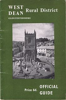
Coordinates: 51°43′30″N2°30′50″W / 51.725°N 2.514°W / 51.725; -2.514 Lydney was a rural district in Gloucestershire, England from 1894 to 1974. It covered an area on the Welsh border by the Severn estuary.

Geographic coordinate system Coordinate system

A geographic coordinate system is a coordinate system that enables every location on Earth to be specified by a set of numbers, letters or symbols. The coordinates are often chosen such that one of the numbers represents a vertical position and two or three of the numbers represent a horizontal position; alternatively, a geographic position may be expressed in a combined three-dimensional Cartesian vector. A common choice of coordinates is latitude, longitude and elevation. To specify a location on a plane requires a map projection.

Rural districts were a type of local government area – now superseded – established at the end of the 19th century in England, Wales, and Ireland for the administration of predominantly rural areas at a level lower than that of the administrative counties.

Gloucestershire County of England

Gloucestershire is a county in South West England. The county comprises part of the Cotswold Hills, part of the flat fertile valley of the River Severn, and the entire Forest of Dean.

It was formed under the Local Government Act 1894 from that part of the Chepstow rural sanitary district which was in Gloucestershire (and England), the rest forming Chepstow Rural District in Monmouthshire.

Local Government Act 1894

The Local Government Act 1894 was an Act of the Parliament of the United Kingdom that reformed local government in England and Wales outside the County of London. The Act followed the reforms carried out at county level under the Local Government Act 1888. The 1894 legislation introduced elected councils at district and parish level.

Chepstow town in Wales

Chepstow is a town and community in Monmouthshire, Wales, adjoining the border with Gloucestershire, England. It is located on the River Wye, about 2 miles (3.2 km) above its confluence with the River Severn, and adjoining the western end of the Severn Bridge. It is 16 miles (26 km) east of Newport, 28 miles (45 km) east-northeast of Cardiff, 18 miles (29 km) northwest of Bristol and 110 miles (180 km) west of London.

Chepstow Rural District was a rural district in the administrative county of Monmouthshire, Wales. It was established under the Local Government Act 1894, and was abolished in 1974 when its functions were assumed by the new Monmouth District Council.

The district consisted of the following parishes :

Alvington, Gloucestershire village and civil parish in Forest of Dean, Gloucestershire, England

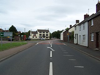
Alvington is a village and civil parish in the Forest of Dean in Gloucestershire, England, situated on the A48 road, six miles north-east of Chepstow in Wales. The parish had a total population of 506 at the 2011 census.

Aylburton village in United Kingdom

Aylburton is a village and civil parish in the Forest of Dean district of Gloucestershire, England, on the A48 road about two miles south-west of Lydney. According to the 2001 census it had a population of 689, increasing to 711 at the 2011 census.

Hewelsfield village in United Kingdom

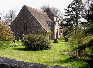
Hewelsfield is a village and parish in the Forest of Dean District of Gloucestershire, England. It is located 6 miles south of Coleford and 5 miles north-east of Chepstow, close to the Wye valley and partly within an Area of Outstanding Natural Beauty. The parish also includes the separate village of Brockweir.

It survived until 1974, when it was merged with other districts to form the Forest of Dean district.

Related Research Articles

Cotswold District Non-metropolitan district in England

Cotswold is a local government district in Gloucestershire in England. It is named after the wider Cotswolds region. Its main town is Cirencester.

Northavon

Northavon was a district in the English county of Avon from 1974 to 1996.

Forest of Dean District Non-metropolitan district in England

Forest of Dean is a local government district in Gloucestershire, England, named after the Forest of Dean. Its council is based in Coleford. Other towns and villages in the district include Blakeney, Cinderford, Drybrook, English Bicknor, Huntley, Littledean, Longhope, Lea, Lydbrook, Lydney, Mitcheldean, Newnham and Newent

Kingswood Borough human settlement in United Kingdom

Kingswood was, from 1974 to 1996, a non-metropolitan district of the County of Avon, England.

Lydney railway station

Lydney railway station is a railway station serving the town of Lydney in Gloucestershire, England. It is located on the Gloucester-Newport line. The station is located a mile south of Lydney, and was originally called Lydney Junction, which is now the name of the nearby station on the preserved Dean Forest Railway.

Gloucester was, from 1894 to 1974, a rural district in the administrative county of Gloucestershire, England. The district did not include the City of Gloucester, which was a separate county borough. In 1935 Gloucester RD was more than doubled in size.

Municipal Borough of Sutton and Cheam

Sutton and Cheam was a local government district in north east Surrey, England from 1882 to 1965.

West Dean Rural District

West Dean Rural District was a rural district in Gloucestershire, England, from 1894 to 1974. It comprised a number of civil parishes, including, confusingly, one called West Dean, and gained further territory in 1935.

Northampton was a rural district in Northamptonshire, England from 1894 to 1974.

Bingham Rural District

Bingham was a rural district in Nottinghamshire, England from 1894 to 1974.

Whitchurch was a rural district in Herefordshire, England from 1894 to 1931.

Culham Rural District

Culham was a rural district in Oxfordshire, England from 1894 to 1932. It was formed under the Local Government Act 1894 from the part of the Abingdon Rural Sanitary District in the administrative county of Oxfordshire. The remainder of the sanitary district, in the administrative county of Berkshire, became Abingdon Rural District. The rural district council continued to be based at Abingdon, holding meetings in the workhouse of the poor law union.

Crowmarsh Rural District

Crowmarsh was a rural district in Oxfordshire, England from 1894 to 1932.

Shifnal was a rural district in Shropshire, England from 1894 to 1974.

Hemel Hempstead was a rural district in Hertfordshire, England from 1894 to 1974.

Lydney Park

Lydney Park is a 17th-century country estate surrounding Lydney House, located at Lydney in the Forest of Dean district in Gloucestershire, England. It is known for its gardens and Roman temple complex.

Thornbury Rural District was a rural district council centred on Thornbury in the south of Gloucestershire. It was originally formed as a Poor Law Union on 5 April 1836 with 26 Guardians representing the 21 parishes in the Union and the Guardians of the Poor became the Rural Sanitary Authority for the District in 1872. The Rural District Council became a separate body in 1894 although the District Councillors had a dual mandate as members of both the council and the Board of Guardians.The District was enlarged in 1904 when Henbury was transferred from the abolished Barton Regis Rural District. In 1930 the Guardians were abolished when their functions were transferred to It was abolished in 1974 and the majority of it transferred into the new county of Avon, as part of the new district of Northavon.

Lydney Town A.F.C.

Lydney Town A.F.C. are a football club based in Lydney, Gloucestershire, England. They are currently member of the Hellenic League Premier Division. The club is affiliated to the Gloucestershire County FA.

Faringdon was a rural district in the administrative county of Berkshire from 1894 to 1974.

References