Lébékére

Last updated
Lébékére
Sub-prefecture and town
Guinea adm location map.svg
Red pog.svg
Lébékére
Location in Guinea
Coordinates: 12°07′N12°24′W / 12.117°N 12.400°W / 12.117; -12.400
CountryFlag of Guinea.svg  Guinea
Region Labé Region
Prefecture Mali Prefecture
Time zone GMT (UTC+0)

Lébékére is a town and sub-prefecture in the Mali Prefecture in the Labé Region of northern Guinea. [1]

Town settlement that is bigger than a village but smaller than a city


A town is a human settlement. Towns are generally larger than villages but smaller than cities, though the criteria to distinguish them vary considerably between different parts of the world.

Sub-prefectures of Guinea

The sub-prefectures are the third-level administrative divisions in Guinea. As of 2009 there were 303 rural sub-prefectures of Guinea and 38 urban sub-prefectures, 5 of which compose the Conakry greater urban area; Kaloum, Dixinn, Matam, Ratoma and Matoto.

Mali Prefecture Prefecture in Labé Region, Guinea

Mali is a prefecture, also known as the Préfecture De Mali, located in the Labé Region of Guinea. The capital is Mali. The prefecture covers an area of 9,790 km.² and has an estimated population of 246,000.

Related Research Articles

Dalaba Prefecture Prefecture in Mamou Region, Guinea

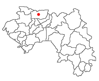
Dalaba is a prefecture located in the Mamou Region of Guinea. The capital is Dalaba. The prefecture covers an area of 4,400 km² and has an estimated population of 155,000.

Niagassola Sub-prefecture and town in Kankan Region, Guinea

Niagassola is a town and sub-prefecture in the Siguiri Prefecture in the Kankan Region of north-eastern Guinea.It is located near the border with Mali. It has no electricity and three water pumps.

Diassodou Sub-prefecture and town in Nzérékoré Region, Guinea

Diassodou is a town and sub-prefecture in the Beyla Prefecture in the Nzérékoré Region of south-eastern Guinea.

Kalinko, Guinea Sub-prefecture and town in Faranah Region, Guinea

Kalinko is a town and sub-prefecture in the Dinguiraye Prefecture in the Faranah Region of western Guinea. As of 2014 it had a population of 31,797 people.

Sélouma Sub-prefecture and town in Faranah Region, Guinea

Sélouma is a town and sub-prefecture in the Dinguiraye Prefecture in the Faranah Region of western Guinea. As of 2014 it had a population of 13,188 people.

Mamouroudou Sub-prefecture in Kankan Region, Guinea

Mamouroudou is a sub-prefecture in the Kankan Prefecture in the Kankan Region of eastern Guinea. As of 2014 it had a population of 14,609 people.

Beindou, Kissidougou Sub-prefecture and town in Faranah Region, Guinea

Beindou is a town and sub-prefecture in the Kissidougou Prefecture in the Faranah Region of Guinea. As of 2014 it had a population of 14,679 people.

Sangardo Sub-prefecture and town in Faranah Region, Guinea

Sangardo is a town and sub-prefecture in the Kissidougou Prefecture in the Faranah Region of Guinea. As of 2014 it had a population of 21,646 people.

Kamaby Sub-prefecture and town in Boké Region, Guinea

Kamaby is a town and sub-prefecture in the Koundara Prefecture in the Boké Region of northern Guinea. As of 2014 it had a population of 16,178 people.

Saréboido Sub-prefecture and town in Boké Region, Guinea

Saréboido is a town and sub-prefecture in the Koundara Prefecture in the Boké Region of northern Guinea. As of 2014 it had a population of 33,700 people.

Kiniéro Sub-prefecture and town in Kankan Region, Guinea

Kiniéro is a town and sub-prefecture in the Kouroussa Prefecture in the Kankan Region of eastern-central Guinea. As of 2014 it had a population of 22,267 people.

Sibiribaro Sub-prefecture and town in Kankan Region, Guinea

Sibiribaro is a town and sub-prefecture in the Kérouané Prefecture in the Kankan Region of south-eastern Guinea. As of 2014 it had a population of 16,485 people.

Dialakoro, Kankan Sub-prefecture and town in Kankan Region, Guinea

Dialakoro is a town and sub-prefecture in the Mandiana Prefecture in the Kankan Region of eastern Guinea. As of 2014 it had a population of 63,159 people.

Kiniéran Sub-prefecture and town in Kankan Region, Guinea

Kiniéran is a town and sub-prefecture in the Mandiana Prefecture in the Kankan Region of eastern Guinea. As of 2014 it had a population of 37,944 people.

Kollet, Labé Sub-prefecture and town in Labé Region, Guinea

Kollet is a town and sub-prefecture in the Tougué Prefecture in the Labé Region of northern-central Guinea.

Bourouwal Sub-prefecture and town in Kindia Region, Guinea

Bourouwal is a town and sub-prefecture in the Télimélé Prefecture in the Kindia Region of western-central Guinea.

Kollet, Télimélé Sub-prefecture and town in Kindia Region, Guinea

Kollet is a town and sub-prefecture in the Télimélé Prefecture in the Kindia Region of western-central Guinea.

Péla Sub-prefecture and town in Nzérékoré Region, Guinea

Péla is a town and sub-prefecture in the Yomou Prefecture in the Nzérékoré Region of south-eastern Guinea.

Hafia Sub-prefecture and town in Labé Region, Guinea

Hafia is a town and sub-prefecture in the Labé Prefecture in the Labé Region of northern-central Guinea.

Popodara is a town and sub-prefecture in the Labé Prefecture in the Labé Region of northern-central Guinea.

References

  1. "Subprefectures of Guinea". Statoids. Retrieved April 19, 2009.

Coordinates: 12°07′N12°24′W / 12.117°N 12.400°W / 12.117; -12.400

Geographic coordinate system Coordinate system

A geographic coordinate system is a coordinate system that enables every location on Earth to be specified by a set of numbers, letters or symbols. The coordinates are often chosen such that one of the numbers represents a vertical position and two or three of the numbers represent a horizontal position; alternatively, a geographic position may be expressed in a combined three-dimensional Cartesian vector. A common choice of coordinates is latitude, longitude and elevation. To specify a location on a plane requires a map projection.