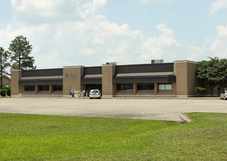
Santa Fe is a city in Galveston County, Texas, United States. It is named for the Santa Fe Railroad which runs through the town alongside State Highway 6. The population of Santa Fe at the 2010 census was 12,222.

The Province of Santa Fe is a province of Argentina, located in the center-east of the country. Neighboring provinces are from the north clockwise Chaco, Corrientes, Entre Ríos, Buenos Aires, Córdoba, and Santiago del Estero. Together with Córdoba and Entre Ríos, the province is part of the economico-political association known as the Center Region.

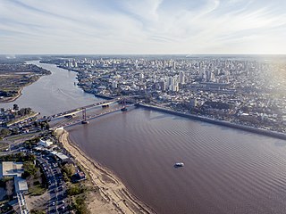
Santa Fe de la Vera Cruz is the capital city of the province of Santa Fe, Argentina. It is situated in north-eastern Argentina, near the junction of the Paraná and Salado rivers. It lies 15 kilometres (9.3 mi) from the Hernandarias Subfluvial Tunnel that connects it to the city of Paraná. The city is also connected by canal with the port of Colastiné on the Paraná River. Santa Fe de la Vera Cruz has about 391,164 inhabitants per the 2010 census [INDEC]. The metropolitan area has a population of 653,073, making it the eighth largest in Argentina. The third largest city in Argentina is Rosario, also located in Santa Fe Province.

Villa Constitución is a city in the province of Santa Fe, Argentina, and the head town of the Constitución Department. It is located on the south-western banks of the Paraná River between the courses of the Arroyo Pavón and the Arroyo del Medio, about 214 km south from the provincial capital, the city of Santa Fe, and 50 km from Rosario. It has a population of more than 47,374 inhabitants as per the 2010 census [INDEC].

Greater Rosario is the metropolitan area of the city of Rosario, in the province of Santa Fe, Argentina. This metropolis has a population of about 1.3 million thus being Argentina's third most populated urban settlement, after Buenos Aires and Córdoba.

San Nicolás de los Arroyos is a city in the province of Buenos Aires, Argentina, on the western shore of the Paraná River, 61 km (38 mi) from Rosario. It has about 133,000 inhabitants. It is the administrative seat of the partido of the same name. It is sometimes called Ciudad de María due to a series of Marian apparitions that led to the erection of the Sanctuary in honor of Our Lady of the Rosary of San Nicolás that began during the 1980s and were approved by Bishop Cardelli of the diocese as "worthy of belief" in 2016.
Villa Gobernador Gálvez is a city in the province of Santa Fe, Argentina, located on the western ravine of the Paraná River, within the metropolitan area of Greater Rosario. It had 74,509 inhabitants per the 2001 census [INDEC]. It is separated from Rosario, to the north, by the Saladillo Stream. It is the fourth most populated city in the province and the second in the metropolitan area.

Reconquista is a city in the north of the province of Santa Fe, Argentina, 327 km (203 mi) from the provincial capital. It is the head town of the General Obligado Department, and it has 99,288 inhabitants according to the 2010 census [INDEC].

Santo Tomé is a city in the province of Santa Fe, Argentina. It is located only 9 km from the capital city. It has a population of about 65,684 inhabitants and estimated at 80,000 inhabitants based on population growth rate provided by the INDEC, and is classified as a second-category municipality.
Melincué is a town (comuna) in the south of the province of Santa Fe, Argentina, 287 km from the provincial capital. It has about 2,200 inhabitants as per the 2001 census [INDEC] and it is the head town of the General López Department. It was founded in 1872 and recognized officially as a town on 3 September 1986.
Helvecia is a town (comuna) in the center-east of the province of Santa Fe, Argentina, on the San Javier River. It had about 8,500 inhabitants at the 2001 census [INDEC] and it is the head town of the Garay Department.
Tostado is a city in the northwest of the province of Santa Fe, Argentina, 334 km (208 mi) north-west from the provincial capital. It had about 14,000 inhabitants at the 2010 census [INDEC] and it is the head town of the Nueve de Julio Department.

Pilar is a city in the province of Buenos Aires, Argentina with a population of 299,077 as per the 2010 census [INDEC]. It is part of the Greater Buenos Aires urban conurbation and is the seat of the administrative division of Pilar Partido. Since the early 1990s, Pilar has gained an increasingly upscale profile due to the development of numerous gated communities, country clubs and polo fields.

The Constitución Department is an administrative subdivision (departamento) of the province of Santa Fe, Argentina. It is located on the south of the province. It has about 83,000 inhabitants as per the 2001 census [INDEC]. Its head town is the city of Villa Constitución.

The San Jerónimo Department is an administrative subdivision (departamento) of the province of Santa Fe, Argentina. It is located in the center-south of the province. It limits with the Paraná River in the east; and from there with the departments of San Lorenzo and Iriondo (south), Belgrano (southwest), San Martín (west), and Las Colonias and La Capital (north).

The Partido de Bahía Blanca is a partido of the Buenos Aires Province is located at the south-west of the province in central Argentina at coordinates 38°42′S62°16′W

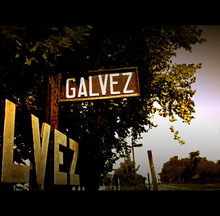
Gálvez is a city in the center of the province of Santa Fe, Argentina, 81 km (50 mi) south of the provincial capital Santa Fe. It has 18,374 inhabitants per the 2001 census [INDEC].
Sunchales is a city in the province of Santa Fe, Argentina. It has 21,304 inhabitants per the 2010 census [INDEC]. It lies in the center-west of the province, 135 km (84 mi) from the provincial capital Santa Fe, on National Route 34.
Los Quirquinchos is a town (comuna) in Santa Fe Province, in Caseros Departamento 140 km (87 mi) from Rosario, 256 km (159 mi) from the provincial capital, by provincial route RP 93. It has a population of 2,900 inhabitants as per the 2001 census [INDEC].

Ataliva is a town in the department of Castellanos in the province of Santa Fe, Argentina. Founded at the end of the 19th century, it maintains some of the characteristics of the rest of the colonies: it is from the beginning a purely agricultural colony, with a population coming from a mostly Italian immigration process. It is the tenth most populated town in the Castellanos department; and the 106th in the province of Santa Fe. In 2010 it had a population of approximately 2100 inhabitants.


