Lügde

Last updated • 1 min readFrom Wikipedia, The Free Encyclopedia
Lügde
Lugde, Germany (Unsplash).jpg
COA Luegde.svg
Location of Lügde within Lippe district
Lugde in LIP.svgBlombergLage
Germany adm location map.svg
Red pog.svg
Lügde
North Rhine-Westphalia location map 01.svg
Red pog.svg
Lügde
Coordinates: 51°57′00″N09°15′00″E / 51.95000°N 9.25000°E / 51.95000; 9.25000
Country Germany
State North Rhine-Westphalia
Admin. region Detmold
District Lippe
Government
   Mayor (202025) Torben Blome [1] (SPD)
Area
  Total88.64 km2 (34.22 sq mi)
Elevation
105 m (344 ft)
Population
 (2022-12-31) [2]
  Total9,364
  Density110/km2 (270/sq mi)
Time zone UTC+01:00 (CET)
  Summer (DST) UTC+02:00 (CEST)
Postal codes
32668–32676
Dialling codes 05281, 05283
Vehicle registration LIP
Website luegde.de

Lügde [ˈlʏçtʰə] is a town in the Lippe district of North Rhine-Westphalia, Germany, with c. 9,800 inhabitants (2013).

Contents

The first written mention of Lügde appears in 784, in the annals of the Frankish Empire, when Charlemagne visited the village during the Saxon Wars. During these wars Charlemagne celebrated his first Christmas in Saxony in Lügde, and the site then became the location of the first church to be built in Saxony. The gothic church, dedicated to Saint Kilian, was rebuilt in the 12th century and still stands today. The church is known as the Kilians-Kirche.

In 2019 Lügde made national news as the site of a series of child rapes on a campground; investigators estimate 1,000 child rapes were committed over the course of 10 years.

Climate

Climate data for Lügde (1991–2020 normals)
MonthJanFebMarAprMayJunJulAugSepOctNovDecYear
Mean daily maximum °C (°F)3.1
(37.6)
4.1
(39.4)
8.5
(47.3)
13.9
(57.0)
17.2
(63.0)
20.7
(69.3)
22.8
(73.0)
22.5
(72.5)
18.5
(65.3)
13.0
(55.4)
7.7
(45.9)
4.2
(39.6)
13.1
(55.6)
Daily mean °C (°F)0.9
(33.6)
1.4
(34.5)
4.6
(40.3)
8.9
(48.0)
12.3
(54.1)
15.5
(59.9)
17.4
(63.3)
17.1
(62.8)
13.5
(56.3)
9.5
(49.1)
5.4
(41.7)
2.1
(35.8)
9.2
(48.6)
Mean daily minimum °C (°F)−1.5
(29.3)
−1.5
(29.3)
0.7
(33.3)
3.6
(38.5)
6.8
(44.2)
10.3
(50.5)
12.0
(53.6)
12.1
(53.8)
9.0
(48.2)
6.1
(43.0)
2.9
(37.2)
−0.1
(31.8)
5.2
(41.4)
Average precipitation mm (inches)82.3
(3.24)
56.9
(2.24)
53.5
(2.11)
38.0
(1.50)
69.9
(2.75)
72.9
(2.87)
83.9
(3.30)
83.3
(3.28)
62.3
(2.45)
69.7
(2.74)
66.1
(2.60)
73.8
(2.91)
819.1
(32.25)
Average precipitation days (≥ 1.0 mm)19.416.315.912.215.214.516.616.514.316.717.920.5198.2
Average relative humidity (%)88.084.578.671.874.676.574.977.082.186.889.789.681.2
Mean monthly sunshine hours 40.268.2121.6180.9194.0204.6209.4184.9150.294.345.833.31,498.1
Source: World Meteorological Organisation [3]

Related Research Articles

<span class="mw-page-title-main">North Rhine-Westphalia</span> State in Germany

North Rhine-Westphalia or North-Rhine/Westphalia, commonly shortened to NRW, is a state (Land) in Western Germany. With more than 18 million inhabitants, it is the most populous state in Germany. Apart from the city-states, it is also the most densely populated state in Germany. Covering an area of 34,084 square kilometres (13,160 sq mi), it is the fourth-largest German state by size.

<span class="mw-page-title-main">Münster</span> City in North Rhine-Westphalia, Germany

Münster is an independent city in North Rhine-Westphalia, Germany. It is in the northern part of the state and is considered to be the cultural centre of the Westphalia region. It is also a state district capital. Münster was the location of the Anabaptist rebellion during the Protestant Reformation and the site of the signing of the Treaty of Westphalia ending the Thirty Years' War in 1648. Today, it is known as the bicycle capital of Germany.

<span class="mw-page-title-main">Lüdenscheid</span> Town in North Rhine-Westphalia, Germany

Lüdenscheid is a city in the Märkischer Kreis district, in North Rhine-Westphalia, Germany. It is located in the Sauerland region.

<span class="mw-page-title-main">Herford (district)</span> District in North Rhine-Westphalia, Germany

Herford is a Kreis (district) in the northeastern part of North Rhine-Westphalia, Germany. Neighboring districts are Minden-Lübbecke, Lippe, the urban district of Bielefeld and the districts of Gütersloh and Osnabrück.

<span class="mw-page-title-main">Herford</span> Town in North Rhine-Westphalia, Germany

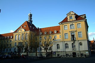
Herford is a town in North Rhine-Westphalia, Germany, located in the lowlands between the hill chains of the Wiehen Hills and the Teutoburg Forest. It is the capital of the district of Herford.

<span class="mw-page-title-main">Borken, North Rhine-Westphalia</span> Town in North Rhine-Westphalia, Germany

Borken is a town and the capital of the district of the same name, in North Rhine-Westphalia, Germany.

<span class="mw-page-title-main">Dinslaken</span> Town in North Rhine-Westphalia, Germany

Dinslaken is a town in the district of Wesel, in North Rhine-Westphalia, Germany. It is known for its harness racing track, its now closed coal mine in Lohberg and its wealthy neighborhoods Hiesfeld and Eppinghoven.

<span class="mw-page-title-main">Paderborn</span> City in North Rhine-Westphalia, Germany

Paderborn is a city in eastern North Rhine-Westphalia, Germany, capital of the Paderborn district. The name of the city derives from the river Pader and Born, an old German term for the source of a river. The river Pader originates in more than 200 springs near Paderborn Cathedral, where St. Liborius is buried.

<span class="mw-page-title-main">Extertal</span> Municipality in North Rhine-Westphalia, Germany

Extertal is a municipality in the Lippe district of North Rhine-Westphalia, Germany, with c. 11,500 inhabitants (2013).

<span class="mw-page-title-main">Bad Salzuflen</span> Town in North Rhine-Westphalia, Germany

Bad Salzuflen is a town and thermal spa resort in the Lippe district of North Rhine-Westphalia, Germany. At the end of 2013, it had 52,121 inhabitants.

<span class="mw-page-title-main">Höxter</span> Town in North Rhine-Westphalia, Germany

Höxter is a town in eastern North Rhine-Westphalia, Germany on the left bank of the river Weser, 52 km north of Kassel in the centre of the Weser Uplands. The main town's population is around 15,000, and with outlying centres, about 30,000. It is the seat of the Höxter district. Historical place names of Höxter are Hoxer and Huxaria.

<span class="mw-page-title-main">Euskirchen</span> Town in North Rhine-Westphalia, Germany

Euskirchen is a town in North Rhine-Westphalia, Germany, capital of the district Euskirchen. While Euskirchen resembles a modern shopping town, it also has a history dating back over 700 years, having been granted town status in 1302. As of December 2007, it had a population of 55,446. Its local football club is called TSC Euskirchen.

<span class="mw-page-title-main">Reichshof</span> Municipality in North Rhine-Westphalia, Germany

Reichshof is a North Rhine-Westphalian municipality in the Oberbergischer Kreis in Germany, about 40 km east of Cologne. It is a health resort, known for its good climate. The municipality consists of 106 villages and hamlets. The most important villages are Denklingen, Eckenhagen (1900), Brüchermühle (1700) and Wildbergerhütte (1600).

<span class="mw-page-title-main">Morsbach</span> Municipality in North Rhine-Westphalia, Germany

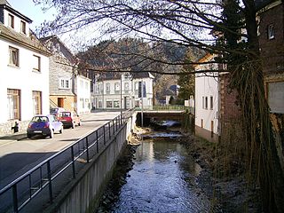
Morsbach is a municipality in Oberbergischer Kreis, a district in North Rhine-Westphalia near the border of Rhineland-Palatinate in Germany. In 2015, Morsbach's population was 10,600. The central village, also named Morsbach, has a population of 3,400. With a number of buildings dating back to the 12th century, it is a popular spot for hikers and other nature lovers.

<span class="mw-page-title-main">Kaarst</span> Town in North Rhine-Westphalia, Germany

Kaarst is a town in Germany. It lies in the district of Rhein-Kreis Neuss in North Rhine-Westphalia. It is 5 km west of Neuss and 12 km east of Mönchengladbach.

<span class="mw-page-title-main">Wettringen (Münsterland)</span> Municipality in North Rhine-Westphalia, Germany

Wettringen is a village and a municipality in the district of Steinfurt, in North Rhine-Westphalia, Germany.

<span class="mw-page-title-main">Spenge</span> Town in North Rhine-Westphalia, Germany

Spenge is a town in the district of Herford, in North Rhine-Westphalia, Germany

<span class="mw-page-title-main">Bad Lippspringe</span> Town in North Rhine-Westphalia, Germany

Bad Lippspringe is a town in the district of Paderborn, in North Rhine-Westphalia, Germany.

<span class="mw-page-title-main">Bestwig</span> Municipality in North Rhine-Westphalia, Germany

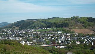
Bestwig is a municipality in the Hochsauerland district, in North Rhine-Westphalia, Germany.

<span class="mw-page-title-main">Ostbevern</span> Municipality in North Rhine-Westphalia, Germany

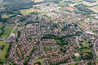
Ostbevern is a municipality in the district of Warendorf, in North Rhine-Westphalia, Germany.

References

  1. Wahlergebnisse in NRW Kommunalwahlen 2020, Land Nordrhein-Westfalen, accessed 21 June 2021.
  2. "Bevölkerung der Gemeinden Nordrhein-Westfalens am 31. Dezember 2022 – Fortschreibung des Bevölkerungsstandes auf Basis des Zensus vom 9. Mai 2011" (in German). Landesbetrieb Information und Technik NRW . Retrieved 20 June 2023.
  3. "World Meteorological Organization Climate Normals for 1991–2020". World Meteorological Organization Climatological Standard Normals (1991–2020). National Oceanic and Atmospheric Administration. Archived from the original on 12 October 2023. Retrieved 13 October 2023.