Møre og Romsdal Agricultural Museum

Last updated

The Møre og Romsdal Agricultural Museum (Norwegian : Landbruksmuseet for Møre og Romsdal) is part of the Sunnmøre Museum Foundation. It is located in Gjermundnes in the municipality of Vestnes. The museum was originally a large farm (storgård, in contrast to a småbruk 'small farm' or husmannsplass 'leased farm') [1] and later on an agricultural school. [2]

Norwegian language North Germanic language spoken in Norway

Norwegian is a North Germanic language spoken mainly in Norway, where it is the official language. Along with Swedish and Danish, Norwegian forms a dialect continuum of more or less mutually intelligible local and regional varieties, and some Norwegian and Swedish dialects, in particular, are very close. These Scandinavian languages, together with Faroese and Icelandic as well as some extinct languages, constitute the North Germanic languages. Faroese and Icelandic are hardly mutually intelligible with Norwegian in their spoken form because continental Scandinavian has diverged from them. While the two Germanic languages with the greatest numbers of speakers, English and German, have close similarities with Norwegian, neither is mutually intelligible with it. Norwegian is a descendant of Old Norse, the common language of the Germanic peoples living in Scandinavia during the Viking Era.

Sunnmøre Museum Foundation

The Sunnmøre Museum Foundation is a foundation comprising 12 museums in the Sunnmøre traditional district of the western Norwegian county of Møre og Romsdal.

Gjermundnes is a hamlet in Norway on the east side of the mouth of Tres Fjord in the municipality of Vestnes. It is also the name of the peninsula where the district is located.

The former Romsdal County (Romsdalen amt) purchased the Gjermundnes Farm 1898. [3] [4] A new facility was built in 1908 to meet the special requirements for the newly established agricultural school. That building had become dilapidated by 1972, and it was decided to demolish it when new construction was completed. However, with financial support from the county executive board, the Norwegian Directorate for Cultural Heritage, and the municipality of Vestnes, the old facility was renovated and converted into an agricultural museum.

Møre og Romsdal County (fylke) of Norway

Møre og RomsdalUrban East Norwegian: [²møːrə ɔ ˈrʊmsdɑːl](listen) is a county in the northernmost part of Western Norway. It borders the counties of Trøndelag, Oppland, and Sogn og Fjordane. The county administration is located in the town of Molde, while Ålesund is the largest town. The county is governed by the Møre og Romsdal County Municipality which includes an elected county council and a county mayor. The national government is represented by the county governor.

The Gjermundnes Farm is a Norwegian farm at Gjermundnes in the municipality of Vestnes in Møre og Romsdal county.

1908 Year

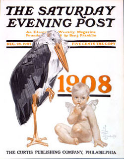
1908 (MCMVIII) was a leap year starting on Wednesday of the Gregorian calendar and a leap year starting on Tuesday of the Julian calendar, the 1908th year of the Common Era (CE) and Anno Domini (AD) designations, the 908th year of the 2nd millennium, the 8th year of the 20th century, and the 9th year of the 1900s decade. As of the start of 1908, the Gregorian calendar was 13 days ahead of the Julian calendar, which remained in localized use until 1923.

The Møre og Romsdal Agricultural Museum was officially opened on August 8, 1981 [5] in conjunction with celebrations marking the centennial of the agricultural school, directed by the Møre og Romsdal agricultural company. In 2009 the museum became part of the Sunnmøre Museum Foundation. [6]

The museum is located in a building from the old agricultural school. It is a natural stop between Ålesund and Åndalsnes, just south of Molde, with panoramic views of the Romsdal Fjord and Molde. The museum barn contains new exhibitions from 2013 presenting the hard life of a fjord farm in Møre og Romsdal a hundred years ago.

Ålesund Municipality in Møre og Romsdal, Norway

Ålesund is a town and municipality in Møre og Romsdal County, Norway. It is part of the traditional district of Sunnmøre and the centre of the Ålesund Region. It is a sea port and is noted for its concentration of Art Nouveau architecture. The town of Ålesund is the administrative centre of Ålesund Municipality, as well as the principal shipping town of the Sunnmøre district.

Åndalsnes Town in Western Norway, Norway

Åndalsnes  is a town in Rauma Municipality in Møre og Romsdal county, Norway. Åndalsnes is the administrative center of Rauma Municipality. The 2.22-square-kilometre (550-acre) town has a population (2013) of 2,244, giving it a population density of 1,011 inhabitants per square kilometre (2,620/sq mi). The village of Isfjorden lies about 7 kilometres (4.3 mi) to the east, Veblungsnes lies just to the west across the Rauma River, and Innfjorden lies about 10 kilometres (6.2 mi) to the southwest via the European Route E136 highway.

Molde Municipality in Møre og Romsdal, Norway

Molde is a city and municipality in Romsdal in Møre og Romsdal county, Norway. The municipality is located on the Romsdal Peninsula, surrounding the Fannefjord and Moldefjord. The city is located on the northern shore of the Romsdalsfjord.

The area around the museum is located in a park with an avenue of oak trees dating from 1758, where there is also an Iron Age burial site. [7] The exhibitions in the former dormitory cover the agricultural school's history at Gjermundnes, with student rooms restored to their conditions in 1960 and 1918.

The Iron Age is the final epoch of the three-age division of the prehistory and protohistory of humankind. It was preceded by the Stone Age and the Bronze Age. The concept has been mostly applied to Europe and the Ancient Near East, and, by analogy, also to other parts of the Old World.

Related Research Articles

Volda Municipality in Møre og Romsdal, Norway

Volda is a municipality in Møre og Romsdal county, Norway. It is part of the Sunnmøre region. The administrative centre is the village of Volda. Other villages in the municipality include Dravlaus, Folkestad, Fyrde, Lauvstad, and Straumshamn. The municipality is located about 50 kilometres (31 mi) south of the city of Ålesund.

Ørsta Municipality in Møre og Romsdal, Norway

Ørsta  is a municipality in Møre og Romsdal county, Norway. It is part of the Sunnmøre region of Western Norway. The administrative centre of the municipality is the village of Ørsta. Other villages in the municipality include Hovdebygda, Flåskjer, Leira, Liadal, Urke, Bjørke, Barstadvik, Åmdalen, Follestaddalen, Nordre Vartdal, Vartdal, Sæbø, Sætre, Store-Standal, and Ytre Standal.

Ørskog Municipality in Møre og Romsdal, Norway

Ørskog is a municipality in Møre og Romsdal county, Norway. It is part of the Sunnmøre region. The administrative centre is the village of Sjøholt. The other main village is Vaksvika, about 7.5 kilometres (4.7 mi) south of Sjøholt. The European Route E39/E136 highway runs through the municipality, connecting the towns of Ålesund and Molde. Rauma Group is the largest company in Ørskog in terms of turnover.

Stordal Municipality in Møre og Romsdal, Norway

Stordal is a municipality in Møre og Romsdal county, Norway. It is part of the Sunnmøre region. The administrative centre of the municipality is the village of Stordal. The historic farm and museum of Ytste Skotet lies along the Storfjorden in the western part of the municipality. Most of the municipality lies on the eastern side of the fjord.

Skodje Municipality in Møre og Romsdal, Norway

Skodje is a municipality in Møre og Romsdal county, Norway. It is part of the Sunnmøre region. The administrative centre is the village of Skodje. The other main village in the municipality is Valle.

Haram, Norway Municipality in Møre og Romsdal, Norway

Haram is a municipality in Møre og Romsdal county, Norway. It is part of the Sunnmøre region. The administrative center is Brattvåg, the industrial center of Sunnmøre. Other important villages in the municipality include Austnes, Eidsvik, Helle, Longva, Hildrestranda, Søvik, Tennfjord, and Vatne.

Vestnes Municipality in Møre og Romsdal, Norway

Vestnes is a municipality in Møre og Romsdal county, Norway. Vestnes is part of the traditional district of Romsdal. The administrative centre of the municipality is the village of Vestnes. Other villages in the municipality include Vikebukt, Vik, Øverås, Fiksdal, Tomrefjord, and Tresfjord.

Nesset Municipality in Møre og Romsdal, Norway

Nesset is a municipality in Møre og Romsdal county, Norway on the Romsdal Peninsula. The administrative centre is the village of Eidsvåg. Other population centers include Rausand, Boggestranda, Myklebostad, Eresfjord, and Eikesdalen.

Romsdal valley in Norway

Romsdal is the name of a traditional district in the Norwegian county Møre og Romsdal, located between Nordmøre and Sunnmøre. The district of Romsdal comprises Aukra, Fræna, Midsund, Molde, Nesset, Rauma, Sandøy, and Vestnes. It is named after the valley of Romsdalen, which covers part of Rauma.

Nordmøre traditional district of Norway

Nordmøre is a traditional district in the Norwegian county of Møre og Romsdal. The 5,426-square-kilometre (2,095 sq mi) area comprises the northern third of the county including the municipalities of Kristiansund, Averøy, Tingvoll, Surnadal, Aure, Halsa, Eide, Sunndal, Gjemnes, and Smøla. The only town in Nordmøre is Kristiansund

Romsdalsfjord fjord in Norway

Romsdalsfjord or Romsdal Fjord is the ninth-longest fjord in Norway. It is 88 kilometres (55 mi) long and located in the Romsdal district of Møre og Romsdal county. It flows through the municipalities of Midsund, Haram, Vestnes, Molde, Nesset, and Rauma. The deepest point in the fjord is just southwest of the town of Molde, where it is 550 metres (1,800 ft) deep. Romsdalsfjord is a threshold-fjord, as it is separated from the ocean by shallower areas at the mouth. Several islands and skerries also shelter the wide central fjord from the Atlantic.

Veøy Former municipality in Møre og Romsdal, Norway

Veøy is a former municipality in Møre og Romsdal county, Norway. The municipality existed from 1838 until 1964. It initially consisted of all of the present-day Vestnes Municipality, as well as the southern part of Molde Municipality and the northern part of Rauma Municipality. Vestnes Municipality was only part of Veøy for a few months in 1838 before it was made into a separate municipality. In 1964, the municipality was split between Molde and Rauma municipalities. Veøy Municipality was named after the island of Veøya, where the main church for the municipality was located.

Romsdal Museum Folk Museum in Molde, Norway

The Romsdal Museum is a museum in the Romsdal district of Møre og Romsdal county, Norway. The museum is based in Molde Municipality, but it has sites all over the region.

Tresfjord or Tresfjorden may refer to:

Solnør

Solnør is a Norwegian farm in Skodje in Møre og Romsdal county.

References

  1. Wisnnes, Jens (2007). From Singsaas to America (PDF). Trondheim: Norwegian University of Science and Technology. p. 7. Retrieved January 21, 2018.
  2. Otterlei, Inger (November 27, 2013). "Nybygg på Gjermundnes". Sunnmørsposten. Retrieved January 21, 2018.
  3. "Landbruksmuseet for Møre og Romsdal, Gjermundnes" . Retrieved January 21, 2018.
  4. "Gjermundnes" (PDF). Møre og Romsdal fylkeskommune. Vestnes kommune. Retrieved January 21, 2018.
  5. Husby, Steinar (1987). "Tankar omkring Landbruksmuseet på Gjermundnes". In Rønnestad, Birgitta. Fiskerimuseet på Hjertøya. Molde: Romsdalsmuseet. p. 54.
  6. "Konsolidering mellom Landbruksmuseet for Møre og Romsdal og Stiftinga Sunnmøre museum". Møre og Romsdal fylkeskommunen. Retrieved January 21, 2018.
  7. "Agricultural Museum, Vestnes". Sunnmøre Museum. Retrieved January 22, 2018.

Coordinates: 62°37′26″N07°09′59″E / 62.62389°N 7.16639°E / 62.62389; 7.16639

Geographic coordinate system Coordinate system

A geographic coordinate system is a coordinate system that enables every location on Earth to be specified by a set of numbers, letters or symbols. The coordinates are often chosen such that one of the numbers represents a vertical position and two or three of the numbers represent a horizontal position; alternatively, a geographic position may be expressed in a combined three-dimensional Cartesian vector. A common choice of coordinates is latitude, longitude and elevation. To specify a location on a plane requires a map projection.