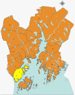
Kristiansand Region is a statistical metropolitan region in the counties of Vest-Agder and Aust-Agder in southern Norway. It is centered on the city of Kristiansand. The region consist of 6 municipalities in the centre of Southern Norway. Vennesla, Songdalen, and Birkenes are inland municipalities while Kristiansand, Søgne, and Lillesand are coastal municipalities. Kristiansand is the largest municipality in population in the region and Birkeland is the largest in area.

Vågsbygd is a borough and district in the city of Kristiansand in Vest-Agder county, Norway. It is the largest borough and district in Kristiansand. Until 1965, Vågsbygd was a part of Oddernes municipality. The borough includes the districts of Flekkerøy, Voiebyen, Vågsbygd/Augland, and Slettheia. The Kristiansand Cannon Museum on Kroodden is an authentic fortress from World War II.

Bråvann is a neighbourhood in the city of Kristiansand in Vest-Agder county, Norway. The neighborhood is located in the borough of Vågsbygd and in the district of Voiebyen. The neighbourhood is located in the western part of the district at the top of a hill and consists mostly of large households. It lies to the west of Rådyr and northwest of Skutevika.
Lauvåsen is a neighbourhood in the city of Kristiansand in Vest-Agder county, Norway. It is a part of the borough of Oddernes and it is in the district of Hånes. The neighbourhood lies between European route E18 and Norwegian National Road 41, just east of the neighborhood of Hånni and southeast of the neighborhood of Grovikheia.

Vigvoll is a neighborhood in the city of Kristiansand in Vest-Agder county, Norway. It is a part of the Oddernes borough and the district of Hånes. The neighborhood lies north of the European route E18 highway, west of the Norwegian National Road 41, and east of the Topdalsfjorden. Vigvoll skole is the only junior high at Hånes. Bus line M2 goes though Vigvoll continuing to Hånes, Voiebyen, or Sørlandsparken. It includes a small shopping area known locally as Hånni.

Grovikheia is a neighbourhood in the city of Kristiansand in Vest-Agder county, Norway. It is a part of the borough of Oddernes and in the district of Hånes. It is located along the Norwegian National Road 41 and it is north of the Hånni neighborhood and northwest of Lauvåsen. The name Grovikheia comes from the cove Grovika.
Ternevig is a neighbourhood in the city of Kristiansand in Vest-Agder county, Norway. The neighborhood is located in the borough of Vågsbygd and in the district of Voiebyen. Ternevig is northeast of Møvik, southeast of Voie, east of Møviklia, and west of the ocean and the island of Andøya. There is a small hospital located in Ternevig serving the borough of Vågsbygd. There is also a marina located in this neighborhood.
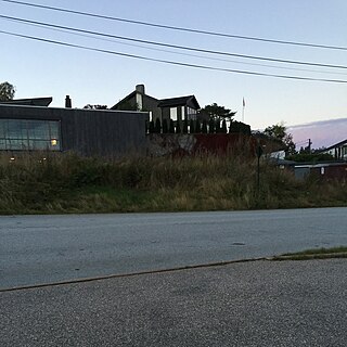
Kroodden is a neighbourhood in the city of Kristiansand in Vest-Agder county, Norway. The neighborhood is located in the borough of Vågsbygd and in the district of Voiebyen. The Kristiansand Cannon Museum is located to the west of Kroodden. Kroodden is south of Spinneren along the coast. From Kroodden, the Flekkerøy Tunnel leads across the strait to the island of Flekkerøy.
Spinneren is a neighbourhood in the city of Kristiansand in Vest-Agder county, Norway. The neighborhood is located in the borough of Vågsbygd and in the district of Voiebyen. Spinneren is located along the coast, south of Møvik and north of Kroodden.
Skutevika is a neighbourhood in the city of Kristiansand in Vest-Agder county, Norway. The neighborhood is located in the borough of Vågsbygd and in the district of Voiebyen. Skutevika is north of Kroodden, south of Møviklia, east of Steindalen, and west of Spinneren.
Steindalen is a neighbourhood in the city of Kristiansand in Vest-Agder county, Norway. The neighborhood is located in the borough of Vågsbygd and in the district of Voiebyen. Steindalen is north of Kroodden, south of Voieåsen, east of Voietun, and west of Møviklia.
Voieåsen is a neighbourhood in the city of Kristiansand in Vest-Agder county, Norway. The neighborhood is located in the borough of Vågsbygd and in the district of Voiebyen. Voieåsen is north of Møviklia, south of Voie, east of Voielia, and west of Møvik.
Voielia is a neighbourhood in the city of Kristiansand in Vest-Agder county, Norway. The neighborhood is located in the borough of Vågsbygd and in the district of Voiebyen. Voielia is north of Voietun, south of Rådyr, east of Bråvann, and west of Voieåsen.
Voietun is a neighbourhood in the city of Kristiansand in Vest-Agder county, Norway. The neighborhood is located in the borough of Vågsbygd and in the district of Voiebyen. Voietun is south of Voielia and west of Steindalen.
Rådyr is a neighbourhood in the city of Kristiansand in Vest-Agder county, Norway. The neighborhood is located in the borough of Vågsbygd and in the district of Voiebyen. The neighborhood of Rådyr is north of Voielia, south of Kjos Haveby, east of Bråvann, and west of Kjosbukta.
Løvika is a neighbourhood in the city of Kristiansand in Vest-Agder county, Norway. The neighborhood is located in the borough of Vågsbygd and in the district of Voiebyen. It is located on the northeastern part of the island of Andøya. Løvika is east of Voie and northeast of Ternevig.
Oddernes is a former municipality in Vest-Agder county, Norway. The 103-square-kilometre (40 sq mi) municipality existed from 1838 until its dissolution in 1964. The administrative centre was the village of Lund on the east side of the river Otra near where Lund Church is located. The former area of the municipality makes up the western part of the municipality of Kristiansand. It encircled the town of Kristiansand, and it included the villages such as Flekkerøy, Vågsbygd, Slettheia, Lund, Strai, Mosby, and Justvik. Today, the town of Kristiansand has a borough named Oddernes, but it has very different boundaries than the old municipality had.

Voie Church is a parish church in Kristiansand municipality in Vest-Agder county, Norway. It is located in the Møvik neighborhood in the district of Voiebyen in the borough of Vågsbygd in the city of Kristiansand. The church is part of the Voie parish in the Kristiansand arch-deanery in the Diocese of Agder og Telemark. The brick church was built in 1990 using plans by the architect Arild Lauvland. The fan-shaped church seats about 300 people, but it can be expanded to about 500 people.