European route E40 is the longest European route, more than 8,000 kilometres long, connecting Calais in France via Belgium, Germany, Poland, Ukraine, Russia, Kazakhstan, Uzbekistan, Turkmenistan, and Kyrgyzstan, with Ridder in Kazakhstan near the border with Russia and China.

Bryansk is a city and the administrative center of Bryansk Oblast, Russia, situated on the River Desna, 379 kilometers (235 mi) southwest of Moscow. Population: 379,152 (2021 Census); 415,721 (2010 Census); 431,526 (2002 Census); 452,160 (1989 Census).
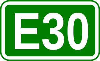
European route E30 is an A-Class European route from the port of Cork in Ireland in the west to the Russian city of Omsk, near the border with Kazakhstan in the east. For much of the Russian stretch, it follows the Trans-Siberian Highway and, east of the Ural Mountains, with AH6 of the Asian Highway Network, which continues to Busan, South Korea. The total length is 6,530 km (4,060 mi)—3,300 km (2,100 mi) from Cork to Moscow, and 3,230 km (2,010 mi) from Moscow to Omsk. The naming is by the United Nations Economic Commission for Europe (UNECE).

The M41, known informally and more commonly as the Pamir Highway, is a road traversing the Pamir Mountains through Afghanistan, Uzbekistan, Tajikistan and Kyrgyzstan with a length of over 1,200 km. It is the only continuous route through the difficult terrain of the mountains and is the main supply route to Tajikistan's Gorno-Badakhshan Autonomous Region. The route has been in use for millennia, as there are a limited number of viable routes through the high Pamir Mountains. The road formed one link of the ancient Silk Road trade route. M41 is the Soviet road number, but it only remains as an official designation in post-Soviet Uzbekistan, as confirmed by official decree. Kyrgyzstan and Tajikistan have passed decrees abolishing Soviet numbering of highways and assigning their own national numbering.

Leningradsky Prospekt, or Leningrad Avenue, is a major arterial avenue in Moscow, Russia. It continues the path of Tverskaya Street and 1st Tverskaya-Yamskaya Street north-west from Belorussky Rail Terminal, and changes the name once again to Leningrad Highway past the Sokol metro station. The Highway continues its way to Saint Petersburg via Tver.
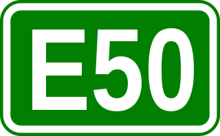
European route E 50 is an A-type east–west connection across the European continent. It connects the key naval port of Brest France with Makhachkala, on the Caspian Sea in the Russian republic Dagestan.

M01 is a Ukraine international highway (M-highway) that stretches from the state capital, Kyiv, to the northern border with Belarus.

The Russian route M2 is a major trunk road that connects Moscow to Crimea. It is part of the European route E105. It is 720 kilometers long.

The Russian route M9, also known as the Baltic Highway, is a 610 km-long trunk road that leads from Moscow through Volokolamsk to Russia's border with Latvia. The road runs north of Moscow across the towns of Krasnogorsk, Istra, Volokolamsk, Zubtsov, Rzhev, Velikiye Luki, and Sebezh, ending up at the state border. It passes Moscow, Tver, and Pskov Oblasts. The highway forms a part of the European route E22 which continues across the border to Rēzekne and Riga.

The Russian route M8 "Kholmogory" or Yaroslavl highway, is a major trunk road that links Moscow to the Russian North in general and the sea harbour of Arkhangelsk in particular. The road runs north of Moscow across a distance of 1271 kilometres through Mytishchi, Pushkino, Sergiyev Posad, Pereslavl-Zalessky, Rostov the Great, Yaroslavl, Danilov, Gryazovets, Vologda, Kadnikov, Velsk, Kholmogory, and Arkhangelsk, ending up in the city of Severodvinsk. It passes Moscow, Vladimir, Yaroslavl, Vologda, and Arkhangelsk Oblasts.

Leninsky Avenue is a major avenue in Moscow, Russia, that runs in the south-western direction between Kaluzhskaya Square in the central part of the city through Gagarin Square to the Moscow Ring Road. It is a part of the M3 highway which continues from Moscow to Kaluga and Bryansk to the border with Ukraine, and provides connections with Kyiv and Odessa. It is also a part of the European route E101 connecting Moscow and Kyiv.

Highway M04 was a Ukraine international highway connecting Znamianka to Krasnodon on the border with Russia, where it continued into Russia as the A260.

Russian federal highways are the most important highways in Russia that are federal property. The following motorways are designated as federal.

Leningradskoye Highway is a part of M10 federal highway Moscow – Saint Petersburg inside Moscow. One of the major thruways of Russia's capital, it connects Moscow with several large commuter towns such as Khimki and Zelenograd, as well as with Sheremetyevo Airport.

Kashirskoye Highway or Kashira Highway is a major street in Moscow, Russia, continued as a highway beyond the city into Moscow Oblast as a backup route for highway M4. It was named in the 19th century after the old Kashira Road, which led to the town of Kashira. It was one of the sites of the Russian apartment bombings of 1999. Along the road, major landmarks include the Saburovo Church and the Orekhovo-Borisovo Cathedral.

Varshavskoye Highway is a major street in Moscow, Russia, continued beyond the city limit at Moscow Ring Road into Moscow Oblast as a backup route for M2 highway, a major trunk road. It continues the Bolshaya Tulskaya Street of central Moscow, and close from its start the Kashira Highway branches from it.

Highway M02 is a Ukraine international highway (M-highway) connecting the M01 near Kipti with Bachivsk on the border with Russia, where it continues as the M3 to Moscow. The entire route is part of European route E101 and the section from Hlukhiv to the Russian border is part of European route E391.

European route E 101 is a road part of the International E-road network. It begins in Moscow, Russia, and ends in Kyiv, Ukraine. It is 850 km (530 mi) long.

Highway M19 is a Ukrainian international highway (M-highway) that completely corresponds to whole length of European route E85 that runs through Ukraine.

M26 is a Ukrainian international highway (M-highway) in western Ukraine that runs within Berehove Raion from the M23 at Vylok near the Hungarian border to the Romanian border where it continues as the DN1C into Romania. The M26 is part of European routes E81 and E58. Before 2013 the route was designated as P55.