
Traffic calming uses physical design and other measures to improve safety for motorists, car drivers, pedestrians and cyclists. It has become a tool to combat speeding and other unsafe behaviours of drivers. It aims to encourage safer, more responsible driving and potentially reduce traffic flow. Urban planners and traffic engineers have many strategies for traffic calming, including narrowed roads and speed humps. Such measures are common in Australia and Europe, but less so in North America. Traffic calming is a calque of the German word Verkehrsberuhigung – the term's first published use in English was in 1985 by Carmen Hass-Klau.
A curb extension is a traffic calming measure which widens the sidewalk for a short distance. This reduces the crossing distance and allows pedestrians and drivers to see each other when parked vehicles would otherwise block visibility. The practice of banning car parking near intersections is referred to as daylighting the intersection.

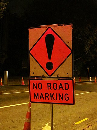
Speed bumps are a class of traffic calming devices that use vertical deflection to slow motor-vehicle traffic in order to improve safety conditions. Variations include the speed hump, speed cushion, and speed table.

A dual carriageway (BrE) or a divided highway (AmE) is a class of highway with carriageways for traffic travelling in opposite directions separated by a central reservation (BrE) or median (AmE). Roads with two or more carriageways which are designed to higher standards with controlled access are generally classed as motorways, freeways, etc., rather than dual carriageways.

A limited-access road, known by various terms worldwide, including limited-access highway, dual-carriageway, expressway, and partial controlled-access highway, is a highway or arterial road for high-speed traffic which has many or most characteristics of a controlled-access highway, including limited or no access to adjacent property, some degree of separation of opposing traffic flow, use of grade separated interchanges to some extent, prohibition of slow modes of transport, such as bicycles, horse-drawn vehicles or ridden horses, or self-propelled agricultural machines; and very few or no intersecting cross-streets or level crossings. The degree of isolation from local traffic allowed varies between countries and regions. The precise definition of these terms varies by jurisdiction.
Standards for Interstate Highways in the United States are defined by the American Association of State Highway and Transportation Officials (AASHTO) in the publication A Policy on Design Standards: Interstate System. For a certain highway to be considered an Interstate Highway, it must meet these construction requirements or obtain a waiver from the Federal Highway Administration.

The Moscow Automobile Ring Road, or MKAD (МКАД), is a ring road running predominantly on the city border of Moscow with a length of 108.9 km (67.7 mi) and 35 exits. It was completed in 1962. The speed limit is 100 km/h.

Road signs in Iceland are visual communication devices placed along roads and highways throughout the country to provide information, warnings, and guidance to motorists and pedestrians. Iceland never ratified the Vienna Convention on Road Signs and Signals, but road signs in Iceland conform to the general pattern of those used in most other European countries, with certain design elements borrowed from Danish and Swedish practice. Signs tend to be more sparsely employed than in other European countries, especially in rural areas.

Traffic signs, installations, and symbols used in Germany are prescribed by the Road Traffic Regulation (StVO) and the Traffic Signs Catalog (VzKat).

Road signs in Pakistan are modelled on the British road sign system, with an exceptional difference being that they are bilingual and contain messages in Urdu, the national language, and English, and in some cases, the local regional or provincial languages. Pakistan drives on the left side of the road and follows the left-hand traffic system. Vehicles must be overtaken on their right.
Road signs in New Zealand are similar to those set by the Vienna Convention on Road Signs and Signals. While New Zealand is not a signatory to the convention, its road signs are generally close in shape and function. New Zealand uses yellow diamond-shaped signs for warnings in common with Australia, the Americas, Ireland, Japan and Thailand. Speed limit signs are a red circle with a white background and the limitation in black, and are in kilometres per hour. There are also some signs unique to New Zealand. Road signs in New Zealand are controlled by NZ Transport Agency Waka Kotahi and are prescribed in the Land Transport Rule: Traffic Control Devices 2004 and set out in the Traffic Control Devices (TCD) Manual.

Bosnia and Herzegovina is a signatory to the Vienna Convention on Road Signs and Signals. Therefore, road signs do not differ much from the rest of Europe, such as Croatia, Slovenia, Serbia and North Macedonia. Ministry of Transportation of Bosnia and Herzegovina regulates them. Bosnia and Herzegovina drives on the right as with the rest of Europe, except for Cyprus, Ireland, Malta and the United Kingdom. Bosnian and Herzegovinan road signs have two scripts, Latin and Cyrillic script.

Road signs in Cambodia are standardized road signs are similar to those used in Europe but much of it resembles road signage systems used in South American countries with certain differences. The designs of road signage match their neighbours of Thailand and Malaysia, both of which adopt a modified version of the South American road signage system. Until the early 1980s, Cambodia closely followed American, European, Australian, and Japanese practices in road sign design, with diamond-shaped warning signs and circular restrictive signs to regulate traffic. Unlike Thailand and Malaysia, Cambodia does not use the FHWA Series fonts typeface, favouring Helvetica instead.

Road signs in France refer to all conventional signals installed on French roads and intended to ensure the safety of road users, either by informing them of the dangers and regulations relating to traffic as well as elements useful for decision-making, or by indicating to them the landmarks and equipment useful for their travel on the national territory. They generally largely follow the general European conventions concerning the use of shape and color to indicate their function. France is a signatory to the 1968 Vienna Convention on Road Signs and Signals. France signed the Vienna Convention on Road Signs and Signals on 8 November 1968 and ratified it on 9 December 1971.

Road signs in Azerbaijan are similar to the road sign system of post-Soviet states that ensure that transport vehicles move safely and orderly, as well as to inform the participants of traffic built-in graphic icons. They generally conform to the Vienna Convention on Road Traffic and Vienna Convention on Road Signs and Signals.

Road signs in Armenia are similar to the signs of other post-Soviet states and most European road sign systems. Armenia is a signatory of the Vienna Convention on Road Traffic and the Vienna Convention on Road Signs and Signals. The Ministry of Transport regulates these icons, while the police enforces them. Road signs ensure transport vehicles move safely and orderly, as well as, to inform both pedestrians and motorists of traffic rules.

Road signs in Lithuania conform to the general pattern of those used in most other European countries as set out in the 1968 Vienna Convention on Road Signs and Signals. Due to the country being occupied and annexed by the Soviet Union between 1940 and 1990, when it restored its independence, modern road signs used in Lithuania are in many ways similar in design to road signs used in the Soviet Union before its dissolution in 1991. This design of road signs is still used in most post-Soviet states, in particular Russia, Belarus, and Ukraine. Neighboring post-Soviet Baltic countries Latvia and Estonia, which were also occupied by the Soviet Union in 1940, have significantly modified their road sign designs, resulting road signs in these two countries being extremely different in design from road signs used in most other post-Soviet states.

Road signs in the Republic of Bulgaria were introduced by the Road Traffic Act and are regulated by:

Road signs in South Africa are based on the SADC-Road Traffic Sign Manual, a document designed to harmonise traffic signs in member states of the Southern Africa Development Community. Most of these signs were in the preceding South African RTSM.

Road signs in Ecuador are regulated in Manual Básico de Señalización Vial and Reglamento Técnico Ecuatoriano. RTE INEN 004-1:2011. Señalización vial, which is based on the United States' Manual on Uniform Traffic Control Devices (MUTCD) originally developed by the Federal Highway Administration (FHWA). Thus, road signs in Ecuador are similar in design to road signs used in the United States. One of the differences is that Ecuador uses the metric system, for example, vehicle speed is measured in km/h.


