Kancheepuram district is one of the 38 districts in the state of Tamil Nadu in India. The area comprising the present day Kancheepuram district was earlier a part of Chingleput district. The original Chingleput district was split in 1997 into form the present day Kancheepuram and Tiruvallur districts.

Dharmapuri is a city in the north western part of Tamil Nadu, India. It serves as the administrative headquarters of Dharmapuri district which is the first district created in Tamil Nadu after the independence of India by splitting it from then Salem district on 2 October 1965. The city is located 50 km from Krishnagiri, 69 km from Salem, 90 km from Hosur, 117 km from Thiruvannamalai, 126 km from Bangalore and Erode, 181 km from Tiruppur, 200 km from Coimbatore and Tiruchirappalli, 300 km from Madurai and the state capital Chennai. It is located between latitudes N 11 47’ and 12 33’ and longitudes E 77 02’ and 78 40’. It is one of the major leading cultivators and producers of mangoes in the state along with Krishnagiri, and is often referred as Mango Capital of India.

Tiruchirappalli District is one of the 38 districts, located along the Kaveri River, in Tamil Nadu, India. The headquarters of the district is the city of Tiruchirappalli.

Krishnagiri district is one of the 38 districts of the state of Tamil Nadu, in India. This district is carved out from Dharmapuri District by 2004. The municipal town of Krishnagiri is the district headquarters. In Tamil Nadu, e-Governance was first introduced at Krishnagiri district under the National e-Governance Project (NEGP) in revenue and social welfare departments on a pilot basis. The district is one of the largest producers of mangoes in India. As of 2011, the district had a population of 1,879,809 with a sex-ratio of 958 females for every 1,000 males. Hosur is the most populous town in the district.

Dharmapuri is one of the 38 districts in the state of Tamil-Nadu, India. It is the first district created in Tamil Nadu after the independence of India by splitting it from then-Salem district on 2 October 1965. Dharmapuri District is one of the major producers of mango in the state, fine quality granite is found in the district. It is also one of the main sericulture belts in the state. Around 30 percent of the district's area is under forest cover. Kaveri enters Tamil Nadu through this district. Dharmapuri district had the lowest literacy rate of 74.23% in Tamilnadu during the 2011 census.

Perambalur is a town in the Indian state of Tamil Nadu. It is the headquarters of Perambalur district and Perambalur taluk (sub-district). As of 2011 census, the town had a population of 49,648.
Bargur is a selection-grade town panchayat in the Krishnagiri district of the Indian state of Tamil Nadu, that serves as the headquarters of Bargur taluk, one of the seven taluks in Krishnagiri district.
Denkanikottai also known as Thenkanikottai is a semi-urban Panchayat Town in Krishnagiri district in the state of Tamil Nadu, India. It is the headquarters of Denkanikottai Taluk. Its altitude 879 m elevation above the sea level. It is a multicultural town with a mix of linguistic groups. Tamil is the official and spoken language. There are a significant number of Kannada, Urdu and Telugu and speakers in the town as it is very near to Karnataka State bordering it. The place is named after the legend of Betrayaswamy Temple located in the centre of the town.
Kambainallur is a panchayat town in karimangalam taluk of Dharmapuri district in the Indian state of Tamil Nadu. It also serves as a main source of transport, food, health and education for many villages situated around the Kambainallur.
Pennagaram is a town in Dharmapuri district in the Indian state of Tamil Nadu. It is the headquarters of Pennagaram taluk (sub-district).

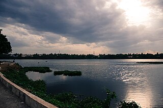
Krishnagiri is a city in the state of Tamil Nadu, India, and it serves as the administrative headquarters of Krishnagiri District formed in 2004. It is located at the bottom of Krishnadevaraya Hills, and the town is fully surrounded by hill rocks. It is located 250 km from Chennai, 45 km from Dharmapuri, and 90 km from Bengaluru. Krishnagiri is known as "Mango Capital of India" as mangoes are cultivated as the main crop, and the land here is extremely fertile with rich access to fresh water making it amenable to growing crops. Krishnagiri is the site of significant business and residential development. The Krishnagiri Dam was built in 1967.
Geographic location The village Dilawarpur is located in Dilawarpur Mandal of Nirmal District in the State of Telangana in India. It is governed by Dilawarpur Gram Panchayat. It comes under Dilawarpur Community Development Block. The nearest town is Nirmal, which is about 14 kilometers away from Nirmal district.
Palacode taluk is a taluk in the Dharmapuri district of the Indian state of Tamil Nadu. The headquarters of the taluk is the town of Palacode. Part of Cauvery North Wildlife Sanctuary is located in this taluk.

Tiruvannamalai district is the largest and one of the 38 districts in the state of Tamil Nadu, in South India. It was formed in the year 1989 through the bifurcation of North Arcot into the Tiruvannamalai Sambuvarayar and Vellore Ambedkar districts. The city of Tiruvannamalai is the district headquarters.

Tirupathur or Tirupattur is the headquarters of Tirupathur district in the state of Tamil Nadu in India and is one of the oldest inhabited places in the state, with a history of over 1,600 years. The town is known for an abundance of sandalwood in the surrounding hills. It is located about 89 km (55 mi) from Vellore, 85 km (53 mi) from Hosur, 60 km (37 mi) from Dharmapuri, 50 km (31 mi) from Krishnagiri, 50 km (31 mi) from Thiruvannamalai, 210 km (130 mi) from Chennai, and 125 km (78 mi) from Bangalore.
Anchetty is a village in the Anchetti taluk of the Krishnagiri district of the Indian state of Tamil Nadu. The village is in the southern half of the taluk, and is the headquarters of one of its seven firkas.
Nagamangalam is a village in Denkanikottai taluk, Krishnagiri district, Tamil Nadu, India. As of the 2011 Census of India, Nagamangalam had a total population of 4,948 with 2,502 males and 2,446 females.
Averipally is a group of hamlets located 6 km away from Thally town in Krishnagiri district, Tamil Nadu, India. This village comes under Achubalu Panchayat within Denkanikottai taluk. Periya Averipalli, Chinna Averipalli and Averipalli Agaraharam are the 3 sub-hamlets forms Averipally as a Village. This village located 3 km away from Karnataka State Border so apart from Tamil language Kannada also widely spoken in this village.

Dasarapalli, also spelled Dasarapally, is a village located east of the village of Thally Kothanur in Tamil Nadu, India. It is five kilometers away from the town of Thally. The primary occupations of the villagers are farming and labor service.

Christhupalayam, also spelled Kristhupalayam, is a village located 6 km from the major town Denkanikottai, Tamil Nadu, India. The primary occupations of the villagers are farming and labor service.
