
The Andaman and Nicobar Islands is a union territory of India consisting of 572 islands, of which 37 are inhabited, at the junction of the Bay of Bengal and the Andaman Sea. The territory is about 150 km (93 mi) north of Aceh in Indonesia and separated from Thailand and Myanmar by the Andaman Sea. It comprises two island groups, the Andaman Islands (partly) and the Nicobar Islands, separated by the 150 km wide Ten Degree Channel, with the Andaman islands to the north of this latitude, and the Nicobar islands to the south. The Andaman Sea lies to the east and the Bay of Bengal to the west. The island chains are thought to be a submerged extension of the Arakan Mountains.
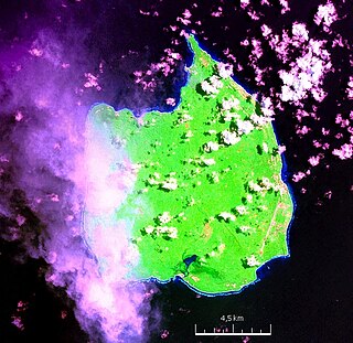
Car Nicobar is the northernmost of the Nicobar Islands. It is also one of three local administrative divisions of the Indian district of Nicobar, part of the Indian union territory of Andaman and Nicobar Islands. Annual rainfall is 2800 millimetres.

Port Blair is the capital city of the Andaman and Nicobar Islands, a union territory of India in the Bay of Bengal. It is also the local administrative sub-division (tehsil) of the islands, the headquarters for the district of South Andaman and is the territory's only notified town.
Little Andaman Island is the fourth largest of the Andaman Islands of India with an area of 707 km2, lying at the southern end of the archipelago. It belongs to the South Andaman administrative district, part of the Indian union territory of Andaman and Nicobar Islands. It lies 88 km (55 mi) south of Port Blair, the capital of Andaman and Nicobar Islands.

Middle Andaman Island is an island of the Andaman Islands. It belongs to the North and Middle Andaman administrative district, part of the Indian union territory of Andaman and Nicobar Islands.
Indira Point, the southernmost point of India's territory, is a village in the Nicobar district at Great Nicobar Island of Andaman and Nicobar Islands in India. It is located in the Great Nicobar tehsil.
Nicobar district is one of three districts in the Indian union territory of Andaman and Nicobar Islands. The district's administrative territory encompasses all of the Nicobar Islands, which are located in the Indian Ocean, between the Bay of Bengal and the Andaman Sea. The headquarters of the district is the village of Malacca, located on the island of Car Nicobar.
Rangat is a town on the Middle Andaman Island, Andaman Archipelago. It is also one of the three counties (tehsils) administrative divisions of the North and Middle Andaman district, in the Andaman and Nicobar Islands union territory of India. Its population, according to the 2001 Census of India, was 38,824 people, mainly of Bengalis and Tamils.

Shaheed Dweep, is an island of the Andaman Islands, located in Ritchie's Archipelago. It belongs to the South Andaman administrative district, part of the Indian union territory of Andaman and Nicobar Islands. The island is located 36 km (22 mi) northeast from Port Blair.
Interview Island is an island of the Andaman Islands. It belongs to the North and Middle Andaman administrative district, part of the Indian union territory of Andaman and Nicobar Islands. It lies 125 km (78 mi) north of Port Blair.
Strait Island is an island of the Andaman Islands. It belongs to the North and Middle Andaman administrative district, part of the Indian union territory of Andaman and Nicobar Islands. The island lies 63 km (39 mi) north from Port Blair.
Trinkat Bay is a village in the Nicobar district of Andaman and Nicobar Islands, India. It is located in the Great Nicobar tehsil. It is located between Lawful and Afra on Great Nicobar island.
Tapong is a village in the Nicobar district of Andaman and Nicobar Islands, India. It is located on the Nancowry Island, around 10 km from the Champin village, and comes under the administration of the Nancowry tehsil.
Champin is a village in the Nicobar district of Andaman and Nicobar Islands, India. It is located on the Nancowry Island, around 10 km from the Tapong village, and comes under the administration of the Nancowry tehsil.
7 km Farm is a village in the Nicobar district of Andaman and Nicobar Islands, India. It is located in the Great Nicobar tehsil.
Vijoy Nagar is a village in the Nicobar district of Andaman and Nicobar Islands, India. It is located in the Great Nicobar tehsil.
Sastri Nagar is a village in the Nicobar district of Andaman and Nicobar Islands, India. It is located in the Great Nicobar tehsil, around 35 km from Campbell Bay.
East Island is an island of the Andaman Islands. It belongs to the North and Middle Andaman administrative district, part of the Indian union territory of Andaman and Nicobar Islands. The island is located 220 km (137 mi) north from Port Blair.
Curlew Island is an island of the Andaman Islands. It belongs to the North and Middle Andaman administrative district, part of the Indian union territory of Andaman and Nicobar Islands. The island lies 150 km (93 mi) north of Port Blair.
Stewart Island is an island of the Andaman Islands. It belongs to the North and Middle Andaman administrative district, part of the Indian union territory of Andaman and Nicobar Islands. The island lies 150 km (93 mi) north of Port Blair. Its population only consists of two people.
