Maggie, Virginia | |
|---|---|
 Johns Creek Volunteer Fire Company in Maggie | |
 Maggie Location in Virginia  Maggie Maggie (the United States) | |
| Coordinates: 37°25′24″N080°22′55″W / 37.42333°N 80.38194°W [1] | |
| Country | United States |
| State | Virginia |
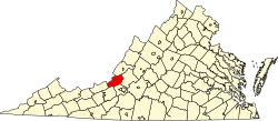
| County | Craig |
| Elevation | 1,801 ft (549 m) |
| Time zone | UTC-5 (Eastern (EST)) |
| • Summer (DST) | UTC-4 (EDT) |
| Area code | 540 |
| GNIS ID [1] [2] | 1485155 |
| FIPS code [1] [2] | 51-48648 |
Maggie is an unincorporated community in west-central Craig County, Virginia, United States. [1] It lies along Dicks Creek Road. [3]