The Wisconsin Range is a major mountain range of the Horlick Mountains in Antarctica, comprising the Wisconsin Plateau and numerous glaciers, ridges and peaks bounded by the Reedy Glacier, Shimizu Ice Stream, Horlick Ice Stream and the interior ice plateau.

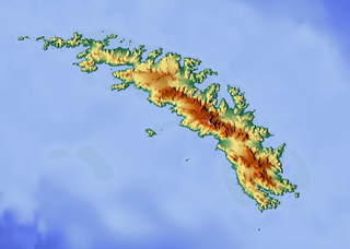
Novosilski Glacier is a glacier, 8 miles (13 km) long and 2 miles (3.2 km) wide, flowing in a westerly direction from the southwest slopes of the Salvesen Range to Novosilski Bay on the south coast of South Georgia. First surveyed and named by a German expedition 1928-29, under Kohl-Larsen. The name derives from nearby Novosilski Bay.

El-Sayed Glacier is a glacier about 15 nautical miles long which drains the northeast slopes of Zuncich Hill in Marie Byrd Land. It flows northeast to enter Land Glacier at the south side of Mount Shirley. It was mapped by the United States Geological Survey from surveys and U.S. Navy air photos, 1959–65, and was named by the Advisory Committee on Antarctic Names for Sayed Z. El-Sayed, a United States Antarctic Research Program oceanographer on the International Weddell Sea Oceanographic Expeditions, 1967–68 and 1969–70.

Astapenko Glacier is a glacier, 11 miles (18 km) long, draining the north and northeast slopes of Stanwix Peak in the Bowers Mountains and flowing east-northeast to Ob' Bay, situated in Victoria Land, Antarctica. It was mapped by the United States Geological Survey from surveys and from U.S. Navy air photos, 1960–62, and named by the Advisory Committee on Antarctic Names for Pavel D. Astapenko, Soviet IGY observer, a Weather Central meteorologist at Little America V in 1958. The glacier lies on the Pennell Coast, a portion of Antarctica lying between Cape Williams and Cape Adare.

Andrew Glacier is a glacier 3 nautical miles (6 km) long, flowing northeast into Ognen Cove in Charcot Bay immediately west of the Webster Peaks on Trinity Peninsula, northern Graham Land.

Bigo Bay is a bay 8 nautical miles (15 km) long and 6 nautical miles (11 km) wide, indenting the west coast of Graham Land between Cape Garcia and Magnier Peninsula surmounted by the Magnier Peaks and Lisiya Ridge.
Chapin Peak is a prominent rock peak, 2,170 metres (7,120 ft) high, on the west side of Reedy Glacier, standing 2 nautical miles (4 km) southeast of Stich Peak in the Quartz Hills. It was mapped by the United States Geological Survey (USGS) surveys and from U.S. Navy air photos, 1960–64, and named by the Advisory Committee on Antarctic Names for Captain Howard Chapin, United States Marine Corps, pilot with U.S. Navy Squadron VX-6 at McMurdo Station, 1962–63 season.

Chavez Island is an island 3 nautical miles (6 km) long which rises to 550 metres (1,800 ft), lying immediately west of Magnier Peninsula, which is between Leroux Bay and Bigo Bay, off the west coast of Graham Land. It was discovered and named by the French Antarctic Expedition, 1908–10, under Jean-Baptiste Charcot, probably for Commandant Alfonso Chaves of Ponta Delgada, Azores, but the spelling Chavez has become established through long usage.

Jeroboam Glacier is a southwestern tributary glacier in the north foothills of Mount Sara Teodora that joins Starbuck Glacier just east of Gabriel Peak in Aristotle Mountains, on the east side of Graham Land, Antarctica. The toponym is one of several in the vicinity applied by the UK Antarctic Place-Names Committee from Herman Melville's Moby-Dick, the Jeroboam being the ship that met the Pequod.
Greenshields Peak is a peak between Leroux Bay and Bigo Bay, rising 1 nautical mile (2 km) west of the Magnier Peaks on the west coast of Graham Land, Antarctica. It was mapped by the Falkland Islands Dependencies Survey from photos taken by Hunting Aerosurveys Ltd in 1956–57, and was named by the UK Antarctic Place-Names Committee for James N.H. Greenshields, a pilot with the Falkland Islands and Dependencies Aerial Survey Expedition in this area, 1955–56.

Drummond Glacier is a glacier 10 nautical miles (18 km) long and 2 nautical miles (4 km) wide, on the west coast of Graham Land, situated south of Hopkins Glacier and flowing west-northwest between Voit Peak and Sherba Ridge into Darbel Bay east of Sokol Point.
Erskine Glacier is a glacier 16 nautical miles (30 km) long on the west coast of Graham Land, flowing west into Darbel Bay to the north of Hopkins Glacier. It was first surveyed by the Falkland Islands Dependencies Survey (FIDS) in 1946–47, and named "West Gould Glacier". With East Gould Glacier it was reported to fill a transverse depression across Graham Land, but further survey in 1957 showed no close topographical alignment between the two. The name Gould has been limited to the east glacier and an entirely new name, for Angus B. Erskine, leader of the first FIDS party to travel down the glacier and to survey it in detail, has been approved for the west glacier.
Mount Forecast is a large mountain comprising several peaks, standing just northeast of Mount Brown-Cooper and 12.5 nautical miles (23 km) southwest of Mount Pollard in the Prince Charles Mountains of Antarctica. It was napped from Australian National Antarctic Research Expeditions surveys and air photos, 1956–65, and was mamed by the Antarctic Names Committee of Australia for M.J. Forecast, a weather observer at Wilkes Station, 1965.

Cape Garcia is a cape at the north side of the entrance to Barilari Bay, forming the north extremity of Felipe Solo (Obligado) Peninsula on the west coast of Graham Land, Antarctica. The cape was discovered and named "Cap Loqui" by the French Antarctic Expedition, 1903–05, under Jean-Baptiste Charcot. At the same time Charcot named the south entrance point to the bay "Cap Garcia," after Rear Admiral Garcia of the Argentine Navy. The maps of Charcot's French Antarctic Expedition, 1908–10, showed "Cap Garcia" as the north cape of Barilari Bay and the name has since become established for this feature. Charcot did not use the name "Cap Loqui" on the maps of his second expedition but, for the sake of historical continuity, the name Loqui Point has been accepted for the south entrance point.
Heathcock Peak is a peak, 2,310 metres (7,580 ft) high, located in the eastern part of the Caloplaca Hills in Antarctica and overlooking the western edge of Reedy Glacier. It was mapped by the United States Geological Survey from surveys and U.S. Navy air photos, 1960–64, and was named by the Advisory Committee on Antarctic Names for Joe D. Heathcock, a U.S. Navy Seabee, stationed at Byrd Station in 1962.
Matthews Peak is a prominent peak, rising to 1,100 metres (3,600 ft) northwest of Statham Peak in the southwest part of Perplex Ridge, Pourquoi Pas Island, in Marguerite Bay, Antarctica. It was named by the UK Antarctic Place-Names Committee in 1979 after David W. Matthews, a British Antarctic Survey geologist on Stonington Island, 1965–67, who worked in the area.
Renard Glacier is a glacier flowing into the southernmost part of Charlotte Bay, on the west coast of Graham Land. Charted by the Belgian Antarctic Expedition under Gerlache, 1897-99. Named by the United Kingdom Antarctic Place-Names Committee (UK-APC) in 1960 for Charles Renard (1847–1905), who, with A.C. Krebs, constructed and flew the first dirigible airship capable of steady flight under control, in 1884.
Lumière Peak is a peak, 1,065 metres (3,500 ft) high, standing 3 nautical miles (6 km) southeast of Cape Tuxen on the west coast of Graham Land, Antarctica. It was discovered by the Third French Antarctic Expedition, 1903–05, and named by Jean-Baptiste Charcot for Louis Lumière, a leader in photographic research and development in France at that time.

Lever Glacier is a glacier, 1.5 nautical miles (3 km) wide at its mouth and at least 6 nautical miles (11 km) long, flowing west-northwest, then west-southwest into the head of the northern arm of Beascochea Bay north of Chorul Peninsula, on the west coast of Graham Land, Antarctica. The glacier was first sighted and roughly surveyed in 1909 by the French Antarctic Expedition. It was resurveyed in 1935 by the British Graham Land Expedition (BGLE) under John Rymill, and named in 1954 for William Lever, 2nd Viscount Leverhulme, who contributed toward the cost of the BGLE.


