Peshawar District is a district in the Peshawar Division of the Khyber Pakhtunkhwa province of Pakistan. It is located about 160 km west of the Pakistan's capital Islamabad. The district headquarter is the city of Peshawar, which is also the capital of Khyber Paktunkhwa.

Bajaur District is a district in the Malakand Division of Khyber Pakhtunkhwa province of Pakistan. Until 2018, it was an agency of the Federally Administered Tribal Areas. in 2018, it was merged with Khyber Pakhtunkhwa, after the announcement of annexing FATA with KPK. According to the 2017 census report, the population of the district was 1,093,684. It shares a 52 km border with Afghanistan's Kunar Province. The town of Khar is its district headquarter.

Mohmand District is a district in Peshawar Division of Khyber Pakhtunkhwa province in Pakistan. Until 2018, it was an agency of Federally Administered Tribal Areas, with merger of FATA with Khyber Pakhtunkhwa, it became a district. It was created as an agency in 1951. Mohmand is bordered by Bajaur District to the north, Khyber District to the south, Malakand and Charsadda districts to the east and Peshawar district to the southeast.

Bara Tehsil is a subdivision located in Khyber District, Khyber Pakhtunkhwa, Pakistan.

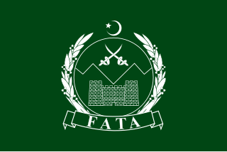
The Federally Administered Tribal Areas, commonly known as FATA, was a semi-autonomous tribal region in north-western Pakistan that existed from 1947 until being merged with the neighbouring province of Khyber Pakhtunkhwa in 2018 through the Twenty-fifth amendment to the constitution of Pakistan. It consisted of seven tribal agencies (districts) and six frontier regions, and were directly governed by the federal government through a special set of laws called the Frontier Crimes Regulations.
January 2010 Bajaur bombing was a suicide bombing in Khar town in Bajaur in Pakistan on January 30, 2010. At least 16 people were killed when a man dressed in a burqa walked up to a military checkpoint and detonated himself. 2 soldiers were among the dead and at least 25 were injured. It has long been suspected that Osama bin Laden and Ayman al-Zawahiri have been hiding in Bajaur. A curfew was imposed in the district after the blast. The bomber was thought to be between 18 – 23 years of age. The attack drew widespread condemnation in Pakistan. The bombing was condemned by President Asif Ali Zardari, Prime Minister Syed Yousaf Raza Gilani, Speaker National Assembly Fahmida Mirza, Deputy Speaker Faisal Karim Kundi, Chairman Senate Farooq H Naek, Deputy Chairman Jan Muhammad Jamali, Foreign Minister Shah Mehmood Qureshi, Minister for Defence Chaudhry Ahmad Mukhtar, Minister for Religious Affairs Hamid Saeed Kazmi, Minister for Zakat and Ushr Noor-ul-Haq Qadri and Minister of State for Religious Affairs Shagufta Jumani.
Inayat Killi is a town in Khar Bajaur Tehsil, Bajaur Agency, Federally Administered Tribal Areas, Pakistan. The population is 10,717 according to the 2017 census.
Barang Tehsil is a subdivision located in Bajaur District, Khyber Pakhtunkhwa, Pakistan.

Mamund Tehsil is a subdivision located in Bajaur District, Khyber Pakhtunkhwa, Pakistan. Mamund is the largest tehsil of district Bajaur.
Utman Khel Subdivision is a subdivision located in Bajaur District, Khyber Pakhtunkhwa, Pakistan. The population is 107,356 according to the 2017 census.
Kitkot or Katkot is a village located in Mamund Tehsil, Bajaur District, Khyber Pakhtunkhwa, Pakistan. The population is 7,398 according to the 2017 census.
Bar Kamar is an area of Mamund Tehsil, Bajaur Agency, Federally Administered Tribal Areas, Pakistan. The population is 1,787 according to the 2017 census.
Pashat is the main town in Salarzai Tehsil, Bajaur District, in the Khyber Pakhtunkhwa province of Pakistan. The population is 5,111 according to the 2017 census.
Chachagai is a village in Salarzai Tehsil, Bajaur Agency, Federally Administered Tribal Areas, Pakistan. The population is 956 according to the 2017 census.
Batwar is an area of Salarzai Tehsil, in Bajaur District, Khyber Pakhtunkhwa province, Pakistan. The population is 5,267 according to the 2017 census.
Lora Miana, or Lwara Myana is an area of Mula Gori Tehsil, Khyber Agency, Federally Administered Tribal Areas, Pakistan. The population is 7,466 according to the 2017 census.
Sadiq Abad is a town in Khar Bajaur Tehsil, Bajur, Khyber Pakhtunkhwa, Pakistan. The population is 10,060 according to the 2017 census.
Lagharai is a town in Mamund Tehsil, Bajaur Agency, Federally Administered Tribal Areas, Pakistan. The population is 592 according to the 2017 census.
Utmankhel Tehsil is a subdivision located in Bajaur District, Khyber Pakhtunkhwa, Pakistan. The population is 107,356 according to the 2017 census.


