
Kew Gardens is a Grade II–listed London Underground and London Overground station in Kew, in the London Borough of Richmond upon Thames. It first opened in 1869 and is now managed by London Underground. The station, which is in Travelcard Zones 3 and 4, is served by both the District line on the London Underground and the North London line on the London Overground, and is situated midway between Gunnersbury and Richmond stations.

Kew Gardens is a neighborhood in the central area of the New York City borough of Queens. Kew Gardens is bounded to the north by the Union Turnpike and the Jackie Robinson Parkway, to the east by the Van Wyck Expressway and 131st Street, to the south by Hillside Avenue, and to the west by Park Lane, Abingdon Road, and 118th Street. Forest Park is to the west and the neighborhood of Forest Hills to the north-west, Flushing Meadows–Corona Park north, Richmond Hill south, Briarwood southeast, and Kew Gardens Hills east.

Malin Head is the most northerly point of mainland Ireland, located in the townland of Ardmalin on the Inishowen peninsula in County Donegal. The head's northernmost point is called Dunalderagh at latitude 55.38ºN. It is about 16 kilometres (10 mi) north of the village of Malin. The island of Inishtrahull is further north, about 10 km (6 mi) northeast of the headland. Malin Head gives its name to the Malin sea area. There is a weather station on the head, which is one of 22 such stations whose reports are broadcast as part of the BBC Shipping Forecast. A tower built in 1805 is on Altnadarrow, also known locally as the Tower Hill.

Potentilla indica known commonly as mock strawberry, Indian-strawberry, or false strawberry, often referred to as a backyard strawberry, mainly in North America, is a flowering plant in the family Rosaceae. It has foliage and an aggregate accessory fruit similar to that of a true strawberry. It has yellow flowers, unlike the white or slightly pink flowers of true strawberries. It is native to eastern and southern Asia, but has been introduced to many other areas as a medicinal and an ornamental plant, subsequently naturalizing in many regions worldwide.

Kew Gardens Hills is a neighborhood in the middle of the New York City borough of Queens. The borders are Flushing Meadows-Corona Park to the west, the Long Island Expressway to the north, Union Turnpike to the south, and Parsons Boulevard to the east.
The Forest Hills station is a station on the Main Line of the Long Island Rail Road (LIRR), located in the Forest Hills neighborhood of Queens in New York City. It is lightly used compared to other stations in the city, with only 1,967 weekday riders; many residents opt for the subway because of its increased service and direct express trains to Midtown Manhattan. The station is wheelchair accessible.

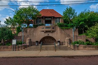
Kew Gardens is a station on the Main Line of the Long Island Rail Road (LIRR). It is located in the Kew Gardens neighborhood of Queens, New York City, near Austin Street and Lefferts Boulevard. The station is located within the City Terminal Zone, part of LIRR fare zone 1. It contains four tracks and two side platforms for the outermost tracks.

Union Turnpike is a thoroughfare stretching across part of Long Island in southern New York state, mostly within central and eastern Queens in New York City. It runs from Myrtle Avenue in Glendale, Queens, to Marcus Avenue in North New Hyde Park, Nassau County, about 1 mile (1.6 km) outside New York City border. The name memorializes the Union Racetrack, once a famous attraction for Queens residents.

Kew Gardens is a botanic garden in southwest London that houses the "largest and most diverse botanical and mycological collections in the world". Founded in 1840, from the exotic garden at Kew Park, its living collections include some of the 27,000 taxa curated by Royal Botanic Gardens, Kew, while the herbarium, one of the largest in the world, has over 8.5 million preserved plant and fungal specimens. The library contains more than 750,000 volumes, and the illustrations collection contains more than 175,000 prints and drawings of plants. It is one of London's top tourist attractions and is a World Heritage Site.
Tamanthi, Htamanthi or Tamanthe is a village on the Chindwin River in Homalin Township in Hkamti District in the Sagaing Region of northwestern Burma. It is located near the Tamanthi Wildlife Reserve. It is near the planned multi-purpose Tamanthi Dam. Gardens were planted in Tamanthi and other nearby villages around 1700 and the village has been documented as producing pickled tea, known as "letpet".

Homalin Township is a township in Hkamti District in the Sagaing Region of Burma. The principal town is Homalin. The principal rivers flowing through the township are the Chindwin River form north to south and the Uyu River from east to west, joining the Chindwin near Homalin town.
Maungkan is a village on the Chindwin River in Homalin Township, Hkamti District, in the Sagaing Region of northwestern Burma. It is located next to Chaungson and south of Tason. Gardens were planted in Maungkan and other nearby villages around 1700 and the village has been documented as producing pickled tea, known as "letpet".
Tason is a village on the Chindwin River in Homalin Township, Hkamti District, in the Sagaing Region of northwestern Burma. It is located north of Maungkan. Gardens were planted in Tason around 1700 and the village has been documented as producing pickled tea, known as "letpet".
Kawya is a village on the Chindwin River in Homalin Township, Hkamti District, in the Sagaing Region of northwestern Burma. It is located north of the town of Homalin and south of Maungkan, about half way. Gardens were planted in Kawya and other nearby villages around 1700 and the village has been documented as producing pickled tea, known as "letpet".
Onbet is a village on the Chindwin River in Homalin Township, Hkamti District, in the Sagaing Region of northwestern Burma. It is located north of Tason. Gardens were planted in Onbet and other nearby villages around 1700 and the village has been documented as producing pickled tea, known as "letpet".
Maingwe is a village on the Chindwin River in Homalin Township, Hkamti District, in the Sagaing Region of northwestern Burma. It is located north of Tonmalaw. Gardens were planted in Maingwe and other nearby villages around 1700 and the village has been documented as producing pickled tea, known as "letpet".

The Field Elm cultivar Ulmus minor 'Goodyeri', commonly known as 'Goodyer's Elm', was discovered by John Goodyer in 1624 at Pennington near the Hampshire coast between Lymington and Christchurch. No old specimens are known to survive, but the tree is perpetuated by numerous root suckers, notably in the lanes about the Alice Lisle public house in the New Forest hamlet of Rockford. The tree has suffered misidentification in the centuries since its discovery, firstly by Philip Miller in his 'Gardeners' Dictionary' of 1731, and later in the early 20th century by Augustine Henry and Marcus Woodward, who both confused the tree with Plot Elm, whose centre of distribution is in the East Midlands, some 200 miles away and of completely different appearance.

The R242 road is a regional road in Ireland. It is a road on the northern Inishowen Peninsula in County Donegal. The R242 is Ireland's northernmost regional road and leads to Malin Head. The road forms part of the Wild Atlantic Way.

Pterocarpus officinalis, the dragonsblood tree, is a species of flowering plant in the family Fabaceae, native to southern Mexico, Central America, the Caribbean, and northern South America. It is typically found in coastal freshwater or slightly brackish habitats, in association with mangroves that occupy the more saline areas. Its timber is commercially traded.

