Sinnga is a village in Homalin Township, Hkamti District, in the Sagaing Region of northwestern Burma. [1] [2]
Sinnga is a village in Homalin Township, Hkamti District, in the Sagaing Region of northwestern Burma. [1] [2]

Madison County is a county in the U.S. state of Montana. As of the 2010 United States Census, the population was 7,691. Its county seat is Virginia City. The county was founded in 1865; at the time it was part of the Montana Territory.

Lewis and Clark County is a county located in the U.S. state of Montana. As of the 2010 United States Census, the population was 63,395. Its county seat is Helena, the state capital. The numerical designation for Lewis and Clark County is 5. The county was established in 1865 as Edgerton County, and was renamed "Lewis and Clark County" two years later. The present name was given in honor of explorers Lewis and Clark.

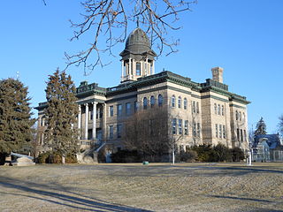
Cascade County is a county located in the U.S. state of Montana. As of the 2010 census, the population was 81,327, making it the fifth-most populous county in Montana. Its county seat is Great Falls.

Edgar County is a county located in the U.S. state of Illinois. As of the 2010 United States Census, the population was 18,576. Its county seat is Paris.

Google LLC is an American multinational technology company that specializes in Internet-related services and products, which include online advertising technologies, a search engine, cloud computing, software, and hardware. It is considered one of the Big Four technology companies, alongside Amazon, Apple, and Microsoft.
A Google Doodle is a special, temporary alteration of the logo on Google's homepages intended to commemorate holidays, events, achievements, and notable historical figures. The first Google Doodle honored the 1998 edition of the long-running annual Burning Man event in Black Rock City, Nevada, and was designed by co-founders Larry Page and Sergey Brin to notify users of their absence in case the servers crashed. Subsequent Google Doodles were designed by an outside contractor until 2001, when Page and Brin asked public relations officer Dennis Hwang to design a logo for Bastille Day. Since then, a team of employees called "Doodlers" have organized and published the Doodles.

Google Maps is a web mapping service developed by Google. It offers satellite imagery, aerial photography, street maps, 360° interactive panoramic views of streets, real-time traffic conditions, and route planning for traveling by foot, car, bicycle and air, or public transportation. In 2020, Google Maps was used by over 1 billion people every month.
Google Earth is a computer program that renders a 3D representation of Earth based primarily on satellite imagery. The program maps the Earth by superimposing satellite images, aerial photography, and GIS data onto a 3D globe, allowing users to see cities and landscapes from various angles. Users can explore the globe by entering addresses and coordinates, or by using a keyboard or mouse. The program can also be downloaded on a smartphone or tablet, using a touch screen or stylus to navigate. Users may use the program to add their own data using Keyhole Markup Language and upload them through various sources, such as forums or blogs. Google Earth is able to show various kinds of images overlaid on the surface of the earth and is also a Web Map Service client. Recently Google has revealed that Google Earth now covers more than 98 percent of the world, and has captured 10 million miles of Street View imagery, a distance that could circle the globe more than 400 times.

OpenStreetMap (OSM) is a collaborative project to create a free editable map of the world. The geodata underlying the map is considered the primary output of the project. The creation and growth of OSM has been motivated by restrictions on use or availability of map data across much of the world, and the advent of inexpensive portable satellite navigation devices.

Half Moon Island is a minor Antarctic island, lying 1.35 km (0.84 mi) north of Burgas Peninsula, Livingston Island in the South Shetland Islands of the Antarctic Peninsula region. Its surface area is 171 hectares. The Argentine Cámara Base is located on the island. It is only accessible by sea and by helicopter; there is no airport of any kind. The naval base is operational occasionally during the summer, but is closed during the winter.

Panoramio was a geo-located tagging, photo sharing mashup. Photos uploaded to the site were accessible as a layer in Google Earth and Google Maps. The site's goal was to allow Google Earth users to learn more about a given area by viewing the photos that other users had taken at that location. The website was available in several languages. Google acquired Panoramio in 2007. In 2009 the website was among 1000 most popular websites worldwide.

Google Street View is a technology featured in Google Maps and Google Earth that provides interactive panoramas from positions along many streets in the world. It was launched in 2007 in several cities in the United States, and has since expanded to include cities and rural areas worldwide. Streets with Street View imagery available are shown as blue lines on Google Maps.

B roads are numbered routes in Great Britain of lesser importance than A roads. See the article Great Britain road numbering scheme for the rationale behind the numbers allocated.
All of the business loops within Texas are maintained by the Texas Department of Transportation (TxDOT). Interstate 20 has fifteen business loops in the state, all located in western Texas. Along I-20, TxDOT identifies each business route as Business Interstate 20 followed by an alphabetic suffix. Along Texas Interstates, the alphabetic suffixes on business route names ascend eastward and northward. There are gaps in the alphabetic values to allow for future system expansion. The alphabetic naming suffixes are included as small letters on the bottom of route shields.

The Carnon River is a heavily polluted river in Cornwall, England. It starts in Chacewater. Trewedna Water and River Kennall flow into the Carnon before it merges with Tallack's Creek to become Restronguet Creek, which eventually flows into the English Channel at the mouth of Carrick Roads.
| This Hkamti District location article is a stub. You can help Wikipedia by expanding it. |