Related Research Articles
Archaic humans emerged out of Africa between 0.5 and 1.8 million years ago. This was followed by the emergence of modern humans in East Africa around 300,000–250,000 years ago. In the 4th millenium BC written history arose in Ancient Egypt, and later in Nubia's Kush, the Horn of Africa's Dʿmt, and Ifrikiya's Carthage. Between around 3000 BC and 1000 AD, the Bantu expansion swept from north-western Central Africa across much of sub-Saharan Africa, laying the foundations for states in Central, Eastern, and Southern regions. In most African societies the oral word is revered, and as such they have generally recorded their history orally. This has led anthropologists to term them oral civilisations, contrasted with literate civilisations which pride the written word. Oral tradition often remained the preferred method of recordation in cases when a writing system was adapted or developed; for example the oral recordation of the Kouroukan Fouga in the Mali Empire while having adapted the Arabic script to be used in scholarly pursuits.

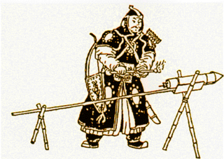
Zheng He was a Chinese admiral, explorer, diplomat, and bureaucrat during the early Ming dynasty (1368–1644). He is often regarded as the greatest admiral in Chinese history. Born into a Muslim family as Ma He, he later adopted the surname Zheng conferred onto him by the Yongle Emperor. Between 1405 and 1433, Zheng commanded seven treasure voyages across Asia under the commission of the Yongle Emperor and the succeeding Xuande Emperor. According to legend, Zheng's largest ships were almost twice as long as any wooden ship ever recorded, and carried hundreds of sailors on four decks.
Ancient history is a time period from the beginning of writing and recorded human history through late antiquity. The span of recorded history is roughly 5,000 years, beginning with the development of Sumerian cuneiform script. Ancient history covers all continents inhabited by humans in the period 3000 BC – AD 500, ending with the expansion of Islam in late antiquity. The three-age system periodizes ancient history into the Stone Age, the Bronze Age, and the Iron Age, with recorded history generally considered to begin with the Bronze Age. The start and end of the three ages vary between world regions. In many regions the Bronze Age is generally considered to begin a few centuries prior to 3000 BC, while the end of the Iron Age varies from the early first millennium BC in some regions to the late first millennium AD in others.

Great Zimbabwe is a medieval city in the south-eastern hills of the modern country of Zimbabwe, near Lake Mutirikwe and the town of Masvingo. It was the capital of the Kingdom of Zimbabwe from the 13th century, having been settled in the 4th century AD. Construction on the city began in the 11th century and continued until it was abandoned in the 15th century. The edifices were erected by ancestors of the Shona people, currently located in Zimbabwe and nearby countries. The stone city spans an area of 7.22 square kilometres (2.79 sq mi) and could have housed up to 18,000 people at its peak, giving it a population density of approximately 2,500 inhabitants per square kilometre (6,500/sq mi). It is recognised as a World Heritage Site by UNESCO.

A junk is a type of Chinese sailing ship characterized by a central rudder, an overhanging flat transom, watertight bulkheads, and a flat-bottomed design. They are also characteristically built using iron nails and clamps. The term applies to many types of small coastal or river ships, usually serving as cargo ships, pleasure boats, or houseboats, but also going up in size up to large ocean-going vessels. There can be significant regional variations in the type of rig and the layout of the vessel.
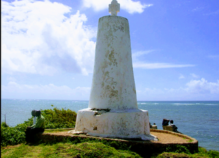
Malindi is a town on Malindi Bay at the mouth of the Sabaki River, lying on the Indian Ocean coast of Kenya. It is 120 kilometres northeast of Mombasa. The population of Malindi was 119,859 as of the 2019 census. It is the largest urban centre in Kilifi County.
The foreign relations of Imperial China from the Qin dynasty until the Qing dynasty encompassed many situations as the fortunes of dynasties rose and fell. Chinese culture had influenced neighboring and distant countries, while being transformed by outside influences as well as being conquered. During the Western Han dynasty, the Silk Road trade routes were established and brought Hellenistic Central Asia, Persia under the Parthian Empire, and South Asia into contact with the Chinese empire. During the 2nd century BC, Zhang Qian became the first known Chinese diplomat to venture deep into Central Asia in search of allies against the Mongolic Xiongnu confederation. Han Chinese attempts were made at reaching the Roman Empire and although the mission led by Gan Ying in 97 AD was a failure, Chinese historical records nevertheless maintain that the Romans traveled to southern China and Vietnam via the Indian Ocean. Buddhism from India was introduced to China during the Eastern Han period and would spread to neighboring Vietnam, Korea, and Japan, all of which would adopt similar Confucian cultures based on the Chinese model.
The Swahili people comprise mainly Bantu, Afro-Arab, and Comorian ethnic groups inhabiting the Swahili coast, an area encompassing the Zanzibar archipelago and mainland Tanzania's seaboard, littoral Kenya, northern Mozambique, the Comoros Islands, and northwest Madagascar.

Zanj is a term used by medieval Muslim geographers to refer to both a certain portion of Southeast Africa and to its Bantu inhabitants. It has also been used to refer to East Africans collectively by Arab sources. This word is also the origin of the place-names Zanzibar and the Sea of Zanj.

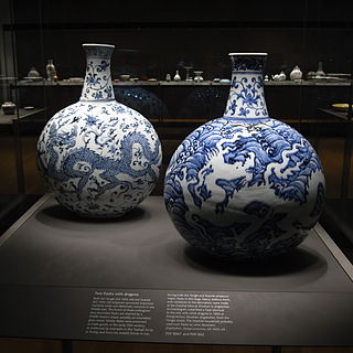
"Blue and white pottery" covers a wide range of white pottery and porcelain decorated under the glaze with a blue pigment, generally cobalt oxide. The decoration was commonly applied by hand, originally by brush painting, but nowadays by stencilling or by transfer-printing, though other methods of application have also been used. The cobalt pigment is one of the very few that can withstand the highest firing temperatures that are required, in particular for porcelain, which partly accounts for its long-lasting popularity. Historically, many other colours required overglaze decoration and then a second firing at a lower temperature to fix that.

Islamic pottery occupied a geographical position between Chinese ceramics, and the pottery of the Byzantine Empire and Europe. For most of the period, it made great aesthetic achievements and influence as well, influencing Byzantium and Europe. The use of drinking and eating vessels in gold and silver, the ideal in ancient Rome and Persia as well as medieval Christian societies, is prohibited by the Hadiths, with the result that pottery and glass were used for tableware by Muslim elites, as pottery also was in China but was much rarer in Europe and Byzantium. In the same way, Islamic restrictions greatly discouraged figurative wall painting, encouraging the architectural use of schemes of decorative and often geometrically patterned titles, which are the most distinctive and original speciality of Islamic ceramics.
Manda is an island of the Lamu Archipelago of Kenya, known for the prosperous 9th century ports of Takwa and Manda town. The island is now linked by ferry to Lamu and is home to Manda Airport, while Manda Toto island lies to its west. The island is separated from the mainland by the narrow Mkanda channel.
Chinese exploration includes exploratory Chinese travels abroad, on land and by sea, from the travels of Han dynasty diplomat Zhang Qian into Central Asia during the 2nd century BC until the Ming dynasty treasure voyages of the 15th century that crossed the Indian Ocean and reached as far as East Africa.
Chinese cartography began in the 5th century BC during the Warring States period when cartographers started to make maps of the Earth's surface. Its scope extended beyond China's borders with the expansion of the Chinese Empire under the Han dynasty. By the 11th century during the Song dynasty highly-accurate maps drawn on grids were produced. During the 15th century, the Ming dynasty admiral Zheng He went on a series of voyages to the South China Sea, Indian Ocean, and beyond and maps for areas outside of China were produced, although world maps covering territories known to the Chinese outside of China existed as early as the Tang dynasty.

The Maritime history of Odisha, known as Kalinga in ancient times, started much before 800 BC according to early sources. The people of this region of eastern India along the coast of the Bay of Bengal sailed up and down the Indian coast, and travelled to Indo China and throughout Maritime Southeast Asia, introducing elements of their culture to the people with whom they traded. The 6th century Manjusrimulakalpa mentions the Bay of Bengal as Kalingodra and in ancient Classical India, the Bay of Bengal was known as Kalinga Sagar, indicating the importance of Kalinga in the maritime trade. The old traditions are still celebrated in the annual Boita Bandana festival including its major celebration at Cuttack on the banks of Mahanadi river called Bali Jatra, and are held for seven days in October-November at various coastal districts, most famous at Cuttack though.

The Sultanate of Mogadishu, also known as Kingdom of Magadazo, was a medieval Muslim sultanate centered in southern Somalia. It rose as one of the pre-eminent powers in the Horn of Africa under the rule of Fakhr al-Din before becoming part of the powerful and expanding Ajuran Sultanate in the 13th century. The Mogadishu Sultanate maintained a vast trading network, dominated the regional gold trade, minted its own currency, and left an extensive architectural legacy in present-day southern Somalia.

The Ming treasure voyages were maritime expeditions undertaken by Ming China's treasure fleet between 1405 and 1433. The Yongle Emperor ordered the construction of the fleet in 1403. The grand project resulted in seven far-reaching ocean voyages to the coastal territories and islands of the South China Sea and Indian Ocean. Admiral Zheng He was commissioned to command the fleet for the expeditions. Six of the voyages occurred during the Yongle Emperor's reign and the seventh voyage occurred during the Xuande Emperor's reign. The first three voyages reached up to Calicut on India's Malabar Coast, while the fourth voyage went as far as Hormuz in the Persian Gulf. In the last three voyages, the fleet traveled up to the Arabian Peninsula and East Africa.
The Ming treasure voyages had a diplomatic as well as a commercial aspect.

Mao Kun map, usually referred to in modern Chinese sources as Zheng He's Navigation Map, is a set of navigation charts published in the Ming dynasty military treatise Wubei Zhi. The book was compiled by Mao Yuanyi in 1621 and published in 1628; the name of the map refers to his grandfather Mao Kun from whose library the map is likely to have originated. The map is often regarded as a surviving document from the expeditions of Zheng He in addition to accounts written by Zheng's officers, such as Yingya Shenglan by Ma Huan and Xingcha Shenglan by Fei Xin. It is the earliest known Chinese map to give an adequate representation of Southern Asia, Persia, Arabia and East Africa.
The medieval and early modern history of Africa spans from the medieval and early modern period until the colonial period in the history of Africa.
References
- 1 2 The Swahili World
- ↑ Why end the voyages of Zheng He?
- ↑ China’s long history in Africa
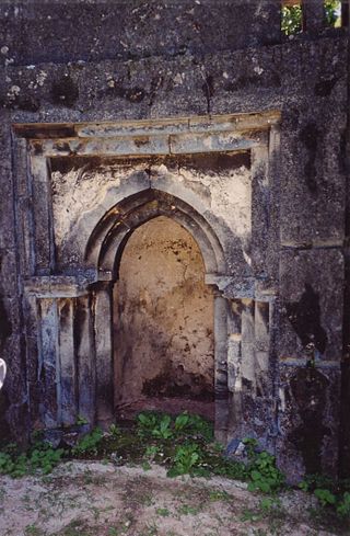
- ↑ "Mambrui: The disappearing town". The Citizen. 2021-04-01. Retrieved 2024-09-10.