
The National Centre for Radio Astrophysics is a research institution in India in the field of radio astronomy is located in the Pune University Campus, is part of the Tata Institute of Fundamental Research, Mumbai, India. NCRA has an active research program in many areas of Astronomy and Astrophysics, which includes studies of the Sun, Interplanetary scintillations, pulsars, the Interstellar medium, Active galaxies and cosmology and particularly in the specialized field of Radio Astronomy and Radio instrumentation. NCRA also provides exciting opportunities and challenges in engineering fields such as analog and digital electronics, signal processing, antenna design, telecommunication and software development.
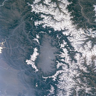
The Kashmir Valley, also known as the Vale of Kashmir, is an intermontane valley in northern Jammu and Kashmir, a region administered by India as a union territory and part of the larger Kashmir region, which has been the subject of a dispute between India and Pakistan since 1947, and between India and China since 1962.
Dadeldhura, a part of Sudurpashchim Province, is one of the seventy-seven districts of Nepal. The district, with Dadeldhura as its district headquarters, covers an area of 1,538 km2 (594 sq mi) and had a population of 126,162 in 2001 and 142,094 in 2011.
Paltas is located to the south of Loja city and is one of the oldest cantons of province of the same name. It was named after the Paltas, a community who used to live over the new city now called Catacocha in Ecuador.

Bal Dheri is one of the 51 union councils of Abbottabad District in Khyber-Pakhtunkhwa province of Pakistan, the union council of Baldheri is named after the main village of the area. The population of Baldheri Union Council is 14,796.

The Qadis District is located in the southern part of Badghis province, Afghanistan, between the districts Jawand in the east, Qala i Naw in the west, Muqur and Bala Murghab in the north. In the south is the Herat province. The capital is Qadis.
Pattan Kalan is one of twenty-nine union councils of the Abbottabad District, in the Khyber-Pakhtunkhwa province of Pakistan. It lies within an area that was affected by the 2005 earthquake, after which a total of 27 small camps were set up in the area.
Golay Wali is a village that is one of the 35 Union Councils of Khushab District in the Punjab Province of Pakistan. It is located at 32°29'21″N 71°50'46″E.
Hilkot is a village and union council of Mansehra District in the Khyber Pakhtunkhwa province of Pakistan. It is located to the north of Mansehra the district capital and south east of Batagram city and lies in an area affected by the 2005 Kashmir earthquake. There are 04 village councils. Village Council 1. Hilkot 2. Kund Bala 3. Sathan Gali 4. Balimang. Spoken languages are Pashto, Gojri & Hindko. Major Castes are Swati & Gujjar. V/C Kund Bala & Sathan Gali have mostly people from Gujjar family which is totally hilly area while V/C Hilkot & Balimang have mostly people from Swati & Syed family. There are green field and most of land is hilly occupied with forests. Main crops are maize, wheat & little bit rice. In fruits there are Orchards & Trees of Apple, Apricot, Pear, Plums & Date-plum. Natural water rich in herbs comes from hills. The literacy rate is growing gradually. There are difficulties that the local population faces the lack of proper healthcare facilities in the area, as there are no hospitals in the region & Also there is no any Govt boys or girls college. Mostly people moved for jobs & businesses and support their families & serving in different departments of country & abroad. Farming is only way of earning but due to hilly area and weather conditions its not fulfill requirements of area.
Rajdahri is a town, and one of twenty union councils in Battagram District in Khyber Pakhtunkhwa province of Pakistan. It is located at 34°40'60N 73°5'60E and has an altitude of 1408 metres .Khan of Garhi Habibullah are Wali of Rajdahri and Neeli-Shang.
Alo is union council of Mardan District in Khyber Pakhtunkhwa province of Pakistan. It is located at 34°26'0N 72°3'0E and has an altitude of 406 metres (1335 feet).
Wazira is a high-ranking female official title that means Minister of a Muslim or Arab regime. During the Abbasid Caliphate, Wazir (وزير) which represents the title of a male Minister was used for the first time. In the modern age, and due to equitable participation of women in politics and government, the Wazira title have become commonly used in many countries within the MENA region, Brunei and the Indian subcontinent.
Kalu Maira is a village in the Khyber Pakhtunkhwa Province of Pakistan. It is located at 34°3'0N 73°6'0E with an altitude of 840 metres.
Daruni Maira is a village in the Khyber Pakhtunkhwa province of Pakistan. It is located at 34°3'0N 73°7'0E with an altitude of 759 metres.
The Abbottabad Cricket Stadium is a cricket ground located in Abbottabad, Khyber Pakhtunkhwa, Pakistan. It was established in 2003 by the Pakistan Cricket Board, and in 2010, it was declared as a first-class ground.
The Twenty-Nine Palms Band of Mission Indians of California is a federally recognized tribe of Mission Indians with a reservation consisting of two sections, one located near the cities of Indio and Coachella in Riverside County, and the other in the city of Twentynine Palms in San Bernardino County, California. While many scholars regard the tribe as being Luiseño, the tribe itself identifies as being Chemehuevi.
Saattoq Island is an island of Greenland. It is located in Baffin Bay in the Upernavik Archipelago.
The Leq'á:mel First Nation, formerly known as Lakahahmen First Nation, is a First Nations band government whose community and offices are located in the area near Deroche, British Columbia in the Fraser Valley region in Canada, about 12 kilometres east of the District of Mission. They are a member government of the Sto:lo Nation Chiefs Council, which is one of two tribal councils of the Sto:lo.
The climate of Faisalabad features a semi-arid climate (BSh) in Köppen-Geiger classification, bordering a humid subtropical climate (Cwa) with very hot and humid summers and dry cool winters. The average maximum and minimum temperatures in June are 45.5 °C (113.9 °F) and 26.9 °C (80.4 °F). In January the average minimum and maximum are 19.4 °C (66.9 °F) and 4.1 °C (39.4 °F).
Dahgal is a village of Rawalpindi District in the Punjab province of Pakistan on Adiyala road. It is located at 33.4920° N, 73.0479° E with an altitude of 418 metres and lies south of the district capital, Rawalpindi near Central Jail Rawalpindi, also known as Adiala Jail.
