
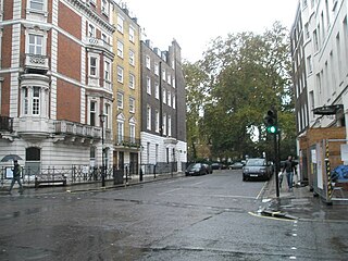
Mandeville Place is a street in the Marylebone district of the City of Westminster, London, the buildings in which are notably more impressive than those to the immediate north and south.
Mandeville Place is a street in the Marylebone district of the City of Westminster, London, the buildings in which are notably more impressive than those to the immediate north and south.

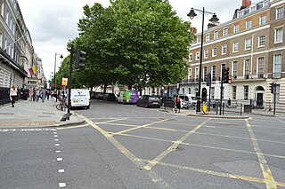
Mandeville Place runs from the junction of Thayer Street and Hinde Street in the north to the junction of Wigmore Street and James Street in the south.
Mandeville Place was built around 1777 and named after the Duke of Manchester (Viscount Mandeville) who lived in nearby Manchester Square. [1]
In 1936, the London County Council tried to rename the street Marylebone High Street, along with Thayer Street and James Street so that the whole north–south route from Oxford Street to Marylebone Road would have the same name. The proposal was opposed by the shopkeepers and small traders of the other streets who worried about the cost of the change, possible customer confusion, and the association with Marylebone Road rather than the closer Oxford Street. The occupants of Mandeville Place felt that they did not want to lose the higher class associations of Oxford Street in order to be associated with shopkeepers, and the prestige of the Mandeville Place was particularly useful for members of the medical profession resident in the street. The proposal did not go ahead. [2] [3]
The buildings in Mandeville Place are notably more impressive than those of Thayer Street to the north or James Street to the south, possibly reflecting its association with the Duke of Manchester. The buildings are mostly of five or six stories excluding the basement making it suitable for hotels or headquarters buildings, unlike the streets to the north or south which are primarily shopping streets similar to Marylebone High Street.
Indeed, the street is the location of the imposing School of Economic Science and the four star Mandeville Hotel. Other businesses in the street include Claessens International at number 3, a specialist in the branding of alcoholic drinks. [4]
A plaque at number 12 marks the location where composer Sir Paolo Tosti lived for 20 years until his death in 1916. [5]

Charing Cross Road is a street in central London running immediately north of St Martin-in-the-Fields to St Giles Circus, which then merges into Tottenham Court Road. It leads from the north in the direction of Charing Cross at the south side of Trafalgar Square. It connects via St Martin's Place and the motorised east side of the square.

Marylebone station is a Central London railway terminus and connected London Underground station in the Marylebone area of the City of Westminster. On the National Rail network, it is also known as London Marylebone and is the southern terminus of the Chiltern Main Line to Birmingham. An accompanying Underground station is on the Bakerloo line, sited between Edgware Road and Baker Street stations in Transport for London's fare zone 1.
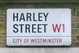
Harley Street is a street in Marylebone, Central London, named after Edward Harley, 2nd Earl of Oxford and Earl Mortimer. Since the 19th century it has housed a large number of private specialists in medicine and surgery.

Baker Street is a street in the Marylebone district of the City of Westminster in London. It is named after builder William Baker, who laid out the street in the 18th century. The area was originally high class residential, but now is mainly occupied by commercial premises.

Manchester Square is an 18th-century garden square in Marylebone, London. Centred 950 feet (290 m) north of Oxford Street it measures 300 feet (91 m) internally north-to-south, and 280 feet (85 m) across. It is a small Georgian predominantly 1770s-designed instance in central London; construction began around 1776. The north side has a central mansion, Hertford House, flanked by approach ways; its first name was Manchester House — its use is since 1897 as the Wallace Collection (gallery/museum) of fine and decorative arts sits alongside the Madame Tussauds museum and the Wigmore Hall concert rooms. The square forms part of west Marylebone, most of which sees minor but overarching property interests held by one owner among which many buildings have been recognised by statutory protection.

The New Road was a toll road built across fields around the northern boundaries of London, the first part of which opened in 1756. The route comprises the modern-day A501.

Marylebone is an area in London, England and is located in the City of Westminster. It is in Central London and part of the West End. Oxford Street forms its southern boundary.
Portland Place is a street in the Marylebone district of central London. Named after the 3rd Duke of Portland, the unusually wide street is home to the BBC's headquarters Broadcasting House, the Chinese and Polish embassies, the Royal Institute of British Architects and numerous residential mansion blocks.

Thayer Street is a street in the Marylebone district of the City of Westminster, London, that contains four listed buildings.
Hinde Street is a street in the Marylebone district of the City of Westminster, London, that contains the Hinde Street Methodist Church and was home to the novelist Rose Macaulay until her death.

James Street is a street in the Marylebone district of the City of Westminster, London, off Oxford Street, that is known for the high number of restaurants and bars that it contains.

Crawford Street is a street in the Marylebone district of the City of Westminster, London. The street contains two grade II listed public houses.

Homer Row is a street in the Marylebone district of the City of Westminster, London, that runs form Old Marylebone Road in the north to the junction of Crawford Place and Crawford Street in the south.

Crawford Place is a street in the Marylebone district of the City of Westminster, London. The street was developed in the first decade of the 1800s and was original known as John Street West.

Marylebone Lane is one of the original streets of the Marylebone district of the City of Westminster, London. It runs from Oxford Street in the south to Marylebone High Street in the north, its winding shape following the course of the River Tyburn that it once ran alongside and pre-dating the grid pattern of the other streets in the area. Today the lane is largely composed of small shops, cafes and restaurants with some small apartment blocks. There are some larger commercial buildings at the southern end near Oxford Street.

South Audley Street is a major shopping street in Mayfair, London. It runs north to south from the southwest corner of Grosvenor Square to Curzon Street.
This is a list of the etymology of street names in the London district of Marylebone. The following utilises the generally accepted boundaries of Marylebone viz. Marylebone Road to the north, Great Portland Street to the east, Marble Arch and Oxford Street to the south and Edgware Road to the west.

The Bull and Mouth Inn was a coaching inn in the City of London that dated from before the Great Fire of London in 1666. It was located between Bull and Mouth Street in the north and Angel Street in the south. It was once an important arrival and departure point for coaches from all over Britain, but particularly for the north of England and Scotland. It became the Queen's Hotel in 1830 but was demolished in 1887 or 1888 when new post office buildings were built in St Martin's Le Grand.

George Street is a street in Marylebone in Central London, England. Located in the City of Westminster, it runs east from Edgware Road until it reaches Marylebone High Street at its junction with Thayer Street. It crosses a number of streets including Seymour Place, Gloucester Place, Manchester Street and Baker Street.

Chiltern Street is a road in the Marylebone area of Central London. Located in the City of Westminster, it runs north to south connecting Marylebone Road and Blandford Street. Baker Street runs parallel a little way to the west. It meets Dorset Street, Crawford Street and Paddington Street along its route. Manchester Square is located beyond the southern end of the street.
![]() Media related to Mandeville Place, London at Wikimedia Commons 51°30′58″N0°09′04″W / 51.5162°N 0.1510°W
Media related to Mandeville Place, London at Wikimedia Commons 51°30′58″N0°09′04″W / 51.5162°N 0.1510°W