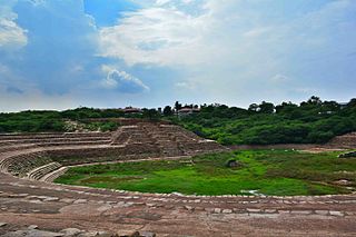
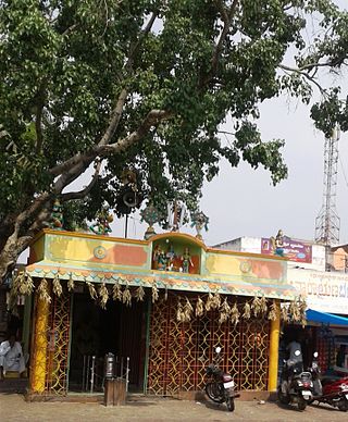
Anekal is a major town and taluk of Bengaluru Urban district. It is a major town in the suburbs of Bengaluru city. Approximately 36 km from Bengaluru Centre and around 15 km from Hosur and Electronic City. Express lines run from Silk Board to Anekal passing through the National Highway and SH broadway thus providing excellent connectivity. It lies in the southern part of the Bangalore metropolitan area. Anekal is known for the Karaga and Dasara festivals.
Malur is a town and taluk headquarters in Kolar district of the Indian state of Karnataka. It is 30 km from Kolar, the district headquarters, and about 25 km from Bangalore. It is accessible from Bangalore by road and railways. The Chennai Central-Bangalore City line passes through Malur, with trains to various parts of India, including Tirupati, Chennai, Kochi, Trivandrum, Patna and Calcutta.

Kalaburagi district, formerly known as Gulbarga district, is one of the 31 districts of Karnataka state in southern India. Kalaburagi city is the administrative headquarters of the district. The district is the headquarters of Kalaburagi division.

Faridabad district is one of the 22 districts of the Indian state of Haryana with Faridabad city being the district headquarters. The Delhi-Mathura-Agra National Highway 44 passes through the centre of the district, which occupies an area of 741 square kilometres (286 sq mi) and as of the 2011 census of India had a population of 1,809,733. Haryana government has created a new Faridabad division which would cover the districts – Faridabad, Nuh and Palwal.
Mulabagilu is a town and taluk headquarters of Mulabagilu taluk in the Kolar district in the state of Karnataka, India. It lies just off the National Highway 75 as the easternmost town of the state and a hill landmark.

Kanakapura is a town in the Ramanagara district of Karnataka on the banks of the Arkavathi river and the administrative center of the taluk of the same name. Previously belonged to Bangalore Rural District. It was formerly the largest constituency in the country. The taluk is very widespread (1,553 km2 [600 sq mi]). It is located among the lush green forests of the state of Karnataka. The town is a tourism hotspot and an often visited tourist favorite in the entire state of Karnataka, as it has something for everyone ranging from avid trekkers to history buffs and wildlife enthusiasts.The forest area in this taluk is very wide and about half of the Bannerghatta National Park is located in our Kanakapura area.Kodihalli wildlife range and harohalli wildlife range its division.The Kaveri Wildlife Sanctuary consists of two main zones namely the Sangam Wildlife range, the Mugur Wildlife range
Chikkanayakanahalli is a town in Tiptur sub-division of Tumakuru district, in the state of Karnataka, India. It is 30 km away from Tiptur and 132 km from Bangalore.

Hindupur is a city in Sri Sathya Sai district of the Indian state of Andhra Pradesh. It is located to the edge of the Andhra–Karnataka border and is the headquarters of Hindupur mandal. Hindupur is the biggest Parliamentary Constituency in the newly formed District Sri Sathya Sai. It is located about 67 km from district headquarters Puttaparthi, 100 km from Bengaluru the capital of Karnataka, 95 km From Kadiri.
Pavagada or Pavgada is a taluk in the Tumkur district in Karnataka, India. Historically it was part of the Mysore kingdom. Though it is geographically connected to Chitradurga district inside state of Karnataka, it comes under Tumkur district. It is 157.8 km from state capital of Bangalore. Uttara Pinakini river flows into this Taluk. Pavagada Taluk falls on the border of Karnataka, hence majority of the population are bilingual speaks Kannada and Telugu. The town is famous for its fort located on the hill, Kote Anjaneya temple at the foothills and also the temple of Sri Shani Mahatma.
Naliganahalli is a village in the Tumkur district of Karnataka, India. The village is located about 105 kilometres (65 mi) from Tumakuru, the district centre, and about 5 kilometres (3.1 mi) from the taluk of Pavagada. The village's name is derived from the Kannada words for "dance" ("nali") and "sing" ("gana"), reflecting the village's rich culture. The total area of the village is 893.71 hectares. Naliganahalli has a population of 903 males, 947 females, and 175 children, for a total of 2,025 people. There are about 429 houses in Naliganahalli village.
Harana Halli is a village in the southern state of Karnataka, India. It is located in the Shimoga taluk of Shimoga district in Karnataka. Harana Halli is about 21 km from Shimoga town. The trains operating from Birur to Sagara go via Harana Halli railway station. The famous Shimoga-Talaguppa railway (RailBus) route which provides access to Jog Falls goes via Harana Halli. The Rail bus service is now stopped.
Adinarayanahalli is a village in the southern state of Karnataka, India. It is located in the Gudibanda taluk of Kolar district in Karnataka.
Chikkanandi is a village in Gokak Taluka of Belagavi district in the southern state of Karnataka, India. It is situated at a distance of 14 km from Gokak Taluka and approx 16 km from Yaragatti.
Patharwadi is a village in Parner taluka in Ahmednagar district of state of Maharashtra, India.
Patrame is a small, rural panchayat village on the left (east) bank of the Netravati River in Karnataka, India. Administratively, it is under Belthangady taluk, Dakshina Kannada district, Karnataka. Patrame is the only village in its gram panchayat. The village of Patrame is 26 km from its taluk headquarters Belthangady, and 8 km by road from Dharmasthala.
Sulikunte is a village located southeast of Bangalore, Karnataka, India. This village is near Kodathi Grama Panchayathand Bengaluru East Taluk.
Rayasandra is a village in the Tumkur district of Karnataka, India. It is located in the Dandinashivara hobli, Turuvekere taluk of Tumkur district in Karnataka. The village belongs to Machenahalli grampanchayat, has around 80-100 houses, the speaking language is Kannada. The village has mainly two communities Lingayat and Adi Karnataka.
Rabodh is a village in Churchu Tehsil, Hazaribagh District, Jharkhand State, India. Rabodh is 21.9 km distance from its Tehsil Main Town Churchu. Rabodh is 30.1 km distance from its District main City Hazaribagh and 45 km distance from its State Main City Ranchi.

Kelgeri is a locality in Dharwad of Karnataka, India. It is surrounded by Kelgeri lake. The Dharwad–Hubli bypass road passes through the area. The famous Dharwad buffaloes are plentiful in this area. Buffalo farming is the main business. It is common to see people with several cans hanging on their bicycles in the morning, supplying milk to remote places of Dharwad. People selling milk are called by the name Gou li.
Edirkottai is a small village in Sivakasi taluk of Tamil Nadu, India. It is located 15 km from Sivakasi and 18 km from Sattur.


