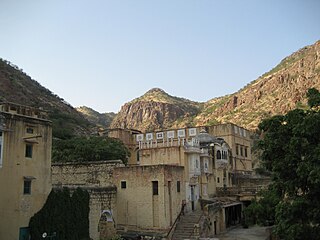
The Hills is a village in Travis County, Texas, United States. The population was 2,613 at the 2020 census, making it the largest village in Texas. It is a suburb of Austin.

Plover is a village in Portage County, Wisconsin, United States. A suburb of Stevens Point, it is part of the Stevens Point Micropolitan Statistical Area. The population was 13,519 at the 2020 United States census.

Karimnagar district is one of the 33 districts of the Indian state of Telangana. Karimnagar city is its administrative headquarters. The district shares boundaries with Peddapalli, Jagityal, Sircilla, Siddipet, Jangaon, Hanamkonda district and Jayashankar Bhupalapally districts.

Jalore District is a district of Rajasthan state in western India. The city of Jalore is the administrative headquarters of the district. The district has an area of 10,640 km2 (4,108 sq mi), and a population of 1,828,730, with a population density of 136 persons per square kilometre.

Perambalur is a town in the Indian state of Tamil Nadu. It is the headquarters of Perambalur district and Perambalur taluk (sub-district). As of 2011 census, the town had a population of 49,648.

Laird is a village in the Canadian province of Saskatchewan within the Rural Municipality of Laird No. 404 and Census Division No. 15. Laird is located in the Saskatchewan River Valley. The village is named after David Laird, Lieutenant Governor of the Northwest Territories.

Maymont is a village in the Canadian province of Saskatchewan within the Rural Municipality of Mayfield No. 406 and Census Division No. 16. It is 90 kilometres (56 mi) north-west of the city of Saskatoon.
Lordi Daijagra is a panchayat village in Rajasthan, India. Administratively, it is under Mandor Taluka, Jodhpur District of Rajasthan. Lordi Daijagra is 26 km by road west of the city of Jodhpur on National Highway 114.

Phagi is a tehsil and a panchayat samiti, near city of Jaipur in Jaipur district in the state of Rajasthan, India. It has an average elevation of 383 m (1,257 ft). Phagi is also one of the Town in Phagi Tehsil in Dudu District. Phagi is located on the intersection of SH2 and SH12 of Rajasthan.
Madhorajpura, is an ILRC and village in Phagi Tahsil in Jaipur district, Rajasthan. It has a population of around 5000. Madhorajpura has eight patwar circles - Gopalpura, Chandma Kalan, Didawata, Dosara, Beechi, Bhankarota, Madhorajpura and Sehdariya
Mandor panchayat samiti is a panchayat samiti in Jodhpur District of Rajasthan state in western India.
Chittora is a village and revenue block (ILRC) in Phagi Tehsil in Jaipur district, Rajasthan.
Chakwara is a patwar circle and village in Phagi Tehsil in Jaipur district, Rajasthan.
Mandi is a patwar circle and village in Phagi Tehsil in Jaipur district, Rajasthan. Mandi is also a patwari circle for nearby villages, Mohanpura Ranwa and Rampura Railway.
Parwan is a patwar circle and village in ILRC Nimera in Phagi Tehsil in Jaipur district, Rajasthan. Parwan is also a patwar circle for nearby villages, Khandooj, Dhunwaliya, Panwasoo Khera, Barh Mordi and Mordi.
Sameliya is a patwar circle and village in ILRC Nimera in Phagi Tehsil in Jaipur district, Rajasthan. Sameliya is also a patwar circle for nearby villages, Chandama Khurd and Mandap.
Sundar Haraicha is a municipality in Morang District of Koshi Province in Nepal. It is centered around Biratchowk town which is the gateway to Biratnagar. It borders Itahari Sub- Metropolitan city to the West, Dharan Sub- Metropolitan city to the Northwest and Belbari municipality to the East and is connected by the Mahendra Highway. It is one of the fastest growing cities in the Eastern Nepal and the second largest city of Morang district after Biratnagar with 121,305 inhabitants living in 26,677 households. It consists the town centres of Biratchowk and Gothgaun which are parts of the Greater Birat Development Area which incorporates the cities of Biratnagar-Itahari-Gothgau-Biratchowk-Dharan primarily located on the Koshi Highway in Eastern Nepal, with an estimated total urban agglomerated population of 804,300 people living in 159,332 households.

Awandiya is a village in Mandor ILRC in Phagi tehsil in Jaipur district, Rajasthan. It is situated 9 km away from sub-district headquarter Phagi and 51 km away from district headquarter Jaipur.


