Mandora Station

Last updated

Mandora Station is a cattle station on the Western Australia coast south of Broome, located in the Shire of Broome. In earlier years it has also been a sheep station. [1]

Cattle station large Australian farm (station, the equivalent of an American ranch), whose main activity is the rearing of cattle

In Australia, a cattle station is a large farm, whose main activity is the rearing of cattle; the owner of a cattle station is called a grazier. The largest cattle station in the world is Anna Creek Station in South Australia, Australia.

Western Australia State in Australia

Western Australia is a state occupying the entire western third of Australia. It is bounded by the Indian Ocean to the north and west, and the Southern Ocean to the south, the Northern Territory to the north-east, and South Australia to the south-east. Western Australia is Australia's largest state, with a total land area of 2,529,875 square kilometres, and the second-largest country subdivision in the world, surpassed only by Russia's Sakha Republic. The state has about 2.6 million inhabitants – around 11 percent of the national total – of whom the vast majority live in the south-west corner, 79 per cent of the population living in the Perth area, leaving the remainder of the state sparsely populated.

Broome, Western Australia Town in Western Australia

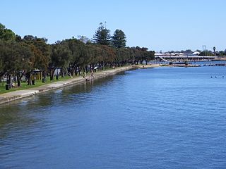
Broome is a coastal, pearling and tourist town in the Kimberley region of Western Australia, 2,240 km (1,390 mi) north of Perth. The urban population was 13,984 at the 2016 Census growing to over 45,000 per month during the peak tourist season.

Contents

It maintains a weather station and is noted for the Mandora Marsh wetland, and for its proximity to Eighty Mile Beach, which are key stopping places for migratory birds.

Mandora Marsh

Mandora Marsh, also known as Mandora Salt Marsh, is a complex and diverse wetland system in Western Australia close to Eighty Mile Beach, and included in the Eighty Mile Beach Ramsar Site. It lies at the western edge of the Great Sandy Desert bioregion and within the Mandora Station pastoral lease. The marsh is part of the 3337 km2 Mandora Marsh and Anna Plains Important Bird Area, identified as such by BirdLife International because of its importance for supporting large numbers of waders and waterbirds.

Eighty Mile Beach beach along the north-west coast of Western Australia about half-way between the towns of Broome and Port Hedland

Eighty Mile Beach, also spelled Eighty-mile Beach or 80-mile Beach, lies along the north-west coast of Western Australia about half-way between the towns of Broome and Port Hedland. It is a beach some 220 kilometres (140 mi) in length, forming the coastline where the Great Sandy Desert approaches the Indian Ocean. It is one of the most important sites for migratory shorebirds, or waders, in Australia, and is recognised as a wetland of international importance under the Ramsar Convention on Wetlands.

Bird migration seasonal movement of birds

Bird migration is the regular seasonal movement, often north and south along a flyway, between breeding and wintering grounds. Many species of bird migrate. Migration carries high costs in predation and mortality, including from hunting by humans, and is driven primarily by availability of food. It occurs mainly in the northern hemisphere, where birds are funneled on to specific routes by natural barriers such as the Mediterranean Sea or the Caribbean Sea.

Mandora crater on Mars is named after the locality; the Mandurah suburb of Madora Bay was also derived from the station as well.

Mandora (crater) crater on Mars

Mandora is a crater on Mars at 12.3N 53.7W. It is 59.4 km in diameter, and is named after the locality of Mandora in Western Australia.

Mars Fourth planet from the Sun in the Solar System

Mars is the fourth planet from the Sun and the second-smallest planet in the Solar System after Mercury. In English, Mars carries a name of the Roman god of war, and is often referred to as the "Red Planet" because the iron oxide prevalent on its surface gives it a reddish appearance that is distinctive among the astronomical bodies visible to the naked eye. Mars is a terrestrial planet with a thin atmosphere, having surface features reminiscent both of the impact craters of the Moon and the valleys, deserts, and polar ice caps of Earth.

Mandurah City in Western Australia

Mandurah is a coastal city in Western Australia, situated approximately 72 kilometres (45 mi) south of the state capital, Perth. It is the state's second-largest city, with a population just ahead of that of Bunbury.

In 2017 the property was sold by Peter and Pol Edmunds. The Edmunds are relatives of the De Pledge family who had owned the property since the 1940s. The 94,000-hectare (232,279-acre) property stocked with 4,500 head of droughtmaster cattle was bought by the Sale family who also have an interest in Bulka, Yougawalla, and Margaret River Stations. [2]

Droughtmaster cattle breed

The Droughtmaster is a tropical breed of beef cattle developed in North Queensland, Australia by several cattlemen from crossing Brahman and British breed cattle, principally the Beef Shorthorn during the early 1900s.

Climate

Climate data for Mandora, Western Australia
MonthJanFebMarAprMayJunJulAugSepOctNovDecYear
Record high °C (°F)46.8
(116.2)
46.7
(116.1)
45.6
(114.1)
43.6
(110.5)
39.8
(103.6)
36.6
(97.9)
36.1
(97)
39.6
(103.3)
42.8
(109)
46.8
(116.2)
46.5
(115.7)
48.4
(119.1)
48.4
(119.1)
Average high °C (°F)36.0
(96.8)
35.6
(96.1)
36.9
(98.4)
36.2
(97.2)
32.1
(89.8)
29.1
(84.4)
29.0
(84.2)
30.9
(87.6)
33.8
(92.8)
36.0
(96.8)
36.6
(97.9)
36.7
(98.1)
34.1
(93.4)
Average low °C (°F)25.4
(77.7)
24.9
(76.8)
24.0
(75.2)
20.8
(69.4)
16.9
(62.4)
14.1
(57.4)
12.5
(54.5)
13.2
(55.8)
15.7
(60.3)
19.2
(66.6)
21.9
(71.4)
24.5
(76.1)
19.4
(66.9)
Record low °C (°F)18.8
(65.8)
15.6
(60.1)
14.5
(58.1)
11.0
(51.8)
5.7
(42.3)
3.4
(38.1)
−0.6
(30.9)
1.4
(34.5)
5.4
(41.7)
10.0
(50)
12.8
(55)
14.5
(58.1)
−0.6
(30.9)
Average precipitation mm (inches)87.6
(3.449)
105.2
(4.142)
73.7
(2.902)
19.1
(0.752)
24.8
(0.976)
17.3
(0.681)
8.8
(0.346)
2.5
(0.098)
1.0
(0.039)
1.2
(0.047)
6.4
(0.252)
33.9
(1.335)
376.6
(14.827)
Average rainy days4.64.93.41.01.31.00.70.30.10.10.31.919.6
Source: [3]

See also

Notes

  1. "Rams for Pastoral Areas". Western Mail . Perth, Western Australia: National Library of Australia. 22 May 1941. p. 37. Retrieved 22 January 2012.
  2. Matt Brann (13 January 2017). "De Pledge family sells Mandora cattle station south of Broome". Australian Broadcasting Corporation . Retrieved 18 March 2017.
  3. "Climate Statistics for Mandora". Australian Bureau of Meteorology. Retrieved 7 June 2018.

Coordinates: 19°44′31.66″S120°50′37.95″E / 19.7421278°S 120.8438750°E / -19.7421278; 120.8438750

Geographic coordinate system Coordinate system

A geographic coordinate system is a coordinate system that enables every location on Earth to be specified by a set of numbers, letters or symbols. The coordinates are often chosen such that one of the numbers represents a vertical position and two or three of the numbers represent a horizontal position; alternatively, a geographic position may be expressed in a combined three-dimensional Cartesian vector. A common choice of coordinates is latitude, longitude and elevation. To specify a location on a plane requires a map projection.

Related Research Articles

Sandfire, Western Australia human settlement in Western Australia

Sandfire is a location and roadhouse on the Great Northern Highway in Western Australia between Port Hedland and Broome. It is on the western edge of the Great Sandy Desert, and east of Wallal Downs and Mandora Station. It is inland, and located 20 km from the coast in the region of the Mandora Marsh and the Eighty Mile Beach, 45 km north of the Kidson Track turnoff. The area surrounding the roadhouse is of high cultural significance to the Nyangumarta People, who hold native title over the area.

Wallal location of a bore in the Kimberley region of Western Australia

Wallal is the location of a bore in the Kimberley region of Western Australia. The bore is located 5 kilometres (3 mi) from the Great Northern Highway between Port Hedland and Broome and has an elevation of 10 metres (33 ft). The nearest town is Marble Bar which is situated 140 kilometres (87 mi) south of the bore.

De Grey Station

De Grey Station is a pastoral lease formerly a sheep station and now a cattle station approximately 80 kilometres (50 mi) east of Port Hedland on the mouth of the De Grey River in the Pilbara Region of Western Australia.

Anna Plains Station

Anna Plains Station is a cattle station in the Kimberley region of Western Australia.

Minderoo Station

Minderoo Station, commonly referred to as Minderoo, is a pastoral lease that once operated as a sheep station but now operates as a cattle station in Western Australia.

Boolaloo

Boolaloo Station, commonly referred to as Boolaloo, is a pastoral lease that once operated as a sheep station but now operates as a cattle station in Western Australia.

Sturt Meadows Station

Sturt Meadows or Sturt Meadows Station is pastoral lease that once operated as a sheep station but now operates as a cattle station in Western Australia.

Ethel Creek Station

Ethel Creek Station is a pastoral lease that operates as a cattle station.

Yanrey

Yanrey Station, often referred to as Yanrey, is a pastoral lease that operates as a sheep station.

Lake Way Station human settlement in Western Australia

Lake Way Station is a pastoral lease that once operated as a cattle station and now operates as a sheep station in Western Australia.

Warrawagine

Warrawagine or Warrawagine Station is a pastoral lease and cattle station located between Marble Bar and Broome in the Pilbara region of Western Australia.

Yarrie Station

Yarrie or Yarrie Station is a pastoral lease and cattle station that once operated as a sheep station, located approximately 73 kilometres (45 mi) north east of Marble Bar and 170 kilometres (106 mi) south east of Port Hedland in the Pilbara region of Western Australia. The De Grey River runs through the property.

Boodanoo Station

Boodanoo Station is a pastoral lease that was once a sheep station but now operates as a cattle station in Western Australia.

Globe Hill Station

Globe Hill Station is a defunct pastoral lease that was once a sheep station and a cattle station in Western Australia.

Hooley Station

Hooley Station is a pastoral lease that was once a sheep station but now operates as a cattle station in Western Australia.

Mount Edgar Station

Mount Edgar Station, often referred to as Mount Edgar, is a pastoral lease that once operated as a sheep station but now operates as a cattle station.

Noreena Downs Station

Noreena Downs Station, often referred to as Noreena Downs, is a pastoral lease that has been used as both a sheep station and a cattle station.

Roebuck Plains Station

Roebuck Plains Station is a pastoral lease that is located close to the township of Broome in the Kimberley region of Western Australia. It is one of the closest pastoral leases to Broome.