Roebuck Plains Station is a pastoral lease that is located close to the township of Broome in the Kimberley region of Western Australia. It is one of the closest pastoral leases to Broome.
Roebuck Plains is also the name of a roadhouse on the Great Northern Highway, just east of Broome.
The Plains in the name is associated with wetlands situated adjacent to Roebuck Bay.[1]
Description
The station is located approximately 30 kilometres (19mi) east of Broome on a rich marine floodplain. It occupies an area of 2,760 square kilometres (1,066sqmi) and is able to support around 20,000 head of cattle.[2] The property is a mixture of floodplains and sandy pindan country.[3]
History
The traditional owners of the area are the Yawuru peoples.[2] The property was acquired and developed by the pearlers, Streeter and Company, to supply meat to Broome. A slaughterhouse was also established on the outskirts of town to process the cattle and sheep that were being raised on the property.[4]
In 1953 the 2,900-square-kilometre (1,120sqmi) station was acquired by the Harris family.[6] It was stocked with 10,000 head of cattle at the time.[7][8]
The Indigenous Land Corporation acquired Roebuck Plains Station in 1999, and in 2006 the Federal Court determined the station was the exclusive possession of the Yawuru under native title.[2] In 2014 the ILC handed the lease over to the Nyamba Buru Yawuru Corporation. Pat Dodson, the chairman of the company, accepted the lease but handed management of the station back to the ILC. The property and the adjacent commercial cattle yards are worth around A$15 million.[9] The plains are also subject to analysis of indigenous perceptions of the landscape.[clarification needed][10]
In 2018, the property was flooded when it received 1,625 millimetres (64in) of rain through the wet season, with half of it falling in one week in January. The 6,000 head of cattle had to be moved off the floodplains to higher ground. The cyclone that brought the rain also caused extensive damage to the property, with trees blown over, buildings damaged and fences washed away.[3]
↑ "Station home blaze". The West Australian. Vol.65, no.19, 671. Western Australia. 3 August 1949. p.24. Retrieved 24 February 2018– via National Library of Australia.
Broome, also known as Rubibi by the Yawuru people, is a coastal pearling and tourist town in the Kimberley region of Western Australia, 2,046 km (1,271 mi) north of Perth. The town recorded a population of 14,660 in the 2021 census. It is the largest town in the Kimberley region.
The Kimberley is the northernmost of the nine regions of Western Australia. It is bordered on the west by the Indian Ocean, on the north by the Timor Sea, on the south by the Great Sandy and Tanami deserts in the region of the Pilbara, and on the east by the Northern Territory.
Roebuck Bay is a bay on the coast of the Kimberley region of Western Australia. Its entrance is bounded in the north by the town of Broome, and in the south by Bush Point and Sandy Point. It is named after HMS Roebuck, the ship captained by William Dampier when he explored the coast of north-western Australia in 1699. The Broome Bird Observatory lies on the northern coast of the bay.
Eighty Mile Beach also spelled Eighty-mile Beach or 80-mile Beach, and formerly called 90-mile Beach, lies along the north-west coast of Western Australia about half-way between the towns of Broome and Port Hedland. It is a beach some 220 kilometres (140 mi) in length, forming the coastline where the Great Sandy Desert approaches the Indian Ocean. It is one of the most important sites for migratory shorebirds, or waders, in Australia, and is recognised as a wetland of international importance under the Ramsar Convention on Wetlands.
The Fitzroy River is located in the West Kimberley region of Western Australia. It has 20 tributaries and its catchment occupies an area of 93,829 square kilometres (36,228 sq mi), within the Canning Basin and the Timor Sea drainage division.
The Shire of Derby–West Kimberley is one of four local government areas in the Kimberley region of northern Western Australia, covering an area of 104,080 square kilometres (40,186 sq mi), most of which is sparsely populated. The Shire's population as at the 2016 Census was almost 8,000, with most residing in the major towns of Derby, which is also the Shire's seat of government, and Fitzroy Crossing. There are also around 70 Aboriginal communities within the Shire.
The Djugun are an Aboriginal Australian people of the Kimberley region of Western Australia.
Wallal is the location of a bore in the Kimberley region of Western Australia. The bore is located 5 kilometres (3 mi) from the Great Northern Highway between Port Hedland and Broome and has an elevation of 10 metres (33 ft). The nearest town is Marble Bar, 140 kilometres (87 mi) south of the bore.
The Yawuru, also spelt Jawuru, are an Aboriginal Australian people of the Kimberley region of Western Australia.
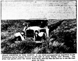
Anna Plains Station is a cattle station in the Kimberley region of Western Australia.
Mardie Station is a pastoral lease and sheep then cattle station that was established in 1866 in the Pilbara region of Western Australia near the mouth of the Fortescue River. The leasee in 2012 was Fourseasons Corporation; Mardie is operating under the Crown Lease number CL453-1984 and has the Land Act number LA3114/1027.
Carlton Hill Station is a pastoral lease and cattle station located in the Kimberley region of Western Australia. Situated approximately 39 kilometres (24 mi) to the north-west of Kununurra and 44 kilometres (27 mi) east of Wyndham, the station covers an area of 3,675 square kilometres (1,419 sq mi).
Wave Hill Station, most commonly referred to as Wave Hill, is a pastoral lease in the Northern Territory operating as a cattle station. The property is best known as the scene of the Wave Hill walk-off, a strike by Indigenous Australian workers for better pay and conditions, which in turn was an important influence on Aboriginal land rights in Australia.
Yeeda Station is a pastoral lease that operates as a cattle station in the Kimberley region of Western Australia.
Meda Station, often referred to as Meda River Station, is a pastoral lease in Western Australia that once operated as a sheep station but presently operates as a cattle station.
Myroodah or Myroodah Station is a pastoral lease that once operated as a sheep station but presently operates as a cattle station located in Western Australia.
Severe Tropical Cyclone Kelvin was a strong tropical cyclone that impacted Western Australia in February 2018, causing moderate damage. The system was first identified as a weak tropical low on the morning of 11 February over the Northern Territory's Tiwi Islands by the Australian Bureau of Meteorology (BoM). The low moved southwestwards over land and emerged over the Indian Ocean near Broome on 16 February. The storm intensified into a Category 1 tropical cyclone on the following day, becoming the sixth named storm of the 2017–18 Australian region cyclone season. Kelvin subsequently moved slowly eastwards and began to rapidly intensify in the hours prior to landfall. On 18 February, the storm crossed the coast along Eighty Mile Beach as a Category 3 severe tropical cyclone on the Australian scale, and a high-end Category 1 hurricane-equivalent cyclone on the Saffir–Simpson scale. Despite being over land, Kelvin weakened at a slow rate over the next few days, and was downgraded to a tropical low on 19 February. The remnant low of the system drifted over the Outback before being last noted by BoM on 21 February.
This page is based on this Wikipedia article Text is available under the CC BY-SA 4.0 license; additional terms may apply. Images, videos and audio are available under their respective licenses.