Bow River Station

Last updated

Australia Western Australia location map.svg
Red pog.svg
Bow River Station

Bow River Station is a pastoral lease that operates as a cattle station in Western Australia.

Cattle station large Australian farm (station, the equivalent of an American ranch), whose main activity is the rearing of cattle

In Australia, a cattle station is a large farm, whose main activity is the rearing of cattle; the owner of a cattle station is called a grazier. The largest cattle station in the world is Anna Creek Station in South Australia, Australia.

Western Australia state in Australia

Western Australia is a state occupying the entire western third of Australia. It is bounded by the Indian Ocean to the north and west, and the Southern Ocean to the south, the Northern Territory to the north-east, and South Australia to the south-east. Western Australia is Australia's largest state, with a total land area of 2,529,875 square kilometres, and the second-largest country subdivision in the world, surpassed only by Russia's Sakha Republic. The state has about 2.6 million inhabitants – around 11 percent of the national total – of whom the vast majority live in the south-west corner, 79 per cent of the population living in the Perth area, leaving the remainder of the state sparsely populated.

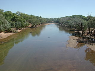
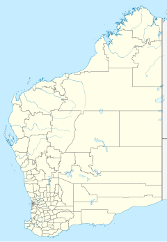
It is located approximately 20 kilometres (12 mi) north west of Warmun and 135 km (84 mi) south of Kununurra on the Bow River in the Kimberley region of Western Australia. [1]

Kununurra, Western Australia Town in Western Australia

Kununurra is a town in far northern Western Australia located at the eastern extremity of the Kimberley Region approximately 37 kilometres (23 mi) from the border with the Northern Territory. Kununurra was initiated to service the Ord River Irrigation Scheme.

Bow River is a 148-kilometre (92 mi) long tributary of the Ord River in the Kimberley region of northern Western Australia. The river was named by pastoralist Michael Durack in 1882 after the Bow River in his family's ancestral home of County Clare, Ireland.

Kimberley (Western Australia) Region in Western Australia

The Kimberley is the northernmost of the nine regions of Western Australia. It is bordered on the west by the Indian Ocean, on the north by the Timor Sea, on the south by the Great Sandy and Tanami Deserts in the region of Pilbara, and on the east by the Northern Territory.

Gold was found in the area in 1885, [2] with squatters occupying grazing lands in 1888. [3]

Gold Chemical element with atomic number 79

Gold is a chemical element with symbol Au and atomic number 79, making it one of the higher atomic number elements that occur naturally. In its purest form, it is a bright, slightly reddish yellow, dense, soft, malleable, and ductile metal. Chemically, gold is a transition metal and a group 11 element. It is one of the least reactive chemical elements and is solid under standard conditions. Gold often occurs in free elemental (native) form, as nuggets or grains, in rocks, in veins, and in alluvial deposits. It occurs in a solid solution series with the native element silver and also naturally alloyed with copper and palladium. Less commonly, it occurs in minerals as gold compounds, often with tellurium.

See also

Related Research Articles

El Questro Wilderness Park

El Questro Wilderness Park is a wilderness park on El Questro Station, a cattle station that diversified its pastoral operation to include tourism, located in the Kimberley region of Western Australia. It remains a working cattle station with a herd of approximately 6,000 head. In 2012 the pastoral station lessee was GPT Funds Management Pty Ltd. El Questro station operates under Crown Lease number CL207-1984 and has Land Act number LA3114/1180.

Fossil Downs Station

Fossil Downs Station is a pastoral lease and cattle station located about 50 kilometres (31 mi) North East of Fitzroy Crossing in the Kimberley region of Western Australia.

Carlton Hill Station

Carlton Hill Station is a pastoral lease and cattle station located in the Kimberley region of Western Australia.

Myroodah human settlement in Australia

Myroodah or Myroodah Station is a pastoral lease that once operated as a sheep station but presently operates as a cattle station located in Western Australia.

Chirritta

Chirritta Station most often referred to as Chirritta or Cherratta is a pastoral lease operating as a sheep station in Western Australia.

Elsinora

Elsinora Station most commonly known as Elsinora is a pastoral lease that has operated as both a sheep station and a cattle station in outback New South Wales. It is situated approximately 160 kilometres (99 mi) north of White Cliffs and 240 kilometres (149 mi) north west of Bourke close to the Queensland border.

Atley Station

Atley Station is a pastoral lease that operates as a sheep and goat station in Western Australia. The property is historically significant for its long association with the pastoral industry in the Sandstone district.

Billiluna Station

Billiluna Station is a pastoral lease that operates as a cattle station in Western Australia.

Bonney Downs Station

Bonney Downs Station is a pastoral lease that was once a sheep station but now operates as a cattle station in Western Australia.

Boodarie Station

Boodarie Station is a pastoral lease that was once a sheep station but now operates as a cattle station in Western Australia.

Bulga Downs Station

Bulga Downs Station is a pastoral lease that once operated as a sheep station but is now a cattle station located in the Mid West region of Western Australia.

Callawa Station

Callawa Station is a pastoral lease that was once a sheep station but now operates as a cattle station in Western Australia.

Carlindi Station

Carlindi Station also sometimes spelled as Carlindie Station, is a pastoral lease that was once a sheep station but now operates as a cattle station in Western Australia.

Coongan Station

Coongan Station is a pastoral lease that was once a sheep station but now operates as a cattle station in Western Australia.

Corunna Downs Station

Corunna Downs Station is a pastoral lease that was once a sheep station but now operates as a cattle station in Western Australia.

Hooley Station

Hooley Station is a pastoral lease that was once a sheep station but now operates as a cattle station in Western Australia.

Lalla Rookh Station

Lalla Rookh Station, often referred to as Lalla Rookh, is a pastoral lease that once operated as a sheep station but now operates as a cattle station.

Mallina Station

Mallina Station is a pastoral lease that was once a sheep station but now operates as a cattle station in Western Australia.

Noreena Downs Station

Noreena Downs Station, often referred to as Noreena Downs, is a pastoral lease that has been used as both a sheep station and a cattle station.

Quanbun

Quanbun Station, also known as Quanbum and Quanbun Downs, is a pastoral lease and cattle station located about 40 kilometres (25 mi) south west of Fitzroy Crossing in the Kimberley region of Western Australia.

References

  1. "Map of Bow River, WA". Bonzle Digital Atlas. Digital Atlas Pty Limited. 2017. Retrieved 9 March 2017.
  2. "Report on the survey on the Kimberley district". The West Australian . 1, (291). Western Australia. 5 December 1885. p. 5. Retrieved 9 March 2017 via National Library of Australia.
  3. "News from Wyndham". The West Australian . 4, (651). Western Australia. 13 April 1888. p. 3. Retrieved 9 March 2017 via National Library of Australia.

Coordinates: 16°52′18″S128°13′00″E / 16.8717°S 128.2167°E / -16.8717; 128.2167

Geographic coordinate system Coordinate system

A geographic coordinate system is a coordinate system that enables every location on Earth to be specified by a set of numbers, letters or symbols. The coordinates are often chosen such that one of the numbers represents a vertical position and two or three of the numbers represent a horizontal position; alternatively, a geographic position may be expressed in a combined three-dimensional Cartesian vector. A common choice of coordinates is latitude, longitude and elevation. To specify a location on a plane requires a map projection.