Mandora Marsh has formed over thousands of years on what used to be the lower reaches and estuary of an ancient river. The main features are two large lakes which are flooded after heavy cyclonic rainfall. The westernmost Lake Walyarta 19°46′S121°17′E / 19.767°S 121.283°E / -19.767; 121.283 is a claypan that extends eastwards about 30km from the inland side of the Great Northern Highway. Although its width may reach 5km, the depth of water never exceeds 2 m. The eastern lake 19°47′S121°35′E / 19.783°S 121.583°E / -19.783; 121.583 is separated from Walyarta by a calcrete ridge. It is a broad and braided drainage line containing islands of vegetation that floods extensively but soon dries out to a series of isolated salt and claypans. Connecting the lakes is Salt Creek, a mangrove-lined watercourse about 5km long and 20 m wide. It holds permanent water and appears to be fed by a series of soaks.[2]
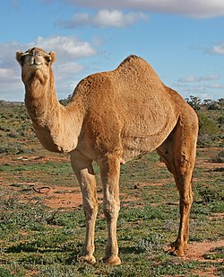
Black-winged stiltBilbyAustralian feral camel
Despite its alternative name, as well as its saline wetlands Mandora Marsh includes a number of permanent or almost permanent freshwaterswamps supplied by springs along the southern side of the two main lakes. The springs are usually formed of a central, raised mound, 2–3 m high, of saturated peat, supporting a mixture of Melaleuca and Sesbania trees, with mangroves appearing at the saline and brackish springs. The springs vary in size from 0.1 to several hectares; each spring's mound is generally surrounded by a moat, varying from a maximum depth of 50cm to isolated shallow pools or just wet soil. Many springs also support small stands of cumbungi with the understories of some dominated by the fernAchrostichum speciosum. Thickets of saltwater paperbark are found where flood waters remain longest; stock watering bores have been established in these thickets, and the watering troughs are used by waterbirds throughout the year. The most spectacular of the springs is Mandora Soak, a raised peat bog estimated to be 7000 years old.[2]
Flora and fauna
Some 269 species of vascular plants, from 55 families, have been collected from Mandora Salt Marsh. This includes 37 species from the Poaceae, or true grass family, and nine introduced weeds. The most inland occurrence of mangroves in Australia is an isolated stand of grey mangroves in the eastern lake of the marsh, 60km inland from Eighty-mile Beach.[3] A new species of bush tomato, Solanum oligandrum, known only from the Mandora Marsh area, was first described in 2001.[2]
The Mandora Marsh is of high cultural significance to the Nyangumarta people, who hold native title over the area.
Conservation
Cattle grazing has caused substantial deterioration in the vegetation and physical environment of the springs and Salt Creek; Saunders Spring in 1997, and Grants Spring in 2001, were fenced to limit further damage. High numbers of feral camels and cats are present in the marsh.[2]
References
Notes
↑ BirdLife International. (2011). Important Bird Areas factsheet: Mandora Marsh and Anna Plains. Downloaded from http://www.birdlife.org on 010/08/2011.
1 2 3 4 5 6 Information Sheet on Ramsar Wetlands: Eighty-mile Beach.
Graham, Gordon. (September 2001). "Great Sandy Desert 1 (GSD1 – McLarty subregion)"(PDF). A Biodiversity Audit of Western Australia's 53 Biogeographical Subregions in 2002: 326–331. Archived from the original(PDF) on 12 March 2011. Retrieved 17 April 2010.
This page is based on this Wikipedia article Text is available under the CC BY-SA 4.0 license; additional terms may apply. Images, videos and audio are available under their respective licenses.