Manpur, Bihar

Last updated

Manpur
Manpur
town
Manpur junction rail station IMG 20200208 092706.jpg
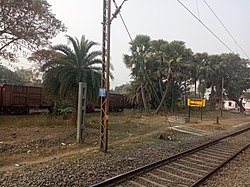
Manpur junction railway station
Nickname: 
Manchester of Eastern India
India Bihar location map.svg
Red pog.svg
Manpur
Location in Bihar, India
Coordinates: 24°49′N85°02′E / 24.82°N 85.03°E / 24.82; 85.03 Coordinates: 24°49′N85°02′E / 24.82°N 85.03°E / 24.82; 85.03
CountryFlag of India.svg  India
State Bihar
District Gaya
Government
  Type Municipal corporation
  Body Nagar Palika
Languages
  Official Magadhi/magahi, Hindi
Time zone UTC+5:30 (IST)
PIN
823003
Telephone code0631
Nearest cityGaya
Lok Sabha constituencyGaya Town
Vidhan Sabha constituencyGaya Town, Wazirganj

Manpur is a block in Gaya District, India. The town is known for its handloom and railroad tie factory. It is situated on the banks of the Phalgu river. It is a country town where the people from the remote villages do their shopping. The main market is known as Manpur Bazaar. The main occupation of the people are business and handloom weaving Weaving of clothes through hand loom and power loom is done mainly in Patwatoli.

Contents

Patwatoli, a muhalla in Manpur, has produced many IITians almost 20 each year Indian Institutes of Technology and about every house has an engineer. Now these days, students are opting other streams too like Law, UPSC, SSC, Medical etc. Due to higher education in Patwatoli, Child marriage is about to end and Girls also going out for higher education. [1]

History

There is also a very ancient temple of Lord Sun in Manpur named as Surya Temple, which is situated on the bank of a pond. The Surya Temple was established around 400 years ago by Raja Man Singh, an army chief of the Mughal Emperor Akbar as well as king of Amer. Raja Man Singh, during his campaign to quell Bengal riots, established Manpur; that's why it is named as Man-pur. Patwatoli, near the Shiv Mandir, Sri Ram Nagar, Durga Asthan and Shivcharan Lane, has the highest number of power looms installed. There are almost 5000- 8000 power looms set up.

Manpur is also famous for Diwali and almost hundreds of statues of Goddess Lakshmi, Lord Ganesha and Goddess Saraswati are worshipped and decorated on the occasion of Diwali. People from all over Manpur as well as Gaya town come out of their houses in Diwali to see the very well decorated statues. On 2nd day of Diwali people roam around the patwatoli for Pandal Hoping.

Transport

Manpur is connected by train with various cities of Bihar. The nearest two station namely Manpur Junction and Shaheed Ishwar Chowdhary Halt railway station is situated on Gaya–Kiul line. [2]

Related Research Articles

<span class="mw-page-title-main">Haridwar</span> City in Uttarakhand, India

Haridwar is a city and municipal corporation in the Haridwar district of Uttarakhand, India. With a population of 228,832 in 2011, it is the second-largest city in the state and the largest in the district.

<span class="mw-page-title-main">Datia</span> City in Madhya Pradesh, India


Datia is the district headquarter of the Datia District in north central Madhya Pradesh,a state of Central India. It is an ancient town, mentioned in the Mahabharata ruled by King Dantavakra. The city is 78 km from Gwalior, 325 km south of New Delhi and 344 km north of Bhopal. About 18 km from Datia is Sonagiri, a sacred Jain hill. Datia is also about 31 km from Jhansi and 52 km from Orchha. The nearest airport is at Gwalior. It was formerly the seat of the eponymous princely state in the British Raj. Datia is situated near Gwalior and on the border with Uttar Pradesh.

<span class="mw-page-title-main">Maheshwar</span> Town in Madhya Pradesh, India

Maheshwar is a town, near Khargone city in Khargone district of Madhya Pradesh state, in central India. It is located on State Highway-38 ,13.5 km east of National Highway 3 and 91 km from Indore, the commercial capital of the state. The Town lies on the north bank of the Narmada River. It was the kingdom of Chaktavartin Samrat Sahastraarjun, Kartavirya Arjuna a Heheya king. Lately, after many years, it was the capital of the Malwa during the Maratha Holkar reign till 6 January 1818, when the capital was shifted to Indore by Malhar Rao Holkar III.

<span class="mw-page-title-main">Nawada</span> City in Bihar, India

Nawada is a city and a municipality in Bihar, India. It is also the headquarters of the Nawada district. It is the headquarters of the subdivision of the same name, lying on both sides of the Khuri River( also known as Sakri river in some parts) at 24º 53’ N and 85º 33’ E. The name evolved from Nau-wada, meaning the new town. On 26 January 1973, Nawada was formed as a separate district from Gaya.

<span class="mw-page-title-main">Jamui district</span> District of Bihar in India

Jamui is a district among 38 districts of Bihar state, India. The district was formed on 21 February 1991, when it was separated from Munger district. It is located at a longitude of 86° 13'E and the latitude is 24° 55'N.

<span class="mw-page-title-main">Umaria district</span> District of Madhya Pradesh in India

Umaria district is a district of Madhya Pradesh. The town of Umaria is the district headquarters. The district is part of Shahdol Division.

<span class="mw-page-title-main">Shantipur</span> City in West Bengal, India

Santipur is a city and a municipality in the Ranaghat subdivision of Nadia district in the Indian state of West Bengal. The fort area of this city, also known as Daak-Garh is thought to have been built by Raja Krishnachandra of Nadia.

Balaramapuram is one of the panchayats that form the city of Trivandrum, the capital of Kerala, India. It is the most urbanized panchayat in the Thiruvananthapuram district.

<span class="mw-page-title-main">Jagadhri</span> City in Haryana, India

Jagadhri is a city and a municipal council in the Yamunanagar district of the Indian state of Haryana. This town lies adjacent to the city of Yamunanagar. The demarcation line between the two is difficult to discern. Jagadhri is around 90  km away from Chandigarh, the capital city of Haryana state. This town is known for the cluster of brass and copper industries. Jagadhri is known as the "Brass City" of India. 

Chennimalai is a town in Erode district, Tamil Nadu, India. It is popularly known as the 'Handloom Town'.

<span class="mw-page-title-main">Kotdwar</span> City in Uttarakhand, India

Kotdwar is a city, municipal corporation in Pauri Garhwal district of Uttarakhand, India. It's just 101 km from Pauri town, the district headquarter. It is the eighth-largest city in Uttarakhand. Its old name was "Khohdwar", which means the gateway of the river Khoh since it is located on the bank of river Khoh. It is situated in the southwestern part of the state and is one of the main entrance points in the state of Uttarakhand.

<span class="mw-page-title-main">Surada</span> Town in Odisha, India

Surada is a town and a Notified Area Council in Ganjam district in the Indian state of Odisha.

Vanavasi is a Town Panchayat in Mettur Taluka, Salem District, in the Indian state of Tamil Nadu.

<span class="mw-page-title-main">Vijayapuri, Erode district</span> Census town in India

Vijayamangalam is a census town in Erode district in the Indian state of Tamil Nadu. It is located on National Highway 47 (NH-47) between Perundurai and Perumanallur.

Tanda is a town in Ambedkar Nagar district in the Indian state of Uttar Pradesh situated on the banks of Ghaghara River. It is a nagar palika parishad and is part of Faizabad division in Uttar Pradesh. The town is situated 20 kilometres (12 mi) north east from district headquarter Akbarpur. Tanda is also a tehsil in the district. It has one of the largest handloom weaving industries for manufacturing varieties like gamchha, lungi, polyester clothing, check-shirt clothes material in state of Uttar Pradesh.

Kudra, formerly known as Jahanabad, is a town and corresponding community development block in Kaimur district in the state of Bihar, India. It is the third largest town in Kaimur district. It is situated about 18 km from District Headquarter Bhabua. As of 2011, the population of Kudra was 30986. The railway station in Kudra is connected to all major railway routes.

Khatangi is a prominent village in Bihar, India. It is situated in Sonbhadra-Bansi-Surajpur Block in Arwal district of the State of Bihar. It is located at 96.1 km distance from Arwal and at 114 km distance from the state capital Patna. It is a very old village with a population of about 5,000 people. The literacy rate is 45.56%, comprising a female literacy rate of 27.3% and a male literacy rate of 62.98%. The people here are very friendly and hospitable. The economy of this village is agro-based and agriculture remains the main source of income.

Banjari is a small town at the south-western tip of Bihar state, India. It is located on the Sone River, the largest of the Ganges' southern tributaries, in Rohtas district. It is framed by the Kaimur mountain range, to the south-east of Sasaram.

<span class="mw-page-title-main">Janjgir</span> Town in Chhattisgarh, India

Janjgir is the headquarters of the Janjgir–Champa district in Chhattisgarh, India. It has been the district headquarters since 25 May 1998, when Janjgir–Champa was carved out of Bilaspur. Well known for its Vishnu Temple aka Nakta Mandir,Nahariya Baba Mandir, Agricultural industries, and Rice production, Janjgir is undergoing rapid industrial development and will become home to various industries and plants in the coming years, city's railway station name is Janjgir-Naila. Janjgir is well connected by railways and roads and is connected to major cities like Bilaspur and Raipur through National Highway 149.

The Patwa are a mainly Jain and Hindu community native to Hindi Belt.Traditionally, they were Hindu baniya.

References

  1. "Tradition alive and kicking". The Telegraph. Archived from the original on 19 August 2014. Retrieved 26 May 2011.
  2. Rehman, Abdul. "Manpur Railway Station Map/Atlas ECR/East Central Zone - Railway Enquiry". indiarailinfo.com. Retrieved 2 April 2021.