Related Research Articles

The Bridge River is an approximately 120 kilometres (75 mi) long river in southern British Columbia. It flows south-east from the Coast Mountains. Until 1961, it was a major tributary of the Fraser River, entering that stream about six miles upstream from the town of Lillooet; its flow, however, was near-completely diverted into Seton Lake with the completion of the Bridge River Power Project, with the water now entering the Fraser just south of Lillooet as a result.
Tyaughton Creek, formerly gazetted as the Tyaughton River, also historically known as Tyoax Creek, is a 50 kilometre tributary of British Columbia's Bridge River, flowing generally southeast to enter the main flow of that river about mid-way along the length of Carpenter Lake, a reservoir formed by Terzaghi Dam of the Bridge River Power Project.
Robert Allan Brown was a well-known and flamboyant prospector and speculator in 19th and early 20th Century in the Canadian province of British Columbia. He was known generally as Volcanic Brown, especially in the province's Kootenay and Boundary districts and in adjoining Eastern Washington, and also as Sunset Brown in the Similkameen District and still also to others as Crazy Brown. His enthusiastic nature contributed to his nickname, and as result of that and his flamboyant personality he was a fixture in mining industry news in a wide region which spanned the British Columbia-United States border.

The Moyie River is a 92-mile (148 km) long tributary of the Kootenai River in the U.S. state of Idaho and the Canadian province of British Columbia. The Moyie River is part of the Columbia River basin, being a tributary of the Kootenay River, which is tributary to the Columbia River.

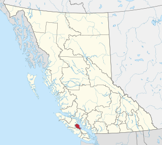
The Comox Valley Regional District is a regional district in British Columbia, Canada. It was created on February 15, 2008, encompassing the southeastern portions of the former Regional District of Comox-Strathcona, and centred about the Comox Valley. The partition left the new Comox Valley Regional District with only 8.4 percent of the former Comox-Strathcona's land area, but 57.9 percent of its population. The CVRD covers an area of 2,425 square kilometres, of which 1,725 square kilometres is land, and serves a population of 66,527 according to the 2016 Census. The district borders the Strathcona Regional District to the northwest, the Alberni-Clayoquot Regional District to the southwest, and the Regional District of Nanaimo to the southeast, as well as the Powell River Regional District along the Strait of Georgia to the east.
The Beaver River is a tributary of the Liard River, entering that stream in the area of its Grand Canyon just south of the British Columbia-Yukon border after running generally south-east from its origin in the extreme southeast corner of the Yukon Territory.
The Beaver River, also known as the Beavermouth Creek or Beaver Creek, is a tributary of the Columbia River in British Columbia, Canada, joining that river in the Rocky Mountain Trench northwest of the town of Golden. It enters the Columbia via Kinbasket Lake.

The Kingcome River is a river in the Canadian province of British Columbia. Its drainage basin is 1,456 square kilometres (562 sq mi) in size.

Birkenhead Peak, commonly known as Mount Birkenhead and sometimes Birkenhead Mountain and also Mount Birken, 2506 m (8222 ft) prominence: 1781 m, is a mountain in the Gates Valley region of the Lillooet Country of the South-Central Interior of British Columbia, Canada. Located approximately midway between the towns of Lillooet (NE) and Pemberton-Mount Currie, the mountain's very high prominence separates it from the adjoining Cadwallader Range by the pass between Blackwater Creek and Birkenhead Lake.
The Germansen River, formerly Germansen Creek, is a major south tributary of the Omenica River in the Northern Interior of British Columbia, Canada. The settlement and former gold-rush centre of Germansens Landing is located at its confluence with the Omineca. Along its course is Germansen Lake at 55°41′45″N124°51′10″W, south of which is the Germansen Range and Mount Germansen.
Palmer Bar Creek is a creek in the East Kootenay region of British Columbia. This creek is a tributary of the Moyie River and discovered in the 1860s. Palmer Bar Creek has been mined for gold.
Weaver Creek is a creek located in the East Kootenay region of British Columbia. Weaver Creek is a tributary of the Moyie River. The creek has been mined for gold.
The Nazko River is a tributary of the West Road River, one of the main tributaries of the Fraser River, in the Canadian province of British Columbia. It flows through the Fraser Plateau region west of Quesnel.
Dog Creek is a tributary of the Fraser River in the Cariboo region of the Canadian province of British Columbia, entering that river south of the confluence of the Chilcotin River.] The eponymous community of Dog Creek is located on the northeast side of the creek's confluence with the Fraser.

The Gamsby River is a river in the Kitimat Ranges of the North Coast region of British Columbia, Canada. It flows southwest to meet the Kitlope River, of which it is a tributary.

Call Inlet is an inlet on the Central Coast region of British Columbia, Canada, located south of the lower reaches of Knight Inlet to the east of East Cracroft Island. Pawala Indian Reserve No. 5 is at the head of the inlet. Chatham Channel connects the outlet of the inlet to Knight Inlet and separates East Cracroft Island from the mainland peninsula on the north side of the inlet. Havannah Channel leads southwest out of the inlet, south and east around East Cracroft and past Hull Island, to Johnstone Strait.
Mosely Creek is a large creek in the Pacific Ranges of the Coast Mountains in British Columbia, Canada, flowing southwest to join the Homathko River in its canyon downstream from Tatlayoko Lake, and a short distance above Murderers Bar at 51°16′00″N124°54′00″W, which is the site of the opening events of the Chilcotin War of 1864.
The Nation River, formerly known as the Tribe River and originally in French as the Rivière au Nation, is a river in the Northern Interior of British Columbia, Canada, originally a tributary of the Parsnip River, it now feeds Lake Williston via Nation Arm of that lake, which is the reservoir formed by WAC Bennett Dam. The town of Mackenzie is to the southeast of the river's terminus at the lake.