Starobin is an urban-type settlement in Salihorsk District, Minsk Region, Belarus. It is situated 12 kilometres (7.5 mi) from Salihorsk and 145 kilometres (90 mi) from the capital Minsk. As of 2024, it has a population of 6,492.

Knyahinin is an agrotown in Myadzyel District, Minsk Region, Belarus. It serves as the administrative center of Knyahinin selsoviet. It is located 30 kilometres (19 mi) from Myadzyel and 100 kilometres (62 mi) from the capital Minsk. In 1998, it had a population of 1,056. In 2010, it had a population of 834.
Zanarach is an agrotown in Myadzyel District, Minsk Region, Belarus. It serves as the administrative center of Zanarach selsoviet. It is located 25 kilometres (16 mi) from Myadzyel, by the southern shore of lake Narach, and its name literally means "place beyond Narach". In 1998, it had a population of 692. In 2011, it had a population of 653.

Alyakhnovichy is an agrotown in Maladzyechna District, Minsk Region, Belarus. It serves as the administrative center of Alyakhnovichy selsoviet. It is located 19 kilometres (12 mi) from Maladzyechna and 50 kilometres (31 mi) from the capital Minsk. In 1995, it had a population of 1,181. In 2010, it had a population of 1,709.

Palachany is an agrotown in Maladzyechna District, Minsk Region, Belarus. It serves as the administrative center of Palachany selsoviet. It is located 15 kilometres (9.3 mi) from Maladzyechna and 88 kilometres (55 mi) from the capital Minsk. In 2000, it had a population of 1,047. In 2010, it had a population of 977.

Khazhova is an agrotown in Maladzyechna District, Minsk Region, Belarus. It serves as the administrative center of Khazhova selsoviet. It is located 10 kilometres (6.2 mi) from Maladzyechna and 88 kilometres (55 mi) from the capital Minsk. In 2002, it had a population of 657. In 2010, it had a population of 577.

Vyvyery is an agrotown in Maladzyechna District, Minsk Region, Belarus. It is administratively part of Myasata selsoviet; since 2015, it has served as its administrative center. It is located 15 kilometres (9.3 mi) from Maladzyechna and 63 kilometres (39 mi) from the capital Minsk. In 2010, it had a population of 585.

Haradok is an agrotown in Maladzyechna District, Minsk Region, Belarus. It serves as the administrative center of Haradok selsoviet. It is located 19 kilometres (12 mi) from Maladzyechna and 60 kilometres (37 mi) from the capital Minsk. In 1996, it had a population of 576. In 2010, it had a population of 405.

Byerazinskaye is an agrotown in Maladzyechna District, Minsk Region, Belarus. It is administratively part of Haradzilava selsoviet; it has served as its administrative center since 2008. It is located 25 kilometres (16 mi) from Maladzyechna and 106 kilometres (66 mi) from the capital Minsk. In 2010, it had a population of 1,645.

Lyebyedzyeva is an agrotown in Maladzyechna District, Minsk Region, Belarus. It serves as the administrative center of Lyebyedzyeva selsoviet. It is located 12 kilometres (7.5 mi) from Maladzyechna and 90 kilometres (56 mi) from the capital Minsk. In 1998, it had a population of 1,153. In 2010, it had a population of 1,086.

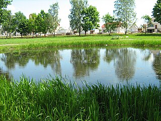
Svatki is an agrotown in Myadzyel District, Minsk Region, Belarus. It serves as the administrative center of Svatki selsoviet. It is located 18 kilometres (11 mi) from Myadzyel, 10 kilometres (6.2 mi) from Knyahinin, and 110 kilometres (68 mi) from the capital Minsk. It is located by the Wuzlianka river, a tributary of the Narach. In 2011, it had a population of 516.
Sosny 2, previously known as Sosny until 2013, is an agrotown in Lyuban District, Minsk Region, Belarus. It serves as the administrative center of Sosny selsoviet. It is located 25 kilometres (16 mi) from Lyuban, 41 kilometres (25 mi) from Urechcha, and 177 kilometres (110 mi) from the capital Minsk. In 2001, it had a population of 772. In 2011, it had a population of 677.

Tal is an agrotown in Lyuban District, Minsk Region, Belarus. It serves as the administrative center of Tal selsoviet. It is located eight kilometres (5.0 mi) from Lyuban, 17 kilometres (11 mi) from Urechcha, and 144 kilometres (89 mi) from the capital Minsk. In 2002, it had a population of 1,395. In 2011, it had a population of 1,095.

Kraysk is an agrotown in Lahoysk District, Minsk Region, Belarus. It serves as the administrative center of Kraysk selsoviet. It is located 58 kilometres (36 mi) from Lahoysk and 97 kilometres (60 mi) from the capital Minsk. In 1998, it had a population of 412. In 2010, it had a population of 346.

Luzhki is an agrotown in Sharkawshchyna District, Vitebsk Region, in northern Belarus. It is located 29 kilometres (18 mi) from Padsvillye, 32 kilometres (20 mi) from Sharkawshchyna, and 198 kilometres (123 mi) from Vitebsk. In 1999, it had a population of 905.

Sinyawka is an agrotown in Klyetsk District, Minsk Region, in south-central Belarus. It is located 20 kilometres (12 mi) southeast of Baranavichy. In 2001, it had a population of 1,728.

Lapichy is an agrotown in Asipovichy District, Mogilev Region, Belarus. It is located 25 kilometres (16 mi) from Asipovichy and 186 kilometres (116 mi) from Mogilev. It serves as the administrative center of Lapichy selsoviet. In 1998, it had a population of 1,012.

Lipyen or Lipen is an agrotown in Asipovichy District, Mogilev Region, Belarus. It is located 20 kilometres (12 mi) from Asipovichy and 126 kilometres (78 mi) from Mogilev. It serves as the administrative center of Lipyen selsoviet. In 1999, it had a population of 1,000.
Abchuha is an agrotown in Krupki District, Minsk Region, Belarus. It is located 140 kilometres (87 mi) northeast of the capital Minsk. It is administratively part of Aktsyabrski selsoviet; it previously served as the administrative center of Abchuha selsoviet before it was abolished in 2013. In 2010, it had a population of 180.

Aboltsy is an agrotown in Talachyn District, Vitebsk Region, Belarus. It is located 40 kilometres (25 mi) west-northwest of Orsha. It serves as the administrative center of Aboltsy selsoviet. In 1994, it had a population of 450.

