Market Hall (ward)

Last updated

Market Hall was a ward of the County Borough of Birmingham. Named after Birmingham Market Hall, it covered an area of central Birmingham, including at times the districts of Lee Bank, Edgbaston around Carpenters Rd and Wellington Rd and the western part of Balsall Heath.

Contents

Ward History

Ticket for the 31 May 1877 "Gladstone Demonstration", a political rally addressed by William Ewart Gladstone, giving the venue as "Market Hall Ward" Gladstone Demonstration ticket, 1877-05-31.jpg
Ticket for the 31 May 1877 "Gladstone Demonstration", a political rally addressed by William Ewart Gladstone, giving the venue as "Market Hall Ward"

The ward, in central Birmingham, [1] has been in existence since the 1830s and the boundaries have changed at various times since then. The boundary changes of 1934 created a ward that covered the city centre, together with the Lee Bank area south west of the centre.

In the boundary changes of 1950 the electorate had declined to the extent that a substantial area of the Edgbaston ward was added, and this was the area bounded by the railway line, Church Rd, Priory Rd, Bristol Rd, Pebble Mill Rd, the River Rea and then Highgate St.

In the boundary changes of 1961 the ward was abolished and was split between Edgbaston and Ladywood wards, with the area north of Lee Bank and Belgrave Roads going to Ladywood (the city centre and Lee Bank), and south of those roads going to Edgbaston.

Parliamentary representation

The ward was part of Birmingham Edgbaston constituency from the constituency's creation in 1918 until its abolition in 1962. However the area that the ward covered continued to be part of the constituency until (and including) the 1970 election.

Politics

The ward was generally a Conservative ward, although Labour did win it on odd occasions.

Election results

11 May 1961 Electorate 11,955
Turnout 26.3%,
PartyCandidateVotes%±%
Conservative D Smith2,19069.6%
Labour N Hinks95730.4%
Majority1,23339.2%
Conservative hold Swing
12 May 1960 Electorate 12,784
Turnout 23.1%,
PartyCandidateVotes%±%
Conservative H Tyler2,14072.6%
Labour E Richards80927.4%
Majority1,33145.1%
Conservative hold Swing

1950s

14 May 1959 Electorate 13,406
Turnout 28.4%,
PartyCandidateVotes%±%
Conservative T John2,45564.4%
Labour N Hinks1,35535.6%
Majority1,10028.9%
Conservative hold Swing
8 May 1958 Electorate 13,875
Turnout 29.7%,
PartyCandidateVotes%±%
Conservative D Smith2,39958.1%
Labour N Hinks1,53337.2%
Communist R Shaw1944.7%
Majority86621.0%
Conservative hold Swing
9 May 1957 Electorate 14,384
Turnout 29.7%,
PartyCandidateVotes%±%
Conservative H Tyler2,69263.0%
Labour B Ruehl1,58437.0%
Majority1,10825.9%
Conservative hold Swing
10 May 1956 Electorate 14,863
Turnout 29.4%,
PartyCandidateVotes%±%
Conservative T John2,59059.3%
Labour B Ruehl1,77740.7%
Majority81318.6%
Conservative hold Swing
12 May 1955 Electorate 15,732
Turnout 35.8%,
PartyCandidateVotes%±%
Conservative D Smith3,52362.6%
Labour A Johnson2,10637.4%
Majority1,41725.2%
Conservative gain from Labour Swing
13 May 1954 Electorate 16,093
Turnout 37.3%,
PartyCandidateVotes%±%
Conservative H Tyler3,52658.8%
Conservative D Smith3,47858.0%
Labour S Goldberg2,51341.9%
Labour A Johnson2,47841.3%
Majority1,013 & 96516.9% & 16.1%
Conservative hold Swing
7 May 1953 Electorate 16,790
Turnout 41.7%,
PartyCandidateVotes%±%
Conservative T John3,87655.4%
Labour S Goldberg3,12444.6%
Majority75210.7%
Conservative hold Swing
8 May 1952 Electorate 17,091
Turnout 41.7%,
PartyCandidateVotes%±%
Labour L Wood3,72452.3%
Conservative R Barrow3,40347.7%
Majority3214.5%
Labour gain from Conservative Swing
10 May 1951 Electorate 17,342
Turnout 31.7%,
PartyCandidateVotes%±%
Conservative H Tyler3,94971.8%
Labour D O'Reilly1,55128.2%
Majority2,39843.6%
Conservative hold Swing
11 May 1950 Electorate 17,170
Turnout 38.5%,
PartyCandidateVotes%±%
Conservative S Smith3,99260.4%
Labour J Brown2,61539.6%
Majority1,37720.8%
Conservative hold Swing

1940s

12 May 1949 Electorate 10,254
Turnout 45.1%,
PartyCandidateVotes%±%
Conservative R Barrow2,37951.5%
Labour S Williams2,24248.5%
Majority1373.0%
Conservative hold Swing
1 November 1947 Electorate 10,248
Turnout 41.5%,
PartyCandidateVotes%±%
Conservative H Tyler2,43357.2%
Labour L Vernon1,38132.4%
Liberal N Hinks44310.4%
Majority1,05224.8%
Conservative hold Swing
2 November 1946 Electorate 9,967
Turnout 28.3%,
PartyCandidateVotes%±%
Conservative S Smith1,58356.2%
Labour E Loynes1,23543.8%
Majority34812.4%
Conservative gain from Labour Swing
3 November 1945 Electorate 9,566
Turnout 28.6%,
PartyCandidateVotes%±%
Conservative R Barrow1,45453.1%
Conservative H Tyler1,44952.9%
Labour E Loynes1,34148.9%
Conservative W Edwards1,31047.8%
Labour W Wiggins1,27246.4%
Labour C Daniels1,15342.1%
Majority144, 139, 315.3%, 5.1%, 1.1%
Conservative hold Swing
Labour hold Swing

Related Research Articles

Edgbaston is a suburb of Birmingham, West Midlands, England. It lies immediately south-west of Birmingham city centre, and was historically in Warwickshire. The wards of Edgbaston and North Edgbaston had a combined population of 42,295 at the 2021 census.

<span class="mw-page-title-main">Harborne</span> Human settlement in England

Harborne is an area of south-west Birmingham, England. It is located three miles southwest from Birmingham city centre. It is a Birmingham City Council ward in the formal district and in the parliamentary constituency of Birmingham Edgbaston.

<span class="mw-page-title-main">Kings Norton</span> Human settlement in England

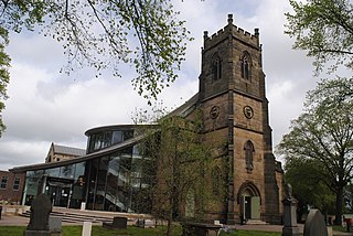
Kings Norton, alternatively King's Norton, is an area of Birmingham, England. Historically in Worcestershire, it was also a Birmingham City Council ward within the Government of Birmingham, England. The district lies 6.5 miles south-southwest of Birmingham city centre and is within 1.5 miles of the north Worcestershire border. Kings Norton has been split into two wards, Kings Norton North and Kings Norton South.

<span class="mw-page-title-main">Erdington</span> Suburb of Birmingham, England

Erdington is a suburb and ward of Birmingham in the West Midlands County, England. Historically part of Warwickshire, it is located 5 miles (8 km) northeast of central Birmingham, bordering Sutton Coldfield. It was also a council constituency, managed by its own district committee. The former council district consisted of the ward of Erdington as well as Tyburn, Stockland Green and Kingstanding, although all of Kingstanding and most of both Tyburn and Stockland Green wards lie outside the historical boundaries of Erdington. Stockland Green was formerly part of Aston, Kingstanding part of Perry Barr, and Tyburn partially split between Aston and Hodge Hill. Erdington (ward) was part of the Sutton Coldfield constituency before 1974.

Ladywood is an inner-city district next to central Birmingham. Historically in Warwickshire, in June 2004, Birmingham City Council conducted a citywide "Ward Boundary Revision" to round-up the 39 Birmingham wards to 40. As a result of this, Ladywood Ward's boundaries were expanded to include the neighbouring areas of Hockley, Lee Bank and Birmingham city centre.

<span class="mw-page-title-main">Government of Birmingham</span>

Birmingham, a city and metropolitan borough in the West Midlands, England, is the second-largest city in the United Kingdom.

<span class="mw-page-title-main">Quinton, Birmingham</span> Suburb and ward in England

Quinton is a suburb and ward of Birmingham, England, 5 miles (8 km) west of the city centre. Formerly part of Halesowen parish, Quinton became part of Birmingham in 1909. Quinton was a village and the surrounding area was farmland until the 1930s when the first housing estates were developed. Most of the farmland had been built on by 1980 but some countryside remains in the form of Woodgate Valley Country Park. Along with Bartley Green, Harborne and Edgbaston, Quinton is within the Birmingham Edgbaston constituency.

<span class="mw-page-title-main">Birmingham Edgbaston (UK Parliament constituency)</span> Parliamentary constituency in the United Kingdom, 1885 onwards

Birmingham Edgbaston is a constituency, represented in the House of Commons of the UK Parliament since 2017 by Preet Gill, a Labour Co-op MP.

<span class="mw-page-title-main">Birmingham Ladywood (UK Parliament constituency)</span> Parliamentary constituency in the United Kingdom, 1918 onwards

Birmingham Ladywood is a constituency in the city of Birmingham that was created in 1918. The seat has been represented in the House of Commons of the Parliament of the United Kingdom by Shabana Mahmood of the Labour Party since 2010. Mahmood currently serves as Lord Chancellor and Secretary of State for Justice under the government of Keir Starmer.

<span class="mw-page-title-main">Lee Bank</span>

Lee Bank was an inner city area of Birmingham, England. It was part of the Edgbaston and Ladywood wards, inside the Middle Ring Road or Middleway, which surrounds Central Birmingham.

Birmingham Central is a former parliamentary constituency in the city of Birmingham, England. It returned one Member of Parliament (MP) to the House of Commons of the Parliament of the United Kingdom, elected by the first-past-the-post voting system.

Birmingham Small Heath was a parliamentary constituency centred on the Small Heath area of Birmingham. It returned one Member of Parliament (MP) to the House of Commons of the Parliament of the United Kingdom.

Birmingham All Saints was a parliamentary constituency in the city of Birmingham, which returned one Member of Parliament (MP) to the House of Commons of the Parliament of the United Kingdom. Elections were held using the first-past-the-post voting system.

<span class="mw-page-title-main">Albert Bore</span> British physicist and politician (born 1946)

Sir Albert Bore is a British nuclear physicist, academic and Labour Party politician.

<span class="mw-page-title-main">Edgbaston (ward)</span> Ward in England

Edgbaston ward is a local government district, one of 40 wards that make up Birmingham City Council. Edgbaston lies to the south west of Birmingham city centre and is home to the University of Birmingham and the Queen Elizabeth hospital. The ward population at the 2011 census was 24,426.

<span class="mw-page-title-main">First Periodic Review of Westminster constituencies</span> 1950s review of UK electoral boundaries

The First Periodic Review of Westminster constituencies was a review of constituency boundaries for the Westminster Parliament in the United Kingdom carried out by the Boundary Commissions created by the House of Commons Act 1949. The Commissions reported in 1954 and their recommendations took effect for the 1955 general election. Legal action over the procedure for such reviews resulted in the passage of the House of Commons Act 1958.

Balsall Heath West is an electoral ward of Birmingham City Council in the south of Birmingham, West Midlands, covering an urban area to the south of the city centre.

<span class="mw-page-title-main">Birmingham Market Hall</span> Market hall in Birmingham, United Kingdom

Birmingham Market Hall was a municipal market hall in the Bull Ring area of Birmingham, England, from 1835 until 1940, when the interior and roof were destroyed by wartime bombing; although the shell of the building remained in use until final demolition in the 1960s.

References

  1. "The Boundary Commission". The Times. No. 31347. 19 January 1885. p. 10.