The River Wharfe is a river in Yorkshire, England. For much of its length it is the county boundary between West Yorkshire and North Yorkshire.

Walkley is an electoral ward in Sheffield, South Yorkshire, England.

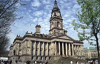
Bolton West is a constituency represented in the House of Commons of the UK Parliament since 2015 by Chris Green of the Conservative Party.

Barnsdale, or Barnsdale Forest, is an area of South Yorkshire, England. The area falls within the Whitley Ward of the Wakefield Metropolitan Council. Barnsdale is historically part of the West Riding of Yorkshire. Barnsdale lies in the immediate vicinity north and north-west of Doncaster, and which was formerly forested and a place of royal hunts, and also renowned as a haunt of the outlaw Robin Hood in early ballads.

Heaton Chapel railway station serves the Heaton Chapel and Heaton Moor districts of Stockport, Greater Manchester, England.

Blackrod is a settlement and civil parish of the Metropolitan Borough of Bolton, in Greater Manchester, England. It is 3.9 miles (6.3 km) north-northeast of Wigan and 6.6 miles (10.6 km) west of Bolton. According to the United Kingdom Census 2001, Blackrod had a population of 5,300, but reduced to 5,001 at the United Kingdom Census 2011.
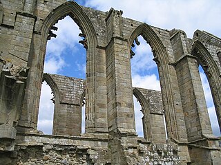
Bolton Abbey is a village and civil parish in the Craven district of North Yorkshire, England, 22 miles (35 km) north-west of Leeds. The village lies in Wharfedale, near the southern edge of the Yorkshire Dales National Park, and just north of the border with West Yorkshire.
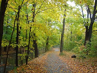
Markland Wood is a residential neighbourhood in Toronto, Ontario, Canada. It is located west of the central core, in the former suburb of Etobicoke. It is bounded by Etobicoke Creek to the west, Elmcrest Creek to the east and surrounded by the Markland Wood Country Club. Markland Wood is the western-most residential community in Toronto along Bloor Street West, which cuts Markland Wood into approximately 1/3 to the south and 2/3 to the north. Markland Wood is part of the Etobicoke Centre riding for federal and provincial governments and Ward 3 for the municipal council.

Lostock is a mostly residential district of Bolton in Greater Manchester, England. It lies 3.5 miles (5.6 km) west of Bolton town centre and 18.1 miles (29.1 km) northwest of Manchester. Historically part of Lancashire, Lostock is bounded by Deane to the southeast, Markland Hill to the northeast and the Middlebrook development, including Bolton Wanderers' football ground, the University of Bolton Stadium in nearby Horwich. Lostock, alongside Heaton and Edgworth, is known for being one of the most expensive places to live in Bolton.
Doffcocker is a mostly residential district of Bolton, Greater Manchester, lying about 3½ miles from the town centre on the northwest edge of the suburbs on the lower south facing slopes of the West Pennine Moors. Historically within Lancashire, it is bounded by Markland Hill and Heaton to the south and Halliwell to the east.

Halliwell is predominantly a residential area of Bolton, Greater Manchester, England. It gives its name to an electoral ward of the wider Metropolitan Borough of Bolton. The population of this ward taken at the 2011 census was 13,929. Halliwell lies about 2 miles (3.2 km) to the north west of Bolton town centre and is bounded by Tonge Moor to the east and Heaton to the south west. Smithills Hall to the north is within the ancient township. It lies on the lower south facing slopes of the West Pennine Moors.
Heaton is a mostly residential district and council ward of Bolton, Greater Manchester, England. It lies about two miles north west of Bolton town centre. It is bounded by Deane to the south, Markland Hill to the west and Smithills and Halliwell to the north.

The A671 is a road in the North West of England, that runs between Oldham, Greater Manchester and Worston, near Clitheroe, Lancashire. Major towns on the route include Rochdale and Burnley. The road is approximately 35 miles (56 km) long. Between Burnley and the A59, the A671 has primary status.

Blue Bus was a large independent bus company serving Greater Manchester, Lancashire and Merseyside.

The geography of Greater Manchester is dominated by one of the United Kingdom's largest metropolitan areas, and in this capacity the landlocked metropolitan county constitutes one of the most urbanised and densely populated areas of the country. There is a mix of high density urban areas, suburbs, semi-rural and rural locations in Greater Manchester, but overwhelmingly the land use in the county is urban.

The Lancashire County Rugby Football Union is the society responsible for rugby union in the county of Lancashire, England and is one of the constituent bodies of the national Rugby Football Union having been formed in 1881. In addition it is the county that has won the county championship on most occasions.
Lostock Junction Mills were a pair of cotton spinning mills in Lostock, Bolton, England which stood on a narrow stretch of land between Heaton Road and the Middlebrook but have since been demolished.

Smithills is a mainly residential suburb of Bolton in Greater Manchester, England. It is 3.1 miles (5 km) northwest of Bolton, 14.5 miles (23 km) south of Blackburn and 17.9 miles (29 km) northwest of Manchester. Smithills lies on the lower south facing slopes of the West Pennine Moors.