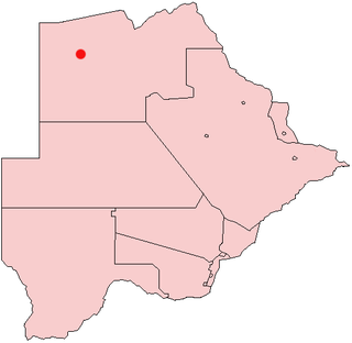
Botswana, officially the Republic of Botswana ; is a landlocked country in Southern Africa. Botswana is topographically flat, with up to 70 percent of its territory being the Kalahari Desert. It is bordered by South Africa to the south and southeast, Namibia to the west and north, and Zimbabwe to the north-east. It is connected to Zambia across the short Zambezi River border by the Kazungula Bridge.
Telecommunications in Botswana include newspapers, radio, television, fixed and mobile telephones, and the Internet.

Gumare or Gomare is a rural village located in the North-West District of Botswana, near the Okavango Delta. The population of Gumare was 6,067 in 2001 census, but had risen to 8,532 iby the 2011 census.
Mahalapye is a town located in the Central District of Botswana. The town has about 41,000 inhabitants and is situated along the main road between the capital Gaborone and the second largest city Francistown. Mahalapye has a bus station, a railway station, a couple of hotels and a market area with many shops and fast food restaurants, Water Shed mall is the latest attraction to those travelling from Gaborone to Francistown, great place for refreshments. It also has several petrol stations, some open 24 hours per day. Being situated on the edge of the Kalahari desert it is quite dry, and the local waterways are dry except during the rainy season. In recent times, it has become a convenient stop-over town for travelers travelling to and from Gaborone.
Mogoditshane is a town located in the Kweneng District of Botswana.

Thamaga is a large village located in the Kweneng District of Botswana and about 40 km west of the capital city Gaborone. It is home to 19,547 inhabitants at the 2011 census. It is becoming year by year like a suburb part of the Gaborone agglomeration.
Tlokweng is a peri-urban settlement classified as an urban village located east of the capital of Botswana, Gaborone and falling under the jurisdiction of South East District Council. It can be considered part of the conurbation of Gaborone. Tlokweng stands on the other side of the river, and is on the road to the border with South Africa, the border post being just 15 km to the east. The population was 35,982 at the 2011 census. It is now part of Gaborone agglomeration, home to 421,907 inhabitants at the 2011 census. The tribe originating from Tlokweng is referred to as Batlokwa. Many people from across Botswana have come to seek permanent and sometimes temporary settlement in Tlokweng because of its proximity to the capital city where most jobs are.
The Botswana Fed Cup team represents Botswana in Fed Cup tennis competition and are governed by the Botswana Tennis Association. They have not competed since 2006.
Gabane is a village in Kweneng District of Botswana. It is located 15 km (10 mi) west of Gaborone, the capital of Botswana. The population was 10,399 in 2001 census, making it the fourth largest settlement in Kweneng. Its population was 14,842 at the 2011 census. It's now part of Gaborone agglomeration home to 421,907 inhabitants at the 2011 census.
Mmopane is a village in the Kweneng District of Botswana. The village is located around 15 km from Gaborone, the capital of Botswana. The population was 3,512 in 2001 census and 14,655 at the 2011 census. It's now part of Gaborone agglomeration home to 421,907 inhabitants at the 2011 census.
Kopong is a small village in Kweneng District of Botswana. It is located around 25 km north of Gaborone, the capital of Botswana. The population was 5,571 in 2001 census and 9,520 at the 2011 census, making it the sixth largest settlement in Kweneng. It is now becoming a suburb of Gaborone agglomeration home to 421,907 inhabitants at the 2011 census.

Nijel Carlos Amilfitano Amos is a Botswanan middle-distance runner who competes in the 800 metres. He won silver at the 2012 Summer Olympics, which was Botswana's first ever Olympic medal.
Lotlhakane is a large village located in the Southern District of Botswana. It had 4,828 inhabitants at the 2011 census.
Maitengwe is a large village located in the Central District of Botswana. It had 5,890 inhabitants at the 2011 census. It is one of many developing villages in the country and best known for its festive celebrations.
Tati Siding is a village located in the North-East District of Botswana. It had 8,112 inhabitants at the 2011 census.
Ranaka is a village located in the Southern District of Botswana. It had 3,089 inhabitants at the 2012 census.
Manyana is a village located in the Southern District of Botswana. It had 3,550 inhabitants at the 2011 census.
Mmathethe is a village located in the Southern District of Botswana. It had 5,078 inhabitants at the 2011 census.
Sefhare is a Botswana village located in the Central district. According to the 2011 census, the village has 5295 inhabitants.
Tapiwa Marobela is a former Botswana female tennis player.


