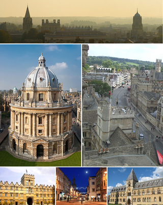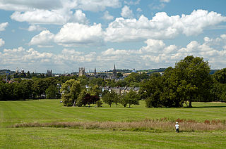
Oxford is a city in England. It is the county town and only city of Oxfordshire. In 2020, its population was estimated at 151,584. It is 56 miles (90 km) north-west of London, 64 miles (103 km) south-east of Birmingham and 61 miles (98 km) north-east of Bristol. The city is home to the University of Oxford, the oldest university in the English-speaking world; it has buildings in every style of English architecture since late Anglo-Saxon. Oxford's industries include motor manufacturing, education, publishing, information technology and science.

Oxfordshire is a historic, ceremonial and non-metropolitan county in South East England. It is a mainly rural county, with its largest settlement being the city of Oxford. The county is a centre of research and development, primarily due to the work of the University of Oxford. Oxfordshire is locally governed by Oxfordshire County Council, together with the lower tier councils of its five non-metropolitan districts: City of Oxford, Cherwell, South Oxfordshire, Vale of White Horse, and West Oxfordshire. The ceremonial county is landlocked and bordered by Northamptonshire to the north-east, Warwickshire to the north-west, Buckinghamshire to the east, Berkshire to the south, Wiltshire to the south-west, and Gloucestershire to the west. The areas of Oxfordshire south of the River Thames were part of the historic county of Berkshire, including the county's highest point, the 261-metre (856 ft) White Horse Hill.

Banbury is a historic market town on the River Cherwell in Oxfordshire, South East England. It had a population of 54,335 at the 2021 Census.

Bicester is a historical market town, garden town, and civil parish in the Cherwell district of northeastern Oxfordshire in Southern England that also comprises an eco town at North-East Bicester and self-build village at Graven Hill. Its local market continues to thrive and is now located on Sheep Street, a very wide pedestrian zone in the conservation area of the town. Bicester is also known for Bicester Village, a nearby shopping centre selling discounted branded clothing.

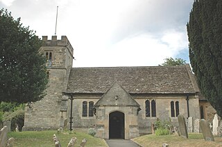
Marston is a village in the civil parish of Old Marston about 2 miles (3 km) northeast of the centre of Oxford, England. It was absorbed within the city boundaries in 1991. It is commonly called Old Marston to distinguish it from the suburb of New Marston that developed between St. Clement's and the village in the 19th and 20th centuries. The A40 Northern Bypass, part of the Oxford Ring Road forms a long north-west boundary of the village and parish and a limb, namely a distributary, of the Cherwell forms the western boundary.

The River Cherwell is a tributary of the River Thames in central England. It rises near Hellidon, Northamptonshire and flows southwards for 40 miles (64 km) to meet the Thames at Oxford in Oxfordshire.

Kidlington is a major village and civil parish in Oxfordshire, England, between the River Cherwell and the Oxford Canal, 5 miles (8 km) north of Oxford and 71⁄2 miles (12 km) south-west of Bicester. It remains officially a village despite its size. The 2011 census put the parish population at 13,723.

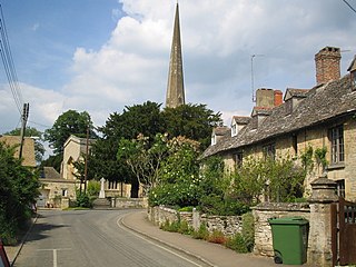
Steeple Aston is a village and civil parish on the edge of the Cherwell Valley, in the Cherwell District of Oxfordshire, England, about 12 miles (19 km) north of Oxford, 7 miles (11 km) west of Bicester, and 10 miles (16 km) south of Banbury. The 2011 Census recorded the parish population as 947. The village is 108 metres (354 ft) above sea level. The River Cherwell and Oxford Canal pass 1 mile (2 km) east of the village. The river forms part of the eastern boundary of the parish. The parish's southern boundary, 1⁄2 mile (800 m) south of the village, also forms part of Cherwell District's boundary with West Oxfordshire.

Lower Heyford is a village and civil parish beside the River Cherwell in Oxfordshire, about 6 miles (10 km) west of Bicester. The 2011 Census recorded the parish's population as 492.

North Oxford is a suburban part of the city of Oxford in England. It was owned for many centuries largely by St John's College, Oxford and many of the area's Victorian houses were initially sold on leasehold by the College.

New Marston is a suburb about 1.25 miles (2 km) northeast of the centre of Oxford, England.

St Clement's is a district in Oxford, England, on the east bank of the River Cherwell. "St Clement's" is usually taken to describe a small triangular area from The Plain bounded by the Cherwell in the West, Cowley Road in the East. to the foot of Headington Hill in the South. It also refers to the ecclesiastical parish of St Clement's which includes some neighbouring areas and is used in the names of local City and County electoral districts.

Marston Road is a road in the east of Oxford, England. It links London Place, the junction of St Clements, the foot of Headington Hill, and Morrell Avenue by South Park to the south with the suburb of New Marston to the north. A mini-roundabout has been replaced by traffic lights and connects with Cherwell Drive and Headley Way at the northern end. To the north is the suburb of Northway. The road is designated the B4150 but this is not shown on signs.

Headington Road is an arterial road in the east of Oxford, England. The road connects the junction of St Clements and Marston Road with the suburb of Headington, up Headington Hill. When it reaches the Headley Way junction, it becomes London Road, as the Boundary Brook runs under the road at this point.
The Oxford Ring Road circles the city of Oxford, England. It is a dual carriageway ring road for most of its length apart from a short section between Woodstock Road and Banbury Road in the north of the city. The severe restrictions on traffic in Oxford city centre mean that it is the only practical way for long-distance traffic to get past Oxford, especially as there are few road bridges over the rivers Isis and Cherwell. Five Park and Rides are close to the ring road.

The Cherwell Boathouse is a boathouse and restaurant on the River Cherwell in Oxford, England. It is located down a small lane off the junction between Chadlington Road and Bardwell Road, which itself is off the Banbury Road in North Oxford.

Milham Ford School was a girls' secondary school in Oxford, England, located in the suburb of New Marston on Marston Road. It was founded in East Oxford in the 1880s and closed in 2003.

The Victoria Arms is a pub on the eastern bank of the River Cherwell at the end of Mill Lane close to Old Marston, northeast of Oxford, England.
The Swan School is a coeducational secondary school and sixth form located in Marston, Oxford. The school opened in September 2019 and was Oxford's first new secondary school in more than 50 years. The Swan is part of the River Learning Trust which also includes nearby Cherwell School.


