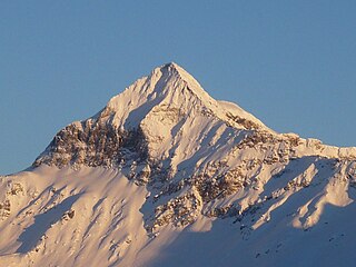
Pizzo Gallina is a 3,061-metre-high (10,043 ft) mountain in the Lepontine Alps of Switzerland, overlooking the Nufenen Pass.

Pizzo di Cassimoi is a mountain of the Lepontine Alps, located on the border between the Swiss cantons of Ticino (west) and Graubünden (east). The mountain overlooks two lakes: Lago di Luzzone on its north-eastern side and Zervreilasee on its north-eastern side.

The Spechhorn is a mountain of the Pennine Alps, located on the border between Italy and Switzerland. On its northern side (Valais) it overlooks the lake of Mattmark.

The Wandfluhhorn is a mountain of the Lepontine Alps, located on the border between Switzerland and Italy. It overlooks Bosco/Gurin on its (Swiss) eastern side and Formazza on its (Italian) western side. Reaching a height of 2,863 metres above sea level, the Wandfluhhorn is the highest summit of the Bosco/Gurin valley.

Pizzo Barone is a mountain of the Lepontine Alps in Switzerland. It is located south of Pizzo Campo Tencia and is the highest summit of the Valle Verzasca in the canton of Ticino. From Sonogno a trail leads to the summit.

Pizzo di Claro is a 2,727 metres high mountain of the Lepontine Alps, located on the border between the Swiss cantons of Ticino and Graubünden. It overlooks Claro on its western side, although Cresciano is closer. On its eastern side it overlooks the valley of Calanca near Arvigo (Graubünden). A small lake lies west of the summit at 2,198 metres, Lago Canee.

Piz Timun is a mountain of the Oberhalbstein Range, located on the border between Italy and Switzerland. On its eastern side it overlooks the artificial lake Lago di Lei.
Pizzo Quadro is a mountain of the Lepontine Alps on the Swiss-Italian border. With an elevation of 2,793 metres above sea level, it is the highest summit of the range lying south of the Wandfluhhorn and the Guriner Furggu. Pizzo Quadro is located between the localities of San Rocco di Prèmia (Piedmont) and Campo (Ticino).
Pizzo di Porcaresc is a mountain of the Lepontine Alps, located on the border between Switzerland and Italy. Its summit is the tripoint between the Valle dell'Isorno, the Valle di Campo and the Valle di Vergeletto.
Pizzo di Madéi is a mountain of the Lepontine Alps, located on the border between Switzerland and Italy. It lies between the valleys of Vergeletto (Ticino), Isorno and Onsernone (Piedmont).

Pizzo Forno is a mountain of the Swiss Lepontine Alps, overlooking Chironico in the canton of Ticino. It is to be found between Piumogna Valley, Chironico Valley and Leventina Valley. It is in pyramid form and is separate from Pizzo Campo Tencia in the east. It is visible from the municipalities of Faido, Giornico and Chironico. The north-east face is particularly striking which rises nearly 1,500 metres from the Piumogna Valley - this face is best viewed from the village of Gribbio.
Pizzo Marumo is a mountain of the Lepontine Alps, overlooking the Greina Pass in Switzerland. It is located in the canton of Ticino, near the border with the canton of Graubünden.

Pizzo di Gino is a mountain of Lombardy, Italy. With an elevation of 2,245 m it is the highest peak of the Lugano Prealps.

Pizzo Scalino is a mountain of the Bernina Range in Lombardy, Italy. It is known as the Valemalenco Matterhorn due to its pyramidal shape when viewed from the valley below. It lies close to Piz Cancian, where the border with Switzerland runs. The mountain is usually climbed from the Campo Moro Dam. From the summit, the whole of the Bernina Range is visible. It was first climbed in 1830.

Pizzo Stella or Pizzo Sterla is a mountain of Lombardy, Italy, located north of Chiavenna. On its northern side it overlooks the Valle di Lei and the lake Lago di Lei.

Tambohorn or Pizzo Tambo[ˈpittso ˈtambo] or Pizzo Tambò[ˈpittso tamˈbɔ] is a mountain located at the eastern extremity of the Lepontine Alps on the Swiss-Italian border. The mountain lies on the German-Italian language border, west of the Splügen Pass which divides the Western Alps from the Eastern Alps.

Pizzo Paglia is a mountain of the Lepontine Alps, overlooking the Val Cama in the canton of Graubünden. The border with Italy runs 300 metres south of the summit.

Pizzo Bianco is a mountain of the Pennine Alps, overlooking Macugnaga in the Italian region of Piedmont. It lies on the range north of the Punta Grober, between the Belvedere Glacier and the valley of Quarazza.

Pizzo di Campel is a mountain of the Lepontine Alps, located south-east of Soazza in the canton of Graubünden. It lies on the range between the Val de la Forcola and the Val de Montogn.
Pizzo Nero is a mountain of the Lepontine Alps, located on the border between the Swiss cantons of Valais and Ticino. Its summit is the tripoint between the valleys of Geretal, Gonerli and Bedretto.


