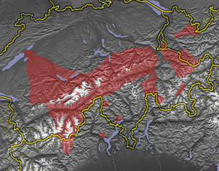
The Alpine region of Switzerland, conventionally referred to as the Swiss Alps, represents a major natural feature of the country and is, along with the Swiss Plateau and the Swiss portion of the Jura Mountains, one of its three main physiographic regions. The Swiss Alps extend over both the Western Alps and the Eastern Alps, encompassing an area sometimes called Central Alps. While the northern ranges from the Bernese Alps to the Appenzell Alps are entirely in Switzerland, the southern ranges from the Mont Blanc massif to the Bernina massif are shared with other countries such as France, Italy, Austria and Liechtenstein.

Ticino, sometimes Tessin, officially the Republic and Canton of Ticino or less formally the Canton of Ticino, is one of the 26 cantons forming the Swiss Confederation. It is composed of eight districts and its capital city is Bellinzona. It is also traditionally divided into the Sopraceneri and the Sottoceneri, respectively north and south of Monte Ceneri. Red and blue are the colours of its flag.

Valle Maggia is an alpine valley in the Vallemaggia district of canton of Ticino, the Italian-spoken canton of Switzerland. The valley is formed by the river Maggia and is situated between the Centovalli and Lago Maggiore as well as the Valle Verzasca in the East.

There are 108 municipalities in the canton of Ticino, Switzerland,. Municipalities (comuni) are grouped in circles (circoli) which are part of districts (distretti).

Walser German and Walliser German are a group of Highest Alemannic dialects spoken in parts of Switzerland, Italy, Liechtenstein, and Austria (Vorarlberg).

The Walser people are the speakers of the Walser German dialects, a variety of Highest Alemannic. They inhabit the region of the Alps of Switzerland and Liechtenstein, as well as the fringes of Italy and Austria. The Walser people are named after the Wallis (Valais), the uppermost Rhône valley, where they settled from roughly the 10th century in the late phase of the migration of the Alamanni, crossing from the Bernese Oberland; because of linguistic differences among the Walser dialects, it is supposed that there were two independent immigration routes.

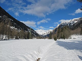
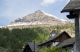
Bosco/Gurin is a municipality in the district of Vallemaggia in the canton of Ticino in Switzerland. The village is near the end of the valley of Bosco Gurin, near the Italian border. Despite the overall prominence of Italian in Ticino, the small municipality of Bosco/Gurin is historically German-speaking.

Avers is a high Alpine valley region and a municipality in the Viamala Region in the Swiss canton of Graubünden. It includes Juf, the highest-altitude year-round settlement in Europe.

Formazza is a comune (municipality) in the Province of Verbano-Cusio-Ossola in the Italian region Piedmont, located about 160 kilometres (99 mi) northeast of Turin and about 50 kilometres (31 mi) north of Verbania, on the border with Switzerland.

Premia is a comune (municipality) in the Province of Verbano-Cusio-Ossola in the Italian region Piedmont, located about 140 kilometres (87 mi) northeast of Turin and about 40 kilometres (25 mi) northwest of Verbania, on the border with Switzerland. As of 31 December 2004, it had a population of 607 and an area of 88.7 square kilometres (34.2 sq mi).

The Martschenspitz is a mountain of the Lepontine Alps on the border between Switzerland and Italy. On its southern side it overlooks the pass Guriner Furggu. The closest locality is Bosco/Gurin in Ticino. Its summit is 2688m high, and is popular with mountain climbers.
Pizzo Quadro is a mountain of the Lepontine Alps on the Swiss-Italian border. With an elevation of 2,793 metres above sea level, it is the highest summit of the range lying south of the Wandfluhhorn and the Guriner Furggu. Pizzo Quadro is located between the localities of San Rocco di Prèmia (Piedmont) and Campo (Ticino).
Pizzo d'Orsalia is a mountain of the Swiss Lepontine Alps, overlooking Bosco/Gurin in the canton of Ticino. It lies on the chain that separates the Val Calnègia from the Valle di Bosco/Gurin.
Pizzo d'Orsalietta is a mountain of the Swiss Lepontine Alps, located west of Cevio in the canton of Ticino. It lies between the valleys of Bavona and Bosco/Gurin.
Pizzo Bombögn is a mountain of the Swiss Lepontine Alps, located between Bosco/Gurin and Campo (Vallemaggia) in the canton of Ticino. It lies on the chain east of Pizzo Quadro.
The Madonino is a mountain of the Swiss Lepontine Alps, located west of Cevio in the canton of Ticino. It lies between the valleys of Bavona and Bosco/Gurin.
Istituto Elvetico Salesiani Don Bosco is an Italian international school, in Lugano, Switzerland. It serves elementary school through liceo.

The Museum Walserhaus Gurin is located in the characteristic Walser village of Bosco/Gurin and is the oldest ethnographic museum in the Canton of Ticino. It is managed by the Walserhaus Gurin Association.


