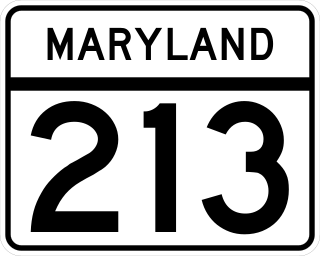
Maryland Route 213 (MD 213) is a 68.25-mile (109.84 km) state highway located on the Eastern Shore of Maryland in the United States. The route runs from MD 662 in Wye Mills, Queen Anne's County, north to the Pennsylvania border in Cecil County, where the road continues into that state as Pennsylvania Route 841 (PA 841). The route, which is a two-lane undivided highway most of its length, passes through mainly rural areas as well as the towns of Centreville, Chestertown, Galena, Cecilton, Chesapeake City, and Elkton. MD 213 intersects many routes including U.S. Route 50 (US 50) near Wye Mills, US 301 near Centreville, and US 40 in Elkton. It crosses over the Chesapeake & Delaware Canal in Chesapeake City on the Chesapeake City Bridge. MD 213 is designated by the state as the Chesapeake Country Scenic Byway between the southern terminus and Chesapeake City with the portion north of MD 18 in Centreville a National Scenic Byway. In addition, the route is also considered part of the Atlantic to Appalachians Scenic Byway between Chesapeake City and MD 273 in Fair Hill.

Maryland Route 528 is a state highway in the U.S. state of Maryland. Known for most of its length as Coastal Highway, the state highway runs 9.04 miles (14.55 km) from the southern terminus of its companion route, unsigned Maryland Route 378, in downtown Ocean City north to the Delaware state line at the northern edge of the resort town, where the highway continues as Delaware Route 1. MD 528 and MD 378 are the primary north–south streets of Ocean City, where they provide access to countless hotels, condos, restaurants, shops, and other businesses catering to tourists. These highways experience heavy seasonal traffic and provide access to hurricane evacuation routes, which include U.S. Route 50, MD 90, and DE 54. Both Baltimore Avenue and Philadelphia Avenue date back to the founding of Ocean City in the late 19th century. MD 378 was assigned to Baltimore Avenue in 1927 and MD 528 was assigned to Philadelphia Avenue in 1933. MD 528 was extended north of 15th Street to the Delaware state line in 1939. Both highways were rebuilt and widened in the 1950s. MD 528 was expanded to a six-lane divided highway north of the one-way pair in the late 1980s.

Maryland Route 90 is a state highway in the U.S. state of Maryland. Known as the Ocean City Expressway, the state highway runs 11.83 miles (19.04 km) from U.S. Route 50 near Whaleyville east to MD 528 in Ocean City. MD 90 is a two-lane expressway that provides one of the main access routes to Ocean City, especially the northern part of the resort town, and thus sees heavy seasonal traffic. The highway was constructed from Ocean City starting in 1970. The state highway was opened west to MD 589 in 1972 and to US 113 in 1975. MD 90 was completed west to US 50 in 1976.
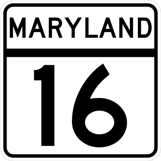
Maryland Route 16 (MD 16) is a state highway in the U.S. state of Maryland. The state highway runs 51.06 miles (82.17 km) from Taylors Island east to the Delaware state line in Hickman, where the highway continues as Delaware Route 16 (DE 16). MD 16 connects Cambridge with several communities in northern Dorchester County and southwestern Caroline County, including East New Market and Preston. The state highway runs concurrently with U.S. Route 50 (US 50) near Cambridge, MD 331 between East New Market and Preston, and both MD 404 and MD 313 near Andersontown. MD 16 was constructed between Church Creek and Preston as one of the original state roads in the early and mid-1910s. The highway was extended in both directions in the late 1910s: north to what was to be designated MD 313 near Denton and west to Taylors Island. MD 16 was extended through Andersontown to the Delaware state line in the early 1930s. MD 16's bypass of Cambridge was constructed in the mid-1960s.

U.S. Route 50 is a major east–west route of the U.S. Highway system, stretching just over 3,000 miles (4,800 km) from West Sacramento, California, east to Ocean City, Maryland, on the Atlantic Ocean. In the U.S. state of Maryland, US 50 exists in two sections. The longer of these serves as a major route connecting Washington, D.C., with Ocean City; the latter is the eastern terminus of the highway. The other section passes through the southern end of Garrett County for less than 10 miles (16 km) as part of the Northwestern Turnpike, entering West Virginia at both ends. One notable section of US 50 is the dual-span Chesapeake Bay Bridge across the Chesapeake Bay, which links the Baltimore–Washington metropolitan area with the Eastern Shore region, allowing motorists to reach Ocean City and the Delaware Beaches.

Maryland Route 611 is a state highway in the U.S. state of Maryland. Known as Stephen Decatur Highway, the state highway runs 8.51 miles (13.70 km) from Assateague Island north to U.S. Route 50 in West Ocean City. MD 611 is named for Stephen Decatur, the U.S. naval officer of the early 19th century who was born in nearby Berlin. The state highway provides access to Assateague State Park and Assateague Island National Seashore via the Verrazano Bridge named for Giovanni da Verrazzano. MD 611 was first paved in West Ocean City in the mid-1930s. The highway was extended south to MD 376 at Lewis Corner in the 1940s. A ferry crossed Sinepuxent Bay to Assateague Island from the southern end of the county highway that continued south from Lewis Corner until MD 611 was extended across the Verrazano Bridge in the mid-1960s.

U.S. Route 13 (US 13) is a United States Numbered Highway running from Fayetteville, North Carolina, north to Morrisville, Pennsylvania. In the U.S. state of Maryland, the route runs 42.48 miles (68.36 km) from the Virginia border south of Pocomoke City in Worcester County north to the Delaware border in Delmar, Wicomico County, where the route intersects Maryland Route 54 (MD 54)/Delaware Route 54 (DE 54), which runs along the state line. The majority of the route within Maryland is a four-lane divided highway that passes through rural areas of woodland and farmland. The route also runs through a few municipalities including Pocomoke City and Princess Anne and it bypasses Fruitland and Salisbury to the east on the Salisbury Bypass, which is a freeway. US 13 intersects many major roads including the southern terminus of US 113 in Pocomoke City, MD 413 in Westover, and MD 12 and US 50 where the route is on the Salisbury Bypass. The route shares a concurrency with US 50 along a portion of the Salisbury Bypass.

Maryland Route 610 is a state highway in the U.S. state of Maryland. Known for most of its length as Whaleyville Road, the state highway runs 6.53 miles (10.51 km) from the county-maintained portion of Dale Road near Whaleyville north to U.S. Route 113 near Bishop. The first segment of MD 610 was constructed near Whaleyville in the mid-1930s. The highway to Bishop was brought into the state highway system in the 1940s. MD 610, which did not originally reach US 50, was extended south to that highway, now MD 346, in 1955. The state highway reached its current southern terminus after the US 50 divided highway was constructed in the mid-1960s.
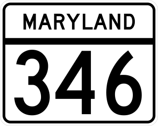
Maryland Route 346 (MD 346) is a state highway in the U.S. state of Maryland. The state highway runs 23.72 miles (38.17 km) from U.S. Route 50 Business (US 50 Business) in Salisbury east to US 50 in Berlin. MD 346 is the old alignment of US 50 between Salisbury and Berlin, connecting those cities with Parsonsburg, Pittsville, and Willards in eastern Wicomico County and Whaleyville in northern Worcester County. Much of what is now MD 346 was built as the original state road between Salisbury and Ocean City in the mid-1910s. The highway was designated US 213 in 1927 and changed to US 50 in 1949. MD 346 was first applied to Church Street in Salisbury in the 1940s; this designation was removed in 1954. MD 346 was reassigned in the mid-1960s to the old alignments of US 50 left behind after US 50's bypass of Berlin opened in the late 1950s and the US 50 divided highway was completed between Salisbury and Berlin in the mid-1960s.

Maryland Route 353 is a state highway in the U.S. state of Maryland. Known for most of its length as Gumboro Road, the state highway runs 5.08 miles (8.18 km) from U.S. Route 50 just south of Pittsville north to the Delaware state line, where the highway intersects Delaware Route 26 and DE-MD 54. MD 353 was constructed in the mid- to late 1920s. The route was extended south from MD 346 to US 50 in Pittsville in 2016.
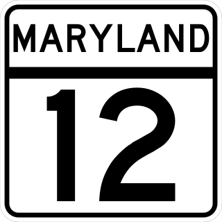
Maryland Route 12 is a state highway on the Eastern Shore in the U.S. state of Maryland. The route runs 30.57 mi (49.20 km) from the Virginia border south of Stockton, Worcester County, where it continues into Virginia as State Route 679, north to Main Street in the city of Salisbury in Wicomico County. The route is known as Snow Hill Road for most of its length and passes mostly through areas of woods and farms as well as the communities of Stockton, Girdletree, and Snow Hill. MD 12 intersects several roads including MD 366 in Stockton, U.S. Route 113 and US 113 Business in Snow Hill, MD 354 in Indiantown, and US 13 near Salisbury. Portions of MD 12 near Snow Hill and Stockton existed as unnumbered state roads by 1910. When the first state highways in Maryland were designated by 1927, MD 12 was assigned to run from Stockton north to Salisbury. By 1940, the route was extended south to the Virginia border and a small incomplete portion between Snow Hill and Salisbury was finished. A dumbbell interchange is planned at the US 113 intersection; however, this project is currently on hold.

Maryland Route 452 is a state highway in the U.S. state of Maryland. Known as Friendship Road, the state highway runs 1.64 miles (2.64 km) from U.S. Route 50 near Berlin north to MD 575 in Friendship in northern Worcester County. MD 452 was built as a cut-off between US 213 and US 113 in the early 1930s.

Maryland Route 589 is a state highway in the U.S. state of Maryland. Known as Racetrack Road, the state highway runs 4.65 miles (7.48 km) from U.S. Route 50 at Grays Corner north to US 113 and MD 575 in Showell. MD 589 provides access to the planned community of Ocean Pines and Ocean Downs, a harness racing venue with a casino. The first portion of the state highway was constructed through Showell in 1935. MD 589 was completed to US 50 in 1949 and 1950.

Maryland Route 575 is a state highway in the U.S. state of Maryland. Known as Worcester Highway, the state highway runs 2.70 miles (4.35 km) from U.S. Route 113 in Friendship north to MD 589 and US 113 in Showell. MD 575 is the old alignment of US 113 in northern Worcester County. The state highway was assigned in 2000 when US 113 was relocated as a four-lane divided highway through the area. As part of the overall project to expand US 113 to four lanes from Berlin to the Delaware state line, 14 unsigned auxiliary routes of MD 575 were designated on old alignments or service roads between 2002 and 2004.

Maryland Route 818 is a state highway in the U.S. state of Maryland. Known as Main Street, the state highway runs 2.62 miles (4.22 km) between two intersections with U.S. Route 113 on the north and south sides of Berlin in Worcester County. MD 818 is the original 1927 alignment of US 113 through Berlin. The state highway was designated shortly after US 113's bypass of Berlin was completed in the late 1950s.
Maryland Route 756 is a state highway in the U.S. state of Maryland. Known as Old Snow Hill Road, the state highway runs 1.17 miles (1.88 km) from U.S. Route 13 east to US 113 within Pocomoke City. MD 756 is the original alignment of US 113 in Pocomoke City. That original alignment was bypassed by what is now MD 359 in the mid-1930s.

Maryland Route 359 is a state highway in the U.S. state of Maryland. Known as Bypass Road, the state highway runs 1.09 miles (1.75 km) from a dead end adjacent to the junction of U.S. Route 13 and US 113 north to MD 756 within Pocomoke City. What is now MD 359 and unsigned MD 250A was part of a bypass of the center of Pocomoke City for the southernmost part of US 113 that was constructed in the mid-1930s. US 113 originally followed MD 756 to its southern terminus at what is now US 13 Business. The bypass was itself bypassed in the 1970s when US 113 was expanded to a four-lane divided highway to end at US 13.

The Harry W. Kelley Memorial Bridge is a bridge in the U.S. state of Maryland. It carries 4 lanes of U.S. Route 50, plus two sidewalks, across Sinepuxent Bay, connecting the downtown area of Ocean City, Maryland to the mainland of Worcester County, Maryland within West Ocean City, and is mere feet from the national eastern terminus of said route. It is one of four entrances to the resort town, and the southernmost of them all; the others are Maryland Route 90, Delaware Route 54, and Delaware Route 1. The bridge features a drawbridge span near the Ocean City end. The bridge is named for Harry W. Kelley, a former mayor of Ocean City.


