U.S. Route 140 was a U.S. highway connecting Gettysburg, Pennsylvania, to Baltimore, Maryland. The route was deleted from the system in 1979; today the road's route is followed by portions of Pennsylvania Route 97, Maryland Route 97, and Maryland Route 140.
Maryland Route 32 (MD 32) is a state highway in the U.S. state of Maryland. The road runs 51.79 miles (83.35 km) from Interstate 97 (I-97) and MD 3 in Millersville west and north to Washington Road in Westminster. The 30 mile four- to six-lane freeway portion of MD 32 is the Patuxent Freeway between I-97 and I-70 in West Friendship. The freeway passes through Odenton and Fort Meade, the site of Fort George G. Meade and the National Security Agency (NSA), in western Anne Arundel County and along the southern part of Columbia in Howard County. Via I-97, MD 32 connects those communities with U.S. Route 50 (US 50)/US 301 in Annapolis. MD 32 also intersects the four primary highways connecting Baltimore and Washington: the Baltimore–Washington Parkway, US 1, I-95, and US 29. MD 32's north–south section, Sykesville Road, connects West Friendship and Westminster by way of Sykesville and Eldersburg in southern Carroll County.
Maryland Route 97 (MD 97) is a state highway in the U.S. state of Maryland. The route runs 55.27 mi (88.95 km) from U.S. Route 29 (US 29) in Silver Spring, Montgomery County, north to the Pennsylvania border in Carroll County, where the road continues into that state as Pennsylvania Route 97 (PA 97). Throughout most of Montgomery County, MD 97 is known as Georgia Avenue, which continues south from the southern terminus along US 29 into Washington, D.C. It is a suburban four- to six-lane divided highway from Silver Spring north to Olney. From here, the route continues as a rural two-lane undivided road north through Brookeville and into Howard County. MD 97 continues through Carroll County where it passes through the county seat of Westminster. The route intersects many major roads, including Interstate 495 north of Silver Spring, MD 28 and MD 200 in Norbeck, I-70/US 40 near Cooksville, MD 26 in Dorsey Crossroads, and MD 27, MD 32, and MD 140 in the Westminster area.
Maryland Route 307 is a state highway in the U.S. state of Maryland. Known for most of its length as Williamsburg Road, the state highway runs 6.05 miles (9.74 km) from MD 331 in Hurlock north to the end of state maintenance at Charles Street a short distance east of the intersection with MD 313/MD 318 in Federalsburg. MD 307 was one of the first highways completed by the Maryland State Roads Commission when the Hurlock–Federalsburg Road was constructed in 1910. The highway was relocated between Williamsburg and Federalsburg in the 1960s.

Maryland Route 31 is a state highway in the U.S. state of Maryland. Known for most of its length as New Windsor Road, the state highway runs 16.95 miles (27.28 km) from MD 26 in Libertytown east to MD 140 in Westminster. MD 31 connects the county seats of Frederick and Westminster via Libertytown in eastern Frederick County and New Windsor in western Carroll County. MD 31 originally extended from Frederick to Manchester, using the paths of what are now MD 26 and MD 27. MD 26 assumed MD 31 west of Libertytown in 1933 and MD 27 took over MD 31's route north of Westminster in 1967. The Westminster–Manchester portion of the state highway was constructed as one of the original state roads in the early 1910s. The remainder of the highway was built in the early to mid-1920s. MD 31 was relocated north of Westminster in the late 1950s and south of Westminster in the mid-1960s. The bypassed sections of the state highway became parts of MD 852.

Maryland Route 140 is a 49-mile (79 km) state highway in the U.S. state of Maryland. The route runs from U.S. Route 1 and US 40 Truck in Baltimore northwest to the Pennsylvania border, where the road continues into that state as Pennsylvania Route 16. MD 140 passes through the northern part of central Maryland, connecting Baltimore, Pikesville, Reisterstown, Westminster, Taneytown, and Emmitsburg.
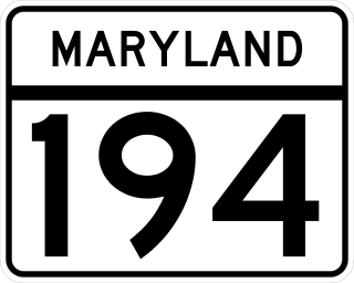
Maryland Route 194 (MD 194) is a state highway in the U.S. state of Maryland. The state highway runs 23.87 miles (38.42 km) from MD 26 in Ceresville north to the Pennsylvania state line near Taneytown, where the highway continues as Pennsylvania Route 194 (PA 194) toward Hanover. MD 194 is the main highway between Frederick and Hanover; the state highway connects the towns of Walkersville and Woodsboro in northeastern Frederick County with Keymar and Taneytown in northwestern Carroll County. MD 194 was blazed as a migration route in the 18th century and a pair of turnpikes in Frederick County in the 19th century, one of which was the last private toll road in Maryland. The state highway, which was originally designated MD 71, was built as a modern highway in Frederick County in the mid-1920s and constructed as Francis Scott Key Highway in Carroll County in the late 1920s and early 1930s. MD 194 received its modern route number in 1956 as part of a three-route number swap. The state highway's bypasses of Walkersville and Woodsboro opened in the early 1980s and mid-1990s, respectively.

Maryland Route 91 is a state highway in the U.S. state of Maryland. The state highway runs 7.86 miles (12.65 km) from MD 32 at Gamber north to MD 30 near Upperco. MD 91 connects southeastern Carroll County and the far western part of Baltimore County south of Hampstead with MD 140 at Finksburg. The state highway was paved at Finksburg in the early 1910s. The remainder of MD 91 was constructed in the mid- to late 1920s.

Maryland Route 30 is a state highway in the U.S. state of Maryland. Known for most of its length as Hanover Pike, the highway runs 19.16 miles (30.84 km) from MD 140 in Reisterstown north to the Pennsylvania state line near Melrose, where the highway continues as Pennsylvania Route 94. MD 30 is a major, two-lane regional highway in western Baltimore County and northeastern Carroll County. Locally, the highway serves the towns of Manchester and Hampstead; the latter town is bypassed by the highway but served by a business route. Regionally, MD 30 connects Reisterstown and Baltimore with Hanover, Pennsylvania.

U.S. Route 15 (US 15) is a part of the United States Numbered Highway System that runs from Walterboro, South Carolina, north to Painted Post, New York. In Maryland, the highway runs 37.85 miles (60.91 km) from the Virginia state line at the Potomac River in Point of Rocks north to the Pennsylvania state line near Emmitsburg. Known for most of its length as Catoctin Mountain Highway, US 15 is the primary north–south highway of Frederick County. The highway connects the county seat of Frederick with Point of Rocks, Leesburg, Virginia, and Charles Town, West Virginia, to the south and with Thurmont, Emmitsburg, and Gettysburg, Pennsylvania, to the north. US 15 is a four-lane divided highway throughout the state except for the portion between the Point of Rocks Bridge and the highway's junction with US 340 near Jefferson. The highway is a freeway along its concurrency with US 340 and through Frederick, where the highway meets US 40 and Interstate 70 (I-70). US 15 has a business route through Emmitsburg.

Maryland Route 318 is a state highway in the U.S. state of Maryland. The state highway runs 11.32 miles (18.22 km) from MD 16/MD 331 at Linchester east to the Delaware state line near Federalsburg, where the highway continues east as Delaware Route 18. MD 318 connects Federalsburg with Preston and Bridgeville, Delaware. The state highway follows the Dorchester–Caroline county line for most of its length between Linchester and Federalsburg. The county line road is considered to be in Caroline County for maintenance purposes. Further east, MD 318 runs concurrently with MD 313 to bypass Federalsburg. The portion of MD 318 west of Federalsburg was originally numbered Maryland Route 319 and assumed by MD 318 in the mid-1950s. The MD 319 section was constructed in the late 1910s near Federalsburg and completed west to MD 16/MD 331 in the late 1920s. MD 318 east of Federalsburg was built in the mid-1920s. MD 318 was placed on the bypass of Federalsburg in the early 1960s; its old alignment through Federalsburg became MD 315.
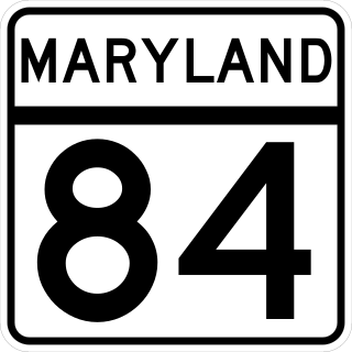
Maryland Route 84 is a state highway in the U.S. state of Maryland. The state highway runs 5.75 miles (9.25 km) from MD 75 near New Windsor north to MD 832 near Frizzelburg. MD 84 provides access to Uniontown and forms part of the connection between New Windsor and Taneytown in western Carroll County. The state highway was constructed from New Windsor to Uniontown in the mid-1920s. The northernmost portion of the highway was constructed in the late 1930s as MD 630, which became a disjoint part of MD 84 in 1951. The gap in MD 84 north of Uniontown was filled in 1956.

Maryland Route 806 is a state highway in the U.S. state of Maryland. The state highway runs a total of 4.05 miles (6.52 km) in two segments from U.S. Route 15 near Catoctin Furnace north to Roddy Creek Road near Thurmont. MD 806A, which has a length of 3.04 miles (4.89 km) from Catoctin Furnace to Thurmont, and MD 806R, which extends 0.55 miles (0.89 km) on the north side of Thurmont, are separated by a section of municipally-maintained road on the south side of Thurmont and a segment of MD 550 north of MD 77. MD 806 is the old alignment of US 15 through Catoctin Furnace and Thurmont. The state highway was originally constructed in the 1910s. MD 806 was assigned to the highway when US 15 bypassed Thurmont in the late 1950s. The state highway became a split route in the late 1980s. There have been several other segments of MD 806 along former sections of US 15 in Frederick County, including portions around Lewistown and south of Frederick.
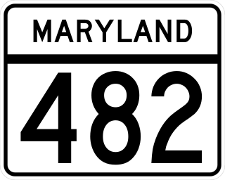
Maryland Route 482 is a state highway in the U.S. state of Maryland. Known as Hampstead Mexico Road, the state highway runs 5.45 miles (8.77 km) from MD 27 in Mexico east to MD 30 Business in Hampstead. In conjunction with MD 27, MD 482 connects Westminster with Hampstead. The state highway was constructed at both ends in the early 1930s; the middle section was completed in the late 1940s. MD 482 was relocated in Mexico around 1960 and in Hampstead in 2009, the latter to connect with the new alignment of MD 30.

Maryland Route 496 is a state highway in the U.S. state of Maryland. Known as Bachmans Valley Road, the state highway runs 7.23 miles (11.64 km) from MD 97 near Pleasant Valley east to MD 30 in Melrose. MD 496 was constructed from Pleasant Valley to Bachman Mills in the mid-1930s. The state highway was completed to Melrose in the late 1940s.

Maryland Route 808 is a state highway in the U.S. state of Maryland. Officially MD 808A and known as Main Street, the state highway runs 2.34 miles (3.77 km) from Ridgeville Boulevard north to MD 27 within Mount Airy. MD 808 follows the Carroll–Frederick county line for a portion of its length near its southern terminus. The county line portion is considered to be in Carroll County for maintenance purposes. MD 808 is the old alignment of MD 27 through Mount Airy. A portion of Main Street was paved by 1910; the sections south and north of the town center were constructed in the early 1910s and late 1910s, respectively. MD 808 was assigned to Main Street after MD 27's bypass of Mount Airy was completed in the mid-1970s.
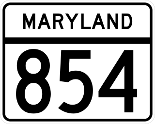
Maryland Route 854 is a collection of state highways in the U.S. state of Maryland. This pair of highways comprise the old alignment of MD 97 between MD 26 near Eldersburg and MD 32 in Fenby in Carroll County. MD 854A and MD 854B, which have lengths of 2.64 miles (4.25 km) and 3.93 miles (6.32 km), respectively, are separated by Morgan Run Natural Environment Area.


