Casal Velino, also spelled Casalvelino, is a town and comune in the province of Salerno in the Campania region of south-western Italy.

Castelnuovo Cilento is a town and comune in the province of Salerno in the Campania region of south-western Italy.

Celle di Bulgheria, also shortened as Celle, is a town and comune in the province of Salerno in the Campania region of south-western Italy.

Futani is a town and comune in the province of Salerno in the Campania region of south-western Italy.

Magliano Vetere is a town and comune in the province of Salerno in the Campania region of south-western Italy. As of 2011 its population was 739.

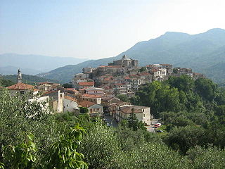
Montano Antilia is a town and comune of the province of Salerno in the Campania region of south-west Italy.

Ogliastro Cilento is a town and comune in the province of Salerno in the Campania region of south-western Italy. As of 2011 its population was of 2,241.

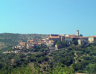
Prignano Cilento is a town and comune in the province of Salerno in the Campania region of south-western Italy. As of 2017 its population was of 1,035.
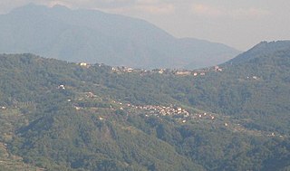
Rofrano is a town and comune of the province of Salerno in the Campania region of south-west Italy. It is located in the southern Cilento. In 2015 its population was 1,539.

Santa Barbara is an Italian village and hamlet (frazione) of the commune of Ceraso in the Province of Salerno, Campania. It has a population of roughly a thousand.
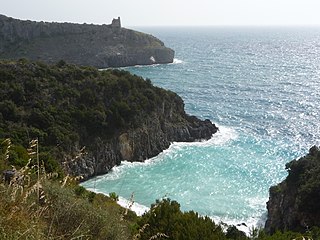
Cilento is an Italian geographical region of Campania in the central and southern part of the province of Salerno and an important tourist area of southern Italy.

Cilento, Vallo di Diano and Alburni National Park is an Italian national park in the Province of Salerno, in Campania in southern Italy. It includes much of the Cilento, the Vallo di Diano and the Monti Alburni. It was founded in 1991 and was formerly known as the Parco Nazionale del Cilento e Vallo di Diano.

Magliano Nuovo is a southern Italian village and hamlet (frazione) of Magliano Vetere, a municipality in the province of Salerno, Campania. As of 2011, its population was 334.

Case del Conte, sometimes also spelled Casa del Conte, is a southern Italian village and hamlet (frazione) of Montecorice, a municipality in the province of Salerno, Campania. As of 2009 its population was of 235.

Marina di Casalvelino, also spelled Casalvelino Marina, is a southern Italian village and hamlet (frazione) of Casal Velino, a municipality in the province of Salerno, Campania. With a population of 1,263 (2009), it is the most populated hamlet of its municipality.

Abatemarco is a southern Italian village and hamlet (frazione) of Montano Antilia, a municipality in the province of Salerno, Campania. in 2011 it had a population of 309.

Piano Vetrale, also shortened as Vetrale or Piano, is a southern Italian village and hamlet (frazione) of Orria, a municipality in the province of Salerno, Campania. As of 2011, its population was of 475.

The strada statale 18 "Tirrena Inferiore" is an Italian state road, connecting Campania and Calabria. It is among the longest and most important state highways in southern Italy, considering that it follows the Tyrrhenian coast, from Salerno to Reggio di Calabria.

Sicilì is a southern Italian village and hamlet (frazione) of Morigerati, a municipality in the province of Salerno, Campania. As of 2011, it had a population of 364.
Gorga, also known as Gorga Cilento, is a southern Italian village and the only hamlet (frazione) of Stio, a municipality in the province of Salerno, Campania. As of 2016, its population was 160.

