
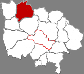
Annaberg is a former district in the Free State of Saxony, Germany. It was bounded by the Czech Republic and the districts of Aue-Schwarzenberg, Stollberg and Mittlerer Erzgebirgskreis. Its colors are pink, green, and blue.

Damaturu is a Local Government Area in Yobe State, Nigeria. Its headquarters are in the town of Damaturu, the State capital.
Coldwater River Provincial Park is a provincial park in British Columbia, Canada, located at the confluence of the Coldwater River with Cullet Creek, 50 km south of Merritt on BC Highway 5.

Petrovce is a village and municipality in Vranov nad Topľou District in the Prešov Region of eastern Slovakia.

Dixie Station was a geographic position during the Vietnam War in the South China Sea off the Mekong Delta from which United States Navy aircraft carriers launched strikes providing close air support for American and Army of the Republic of Vietnam (ARVN) ground troops in South Vietnam. It was located about 130 km due southeast of Cam Ranh Bay, at 11° N and 110° E in 600 m of water.
Diamond Glacier is a glacier in the Garibaldi Ranges of the Pacific Ranges in southwestern British Columbia, Canada. It lies on the Mount Garibaldi massif between Atwell Peak and Diamond Head.
The Pemberton Valley is a valley flanking the Lillooet River upstream from Lillooet Lake, including the communities of Mount Currie, Pemberton, British Columbia and the agricultural district surrounding them and flanking the river as far upstream as the Pemberton Meadows area. The term is normally used only to refer to inhabited parts of the valley, not the unsettled areas to the north of Pemberton Meadows although the official definition extends from the head of Lillooet Lake all the way up to the confluence of Meager Creek. Historically the region was part of the Lillooet Country but due to re-orientation of the area's economy and society since the opening and expansion of BC Highway 99 the area is now more considered to be part of the Sea-to-Sky Corridor.

Moniatycze is a village in the administrative district of Gmina Hrubieszów, within Hrubieszów County, Lublin Voivodeship, in eastern Poland, close to the border with Ukraine. It lies approximately 6 kilometres (4 mi) north of Hrubieszów and 100 km (62 mi) south-east of the regional capital Lublin.
Chełchy Kmiece is a village in the administrative district of Gmina Karniewo, within Maków County, Masovian Voivodeship, in east-central Poland.

Fimbulheimen is a mountain range in Queen Maud Land, Antarctica. It stretches from Jutulstraumen by 1° west of Carsten Borchgrevink Ice at 18° east, about 200 km from the ice edge. Fimbulheimen is thus between Maudheim Plateau and Sør-Rondane.
Lương Phong is a commune (xã) and village in Hiệp Hòa District, Bắc Giang Province, in northeastern Vietnam.

The Rocky Mountain Foothills are an upland area flanking the eastern side of the Rocky Mountains, extending south from the Liard River into Alberta. Bordering the Interior Plains system, they are part of the Rocky Mountain System or Eastern System of the Western Cordillera of North America.

Yuanhui District is a district of the city of Luohe, Henan province, China.
Yancheng District is a district of the city of Luohe, Henan province, China.
Xi County or Xixian is a county in the southwest of Shanxi province, China. It is located in the northwest of the administrative area of the prefecture-level city of Linfen.
Greater Oxdrift is a local services board in Kenora District in northwestern Ontario, Canada, that provides services to the geographic townships of Aubrey, Britton, Brownbridge, Eton, Rugby, Van Horne, Wainwright and Zealand. The board was created in 2009.
The Kokanee Range is a subrange of the Selkirk Mountains in the West Kootenay region of southeastern British Columbia, Canada. It is located between the valley of the Slocan River (W) and that of Kootenay Lake (E), and to the north of the Kootenay River and the West Arm of Kootenay Lake. The range includes Kokanee Glacier Provincial Park, Kokanee Peak, and Grays Peak, notable as the mountain featured on the label of Kokanee beer. The name "Kokanee" refers to a land-locked variety of Sockeye salmon.
Ohessaare is a village in Saaremaa Parish, Saare County in western Estonia.

Andrushivka Astronomical Observatory is a private astronomical observatory in the town suburbs of Andrushivka, Zhytomyr Oblast, Ukraine. It was established in 2001. The founder and director of the observatory is Yuri Ivashchenko. The observatory has IAU observatory code A50.
The Siege of Mainz saw an Imperial French corps under Charles Antoine Morand besieged in Mainz Fortress by an Imperial Russian corps led by Louis Alexandre Andrault de Langeron. When the Russians left in February 1814, they were replaced by the V German Corps, led by Duke Ernest of Saxe-Coburg and made up of the soldiers from the County of Nassau, the Duchy of Berg and several other minor German states. The French were far too strong for the Allies to directly attack the fortress though typhus raged within the city. Despite the epidemic, Morand did not surrender the city until the news of Napoleon's abdication arrived. Of the original garrison of 31,000 men, only 12,000 men survived. Most of the deaths were from typhus.


