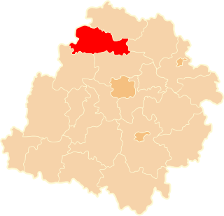
Daszyna is a village in Łęczyca County, Łódź Voivodeship, in central Poland. It is the seat of the gmina called Gmina Daszyna. It lies approximately 13 kilometres (8 mi) north of Łęczyca and 47 km (29 mi) north-west of the regional capital Łódź.
Drzykozy is a village in the administrative district of Gmina Daszyna, within Łęczyca County, Łódź Voivodeship, in central Poland. It lies approximately 5 kilometres (3 mi) west of Daszyna, 13 km (8 mi) north-west of Łęczyca, and 48 km (30 mi) north-west of the regional capital Łódź.
Gąsiorów is a village in the administrative district of Gmina Daszyna, within Łęczyca County, Łódź Voivodeship, in central Poland. It lies approximately 5 kilometres (3 mi) west of Daszyna, 13 km (8 mi) north-west of Łęczyca, and 48 km (30 mi) north-west of the regional capital Łódź.
Jarochów is a village in the administrative district of Gmina Daszyna, within Łęczyca County, Łódź Voivodeship, in central Poland. It lies approximately 2 kilometres (1 mi) north of Daszyna, 15 km (9 mi) north of Łęczyca, and 49 km (30 mi) north-west of the regional capital Łódź.
Jarochówek is a village in the administrative district of Gmina Daszyna, within Łęczyca County, Łódź Voivodeship, in central Poland. It lies approximately 3 kilometres (2 mi) west of Daszyna, 14 km (9 mi) north of Łęczyca, and 48 km (30 mi) north-west of the regional capital Łódź.
Koryta is a village in the administrative district of Gmina Daszyna, within Łęczyca County, Łódź Voivodeship, in central Poland. It lies approximately 4 kilometres (2 mi) south of Daszyna, 10 km (6 mi) north of Łęczyca, and 44 km (27 mi) north-west of the regional capital Łódź.
Krężelewice is a village in the administrative district of Gmina Daszyna, within Łęczyca County, Łódź Voivodeship, in central Poland. It lies approximately 4 kilometres (2 mi) south of Daszyna, 10 km (6 mi) north of Łęczyca, and 43 km (27 mi) north-west of the regional capital Łódź.
Łubno is a village in the administrative district of Gmina Daszyna, within Łęczyca County, Łódź Voivodeship, in central Poland. It lies approximately 8 kilometres (5 mi) west of Daszyna, 17 km (11 mi) north-west of Łęczyca, and 52 km (32 mi) north-west of the regional capital Łódź.
Ogrodzona is a village in the administrative district of Gmina Daszyna, within Łęczyca County, Łódź Voivodeship, in central Poland. It lies approximately 4 kilometres (2 mi) north of Daszyna, 17 km (11 mi) north of Łęczyca, and 51 km (32 mi) north-west of the regional capital Łódź.
Osędowice is a village in the administrative district of Gmina Daszyna, within Łęczyca County, Łódź Voivodeship, in central Poland. It lies approximately 3 kilometres (2 mi) east of Daszyna, 13 km (8 mi) north of Łęczyca, and 46 km (29 mi) north of the regional capital Łódź.
Skrzynki is a village in the administrative district of Gmina Daszyna, within Łęczyca County, Łódź Voivodeship, in central Poland. It lies approximately 7 kilometres (4 mi) south-west of Daszyna, 12 km (7 mi) north-west of Łęczyca, and 47 km (29 mi) north-west of the regional capital Łódź.
Upale is a village in the administrative district of Gmina Daszyna, within Łęczyca County, Łódź Voivodeship, in central Poland. It lies approximately 8 kilometres (5 mi) south of Daszyna, 6 km (4 mi) north of Łęczyca, and 40 km (25 mi) north-west of the regional capital Łódź.
Walew is a village in the administrative district of Gmina Daszyna, within Łęczyca County, Łódź Voivodeship, in central Poland. It lies approximately 13 km (8 mi) north of Łęczyca and 47 km (29 mi) north-west of the regional capital Łódź.
Zagróbki is a village in the administrative district of Gmina Daszyna, within Łęczyca County, Łódź Voivodeship, in central Poland. It lies approximately 6 kilometres (4 mi) west of Daszyna, 15 km (9 mi) north-west of Łęczyca, and 49 km (30 mi) north-west of the regional capital Łódź.
Zieleniew is a village in the administrative district of Gmina Daszyna, within Łęczyca County, Łódź Voivodeship, in central Poland. It lies approximately 6 kilometres (4 mi) west of Daszyna, 15 km (9 mi) north-west of Łęczyca, and 50 km (31 mi) north-west of the regional capital Łódź.
Stary Besk is a village in the administrative district of Gmina Grabów, within Łęczyca County, Łódź Voivodeship, in central Poland. It lies approximately 13 kilometres (8 mi) north-west of Łęczyca and 47 km (29 mi) north-west of the regional capital Łódź.
Błonie is a village in the administrative district of Gmina Łęczyca, within Łęczyca County, Łódź Voivodeship, in central Poland. It lies approximately 6 kilometres (4 mi) north-west of Łęczyca and 40 km (25 mi) north-west of the regional capital Łódź.
Garbalin is a village in the administrative district of Gmina Łęczyca, within Łęczyca County, Łódź Voivodeship, in central Poland. It lies approximately 6 kilometres (4 mi) north of Łęczyca and 41 km (25 mi) north-west of the regional capital Łódź.
Wargawka Młoda is a village in the administrative district of Gmina Witonia, within Łęczyca County, Łódź Voivodeship, in central Poland. It lies approximately 3 kilometres (2 mi) north-west of Witonia, 14 km (9 mi) north of Łęczyca, and 45 km (28 mi) north of the regional capital Łódź.