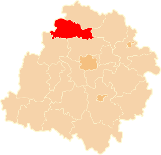
Blękwit is a village in the administrative district of Gmina Złotów, within Złotów County, Greater Poland Voivodeship, in west-central Poland.
Tomice-Młynik is a settlement in the administrative district of Gmina Gizałki, within Pleszew County, Greater Poland Voivodeship, in west-central Poland.

Nowa Wieś Malborska is a village in the administrative district of Gmina Malbork, within Malbork County, Pomeranian Voivodeship, in northern Poland. It lies approximately 3 kilometres (2 mi) south-east of Malbork and 49 km (30 mi) south-east of the regional capital Gdańsk.
Lubstowo is a village in the administrative district of Gmina Nowy Staw, within Malbork County, Pomeranian Voivodeship, in northern Poland. It lies approximately 13 kilometres (8 mi) east of Nowy Staw, 16 km (10 mi) north-east of Malbork, and 45 km (28 mi) south-east of the regional capital Gdańsk.
Nowinki is a village in the administrative district of Gmina Nowy Dwór Gdański, within Nowy Dwór Gdański County, Pomeranian Voivodeship, in northern Poland. It lies approximately 10 kilometres (6 mi) east of Nowy Dwór Gdański and 45 km (28 mi) south-east of the regional capital Gdańsk.
Powalina is a village in the administrative district of Gmina Nowy Dwór Gdański, within Nowy Dwór Gdański County, Pomeranian Voivodeship, in northern Poland. It lies approximately 6 kilometres (4 mi) east of Nowy Dwór Gdański and 41 km (25 mi) south-east of the regional capital Gdańsk.
Dublewo is a settlement in the administrative district of Gmina Sztutowo, within Nowy Dwór Gdański County, Pomeranian Voivodeship, in northern Poland. It lies approximately 7 kilometres (4 mi) south-east of Sztutowo, 10 km (6 mi) north-east of Nowy Dwór Gdański, and 41 km (25 mi) east of the regional capital Gdańsk.
Czernin is a village in the administrative district of Gmina Sztum, within Sztum County, Pomeranian Voivodeship, in northern Poland. It lies approximately 3 kilometres (2 mi) south-east of Sztum and 59 km (37 mi) south-east of the regional capital Gdańsk.
Postolin is a village in the administrative district of Gmina Sztum, within Sztum County, Pomeranian Voivodeship, in northern Poland. It lies approximately 6 kilometres (4 mi) south of Sztum and 62 km (39 mi) south-east of the regional capital Gdańsk.
Litewki is a settlement in the administrative district of Gmina Dzierzgoń, within Sztum County, Pomeranian Voivodeship, in northern Poland.
Stara Wieś is a settlement in the administrative district of Gmina Dzierzgoń, within Sztum County, Pomeranian Voivodeship, in northern Poland.
Tywęzy is a village in the administrative district of Gmina Dzierzgoń, within Sztum County, Pomeranian Voivodeship, in northern Poland. It lies approximately 7 kilometres (4 mi) south-west of Dzierzgoń, 18 km (11 mi) east of Sztum, and 70 km (43 mi) south-east of the regional capital Gdańsk.
Balewo is a village in the administrative district of Gmina Mikołajki Pomorskie, within Sztum County, Pomeranian Voivodeship, in northern Poland. It lies approximately 6 kilometres (4 mi) east of Mikołajki Pomorskie, 16 km (10 mi) south-east of Sztum, and 69 km (43 mi) south-east of the regional capital Gdańsk.
Mirowice is a village in the administrative district of Gmina Mikołajki Pomorskie, within Sztum County, Pomeranian Voivodeship, in northern Poland. It lies approximately 4 kilometres (2 mi) north-west of Mikołajki Pomorskie, 9 km (6 mi) south-east of Sztum, and 64 km (40 mi) south-east of the regional capital Gdańsk.
Sadłuki is a village in the administrative district of Gmina Mikołajki Pomorskie, within Sztum County, Pomeranian Voivodeship, in northern Poland. It lies approximately 4 kilometres (2 mi) north-west of Mikołajki Pomorskie, 8 km (5 mi) south-east of Sztum, and 64 km (40 mi) south-east of the regional capital Gdańsk.
Szalmia is a settlement in the administrative district of Gmina Płoskinia, within Braniewo County, Warmian-Masurian Voivodeship, in northern Poland. It lies approximately 6 kilometres (4 mi) north-west of Płoskinia, 11 km (7 mi) south of Braniewo, and 70 km (43 mi) north-west of the regional capital Olsztyn.
Rucianka is a village in the administrative district of Gmina Młynary, within Elbląg County, Warmian-Masurian Voivodeship, in northern Poland.
Bark is a village in the administrative district of Gmina Barczewo, within Olsztyn County, Warmian-Masurian Voivodeship, in northern Poland.
Kojtryny is a village in the administrative district of Gmina Biskupiec, within Olsztyn County, Warmian-Masurian Voivodeship, in northern Poland.
Mojstir is a village in Bijelo Polje Municipality, in northern Montenegro. According to the 2003 census, the village had a population of 134 people.