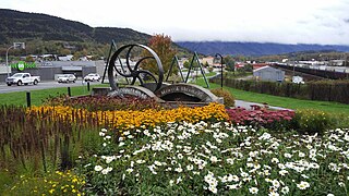
Terrace is a city in the Skeena region of west central British Columbia, Canada. This regional hub lies east of the confluence of the Kitsumkalum River into the Skeena River. On BC Highway 16, junctions branch northward for the Nisga'a Highway to the west and southward for the Stewart–Cassiar Highway to the east. The locality is by road about 204 kilometres (127 mi) southwest of Smithers and 144 kilometres (89 mi) east of Prince Rupert. Transportation links are the Northwest Regional Airport, a passenger train, and bus services.

Sicamous is a district municipality in the Shuswap Country region of south central British Columbia. The place is adjacent to the narrows, which is the confluence of Mara Lake into Shuswap Lake. At the BC Highway 97A intersection on BC Highway 1, the locality is by road about 73 kilometres (45 mi) west of Revelstoke, 140 kilometres (87 mi) east of Kamloops, and 75 kilometres (47 mi) north of Vernon.

The Vancouver School Board (VSB), officially the Board of Education of School District No. 39 (Vancouver), is a school district based in Vancouver, British Columbia, Canada. A board of nine elected trustees governs this school district that serves the city of Vancouver and the University Endowment Lands.
School District 57 Prince George is a school district in central British Columbia that encompasses urban Prince George, its surroundings, and the outlying communities of McBride and Valemount to the southeast, and Mackenzie to the north.

D.P. Todd Secondary School is a public high school in Prince George, British Columbia and is part of School District 57 Prince George.
Prince George Secondary School is a public high school in Prince George, British Columbia, Canada, part of School District 57 Prince George.

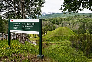
Kitwanga or Gitwangak is in the Skeena region of west central British Columbia. Among the Hazelton and Buckley Mountain Ranges, the place is on the north shore of the Skeena River, east of the Kitwanga River confluence. On BC Highway 37, northeast of the junction with BC Highway 16, the locality is by road about 115 kilometres (71 mi) northwest of Smithers, 99 kilometres (62 mi) northeast of Terrace, and 212 kilometres (132 mi) southeast of Stewart.

The Jasper–Prince Rupert train is a Canadian passenger train service operated by Via Rail between Jasper, Alberta, Prince George and Prince Rupert in British Columbia.
Cedarvale or Meanskinisht is an unincorporated community in the Skeena region of west central British Columbia. Concentrated on the southeastern shore of the Skeena River, no direct link exists to the portion on the northwestern shore. On BC Highway 16, the locality is by road about 130 kilometres (81 mi) northwest of Smithers and 75 kilometres (47 mi) northeast of Terrace.
The Pine Pass, in the Hart Ranges of the Northern Rockies of British Columbia, connects the Peace Country of the province's Northeastern Interior. Highway 97 and the Canadian National Railway (CNR) traverse this mountain pass, which is the location of the Bijoux Falls Provincial Park, the Pine Le Moray Provincial Park, and the Powder King Mountain Resort at Azouzetta Lake.
Willow River is a community northeast of Prince George, on the northeast bank of the Willow River, 2.5 kilometres (1.6 mi) southeast of the confluence with the Fraser River, in central British Columbia. The name derives from the many willow swamps in the river valley. Comprising about 150 residents, it has a general store/post-office, a volunteer fire department, church building and a small community hall. Street map.
Aleza Lake is immediately south of the eastern end of its namesake lake, and west of Upper Fraser, in central British Columbia. The community, which clusters the railway line and highway, comprises 15–20 full-time residents.
Hansard station existed on the southwest side of the Fraser River 2.8 miles (4.5 km) northwest of the Bowron River confluence, and 4 miles (6.4 km) southeast of Upper Fraser, in central British Columbia. The namesake small community to its northwest has since dispersed.
Hutton nestles in the foothills of the Rocky Mountains about four miles (6.4 km) north-northeast of the Grand Canyon of the Fraser, in central British Columbia. Moxley Creek, a tributary on the northeast side of the Fraser River, passes to the southwest. The former mill and village site is private property, whose owners remain the sole occupants. Surviving structures are some concrete foundations of mill buildings and the railway water tower.
Longworth comprises scattered houses in a settlement between Sinclair Mills and Penny on the northeast side of the Fraser River in central British Columbia. Containing less than 15 permanent residents, a community hall, and former schoolhouse housing the post office, the location is a jumping-off point for outdoor recreational activities. Longworth Peak is the highest mountain in the Dezaiko Ranges and is prominent above the community.
Penny, between Longworth and Dome Creek on the northeast side of the Fraser River in central British Columbia, offers an access point for outdoor recreational activities. With a community hall and 15 permanent residents, No utilities infrastructure exists. Prior to the post office permanently closing on 31 December 2013, the community was the only one in Canada that still relied upon the railway for its postal service.
Bend, the remnants of a community 2.1 miles (3.4 km) northwest of Dome Creek in central British Columbia, comprises several scattered rural properties stretching along the Fraser River on the northwest side of the railway bridge. The area was named after the 90-degree curve on the railway track, 1 mile (1.6 km) northwest of the railway bridge.
Dome Creek, between Penny and Crescent Spur on the southwest side of the Fraser River in central British Columbia, provides a year-round destination for hiking, hunting, snowshoeing and snowmobiling. The scattered community of about 40 permanent residents clusters the railway line and the actual creek. The creek and town are similarly named after Dome Mountain. The recreational facility, which occupies the former school building, houses the community hall, a public library and a museum, with a small rustic post office nearby. The visitor centre stands at the front of the lot occupied by the former community hall. (Content specific to Bend or Kidd is contained in those articles.)
Isle Pierre is a railway point in the Nechako Region of central British Columbia. The scattered community straddles the shores of the Nechako River. The west side, off BC Highway 16, is by road about 55 kilometres (34 mi) west of Prince George and 69 kilometres (43 mi) east of Vanderhoof. The east side is by road about 46 kilometres (29 mi) west of Prince George.


