Yamhill County is one of the 36 counties in the U.S. state of Oregon. As of the 2020 census, the population was 107,722. The county seat is McMinnville. Yamhill County was named after the Yamhelas, members of the Kalapuya Tribe.

McMinnville is the county seat of and most populous city in Yamhill County, Oregon, United States. The city is named after McMinnville, Tennessee. As of the 2020 census, the city had a population of 34,319.

Sheridan is a city in Yamhill County, Oregon, United States. Platted in the 1860s when it received a post office, the city was incorporated in 1880. A major fire burned much of the city in 1913, and a flood covered much of the city in 1964. The population of the city as of the 2020 Census was 6,100, a decrease from 6,127 at the 2010 census.

Detroit Lake is a reservoir impounded by the Detroit Dam on the North Santiam River 46 miles (74 km) southeast of Salem, Oregon, United States. The lake is adjacent to Oregon Route 22 near the city of Detroit. This mesotrophic lake stores water for use by the city of Salem and other nearby communities.

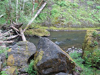
The South Yamhill River is a tributary of the Yamhill River, approximately 60 miles (97 km) long, in northwest Oregon in the United States. It drains an area of the Northern Oregon Coast Range, as well as part of the Willamette Valley west of the Willamette River.

The Nestucca River flows for about 57 miles (92 km) through forests near the Pacific coast of northwest Oregon in the United States. It drains a timber-producing area of the Northern Oregon Coast Range west of Portland.

The Bull Run River is a 21.9-mile (35.2 km) tributary of the Sandy River in the U.S. state of Oregon. Beginning at the lower end of Bull Run Lake in the Cascade Range, it flows generally west through the Bull Run Watershed Management Unit (BRWMU), a restricted area meant to protect the river and its tributaries from contamination. The river, impounded by two artificial storage reservoirs as well as the lake, is the primary source of drinking water for the city of Portland, Oregon.

Millerton Lake is an artificial lake near the town of Friant, about 15 mi (24 km) north of downtown Fresno, California, United States. The reservoir was created by the construction of 319 ft high Friant Dam on the San Joaquin River which, with the lake, serves as much of the county line between Fresno County to the south and Madera County to the north.

The Willamette Valley AVA is an American Viticultural Area which lies in the Willamette Valley of Oregon. The AVA is the wine growing region which encompasses the drainage basin of the Willamette River. It stretches from the Columbia River in the north to just south of Eugene in the south, where the Willamette Valley ends; and from the Oregon Coast Range in the west to the Cascade Mountains in the east. At 5,360 square miles (13,900 km2), it is the largest AVA in the state, and contains most of the state's wineries; approximately 908 as of 2021.

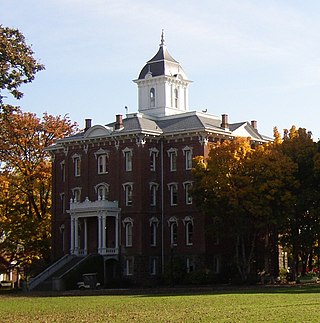
The Yamhill County Courthouse is a courthouse in Yamhill County, Oregon, United States. Though Yamhill County has had a series of historic courthouses, the first being completed in 1860, the current courthouse dates to 1963.

McMinnville Municipal Airport is three miles southeast of McMinnville, in Yamhill County, Oregon. The FAA's National Plan of Integrated Airport Systems for 2009–2013 categorized it as a general aviation facility. It is across Oregon Route 18 from the Evergreen Aviation & Space Museum, home to the Hughes H-4 Hercules Spruce Goose flying boat.

Applegate Lake is a 988-acre (400 ha) reservoir located in the Rogue River–Siskiyou National Forest about 27 miles (43 km) southwest of Medford in the U.S. state of Oregon. It is 16 miles (26 km) south of Oregon Route 238 along Applegate River Road and slightly north of the Oregon–California border. The lake is an impoundment of the Applegate River about 46 miles (74 km) from its confluence with the Rogue River.

The steamship Altona operated from 1890 to 1907 on the Willamette River in the U.S. state of Oregon. In 1907, she was transferred to Alaska.

The Prineville Reservoir is in the high desert hills of Central Oregon, Oregon, United States. The reservoir is on the Crooked River 14 miles (22.5 km) southeast of Prineville, and 29 miles (46.7 km) east of Bend. This reservoir is a popular retreat for most of Central Oregon. It is near the geographic center of Oregon. Prineville Reservoir State Park is managed by the Oregon Parks and Recreation Department.

McKay Reservoir is a reservoir in Umatilla County of the U.S. state of Oregon. It is an impoundment of McKay Creek, a tributary of the Umatilla River. The reservoir is located 6 miles (9.7 km) south of Pendleton on U.S. Route 395. The reservoir has a capacity of 65,534 acre-feet (80,835,000 m3) of water. The reservoir and land that immediately surrounds it are designated as the McKay Creek National Wildlife Refuge. The reservoir and creek that it impounds are named for Dr. William C. McKay. McKay was an early settler in the Pendleton, Oregon area. He settled near the mouth of McKay Creek about 1851. The place was originally called Houtama. He died in Pendleton in 1893.

Blue Lake Regional Park is a public park in Fairview, in the U.S. state of Oregon. The 101-acre (41 ha) park, near the south shore of the Columbia River in Multnomah County, includes many covered and uncovered picnic areas, playing fields for sports such as softball, a cross country course and infrastructure related to lake recreation including swimming, boating, and fishing. Encompassing wooded areas, three ponds, and a wetland in addition to the lake, the park is frequented by migrating birds and other wildlife. Paved paths run through the park, which is near the 40-Mile Loop hiking and biking trail. Park vegetation includes cottonwoods, willows, and other trees and shrubs as well as wetland plants such as cattails.
Lake Allison was a temporary lake in the Willamette Valley of Oregon, formed periodically by the Missoula Floods from 15,000 to 13,000 BC. The lake is the main cause of the rich and fertile soil that now characterizes the Willamette Valley.

Leesville Lake is a reservoir located near Ohio State Route 212 and Leesville, Ohio. The lake is formed by Leesville Dam 40°28′6″N81°11′41″W across McGuire Creek, a tributary of Conotton Creek. The lake is named for the village of Leesville.

The Yamhill River lock and dam was completed in 1900. It was built near Lafayette, Oregon, to allow better river transport on the Yamhill River from Dayton, to McMinnville, Oregon. While the Corps of Engineers had recommended against construction of the lock, it was built anyway, largely as a result of political effort by the backers of the project. For almost forty years prior to the lock construction there had been efforts made to construct a lock and dam on the Yamhill River.


