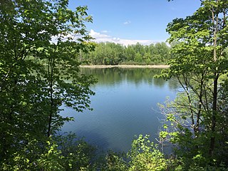
Rockcliffe Park is a neighbourhood in Rideau-Rockcliffe Ward, close to the centre of Ottawa, Ontario, Canada. Established in 1864, organized as a Police village in 1908, and an independent village from 1926, and ultimately amalgamated with the rest of Ottawa on January 1, 2001. As of 2011, it had a population of 2,021. In 1977 the entire village of Rockcliffe Park was designated a Heritage Conservation District. Rockcliffe Park is one of only a handful of surviving nineteenth-century communities of its kind in North America.

Beckwith is a township in eastern Ontario, Canada. It is located in Lanark County on the Mississippi River. It is located within Canada's National Capital Region.

Drummond/North Elmsley is a township in eastern Ontario, Canada in Lanark County. It is situated on the north shore of the Rideau River between the town of Perth and the town of Smiths Falls. It is a predominantly rural municipality. The township offices are located in the hamlet of Port Elmsley.
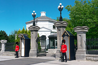
New Edinburgh is a neighbourhood in Rideau-Rockcliffe Ward, in Ottawa, Ontario, Canada. It is located to the northeast of the downtown core. It is bordered on the west by the Rideau River, to the north by the Ottawa River, to the south by Beechwood Avenue, and on the east by Springfield Road and the former Rockcliffe Park village limits.

Mer Bleue Bog is a 33.43 km2 (12.91 sq mi) protected area in Gloucester, Ontario, an eastern suburb of Ottawa in Eastern Ontario, Canada. Its main feature is a sphagnum bog that is situated in an ancient channel of the Ottawa River and is a remarkable boreal-like ecosystem normally not found this far south. Stunted black spruce, tamarack, bog rosemary, blueberry, and cottongrass are some of the unusual species that have adapted to the acidic waters of the bog.
Thomas McKay was a Canadian businessman who was one of the founders of the city of Ottawa, Ontario.

Spencer Spit State Park is a public recreation area ran under the Washington State Parks. It covers one hundred and thirty-eight acres (56 ha) on the eastern shore of Lopez Island in San Juan County, Washington. It overlooks the Strait of Juan de Fuca. The state park features two sand spits that enclose a salt chuck lagoon that provides a migratory stop for waterfowl, including Bonaparte's gulls. Other local fauna include great blue herons and kingfishers.
Pottageville is an unincorporated community located in northeastern King Township, in Ontario, Canada. It is near Schomberg. It is named for one of its early settlers, Edward Pottage.

Cowles Bog is a 4,000-year-old wetland complex in Indiana Dunes National Park, near Chesterton, Indiana. It is named for Henry Chandler Cowles who did his pioneering work in ecology and ecological succession here. His work brought international attention to the area which led to efforts to preserve the Indiana Dunes. It was designated a National Natural Landmark in 1965. It contains bog, fen, marsh, wet meadow, swamp, and pond habitats.
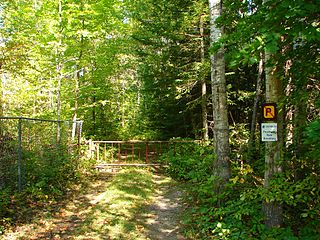
Westmeath Provincial Park is a provincial park on the Ottawa River in Renfrew County, Ontario, Canada. Located on the section of the river known as Bellows Bay, it features a long sandy beach and an active sandspit. It is one of the most pristine sand dune and wetland complexes along the southern Ottawa River.

The Coast Range ecoregion is a Level III ecoregion designated by the Environmental Protection Agency (EPA) in the U.S. states of Washington, Oregon, and California. It stretches along the Pacific Coast from the tip of the Olympic Peninsula in the north to the San Francisco Bay in the south, including Grays Harbor, Willapa Bay, and the Long Beach Peninsula in Washington, the entire length of the Oregon Coast, and the Northern California Coast. Named for the Coast Range mountains, it encompasses the lower elevations of the Olympic Mountains, the Oregon Coast Range, the Californian North Coast Ranges, and surrounding lowlands.
Emerald Lake State Park is a 430-acre (170 ha) state park in the town of Dorset, Vermont, United States, 3 miles (5 km) north of the village of East Dorset, the park's mailing address. It is the home of 20-acre (8.1 ha) Emerald Lake, called such because of its emerald color.
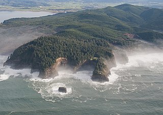
The Central Pacific coastal forests is a temperate coniferous forest ecoregion located in the Canadian province of British Columbia and the U.S. states of Oregon and Washington, as defined by the World Wildlife Fund (WWF) categorization system.
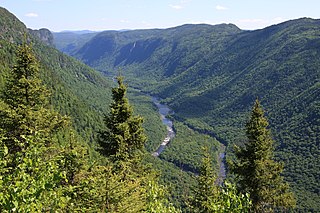
The eastern forest–boreal transition is a temperate broadleaf and mixed forests ecoregion of North America, mostly in eastern Canada. It is a transitional zone or region between the predominantly coniferous Boreal Forest and the mostly deciduous broadleaf forest region further south.

Central Park is a 90-hectare (220-acre) urban park in Burnaby, British Columbia, founded in 1891.
Widgeon Valley National Wildlife Area is a National Wildlife Area located near the south end of Pitt Lake in British Columbia, Canada. The property was purchased by the Nature Trust of British Columbia in 1973 and declared a National Wildlife Area by the Canadian Wildlife Service in October of that year. The Widgeon Valley National Wildlife Area is a biologically diverse marsh wetland. It is the traditional territory of various First Nations groups. The Widgeon Valley Wildlife Area is a protected wildlife area that is home to a number of sensitive waterfowl and fish species. The public uses the channels through the Widgeon Valley National Wildlife Area for recreational canoeing, anywhere else within the protected area is strictly off-limits to the public. There are future plans to develop interpretive trails through the park and open it to the public.
The Espy Bog is wetland complex in Columbia County, Pennsylvania, in the United States. It is situated near Bloomsburg and Espy. The wetlands contain a lake, as well as forested swamps, shrub swamps, and graminoid openings. The lake in the wetland complex may be manmade. The predominant soil in the area is known as mucky peat. The wetland complex has a high level of plant and animal biodiversity, including birds, turtles, fish, trees, shrubs, and ferns.
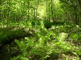
The Keddy Nature Sanctuary consists of approximately one square mile of forest and wetland on the very edge of the Canadian shield, just an hour west of Ottawa on the east side of Lanark County, in Ontario, Canada. It is mostly second growth temperate deciduous forest, interspersed with wetlands and beaver ponds, as well as sedge-dominated rock-ridges. A central ridge has more than twenty hectares of hemlock forest. There are also old fields that remain from pastures created in the previous century. Parts of this property, as well as adjoining lands, are designated as the Scotch Corners Provincially Significant Wetland. The property is one of several protected by the Mississippi Madawaska Land Trust.
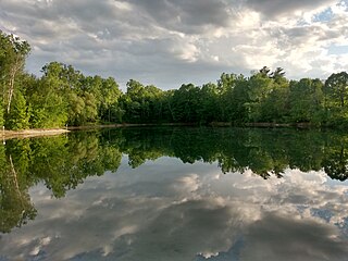
Sand Pits Lake, better known as The Pond or McKay Pond is an artificial lake located next to McKay Lake in the Rockcliffe Park neighbourhood of Ottawa, Ontario, Canada.

Governor Bay, better known historically as Governor's Bay is a bay in the Ottawa River in Ottawa, Ontario, Canada. It is roughly located between the neighbourhoods of New Edinburgh and Rockcliffe Park, below 24 Sussex, the official residence of the Prime Minister of Canada, and adjacent to Rideau Hall, the home of the Governor General of Canada.


