Big Arm is a census-designated place (CDP) in Lake County, Montana, United States. The population was 177 at the 2010 census, up from 131 in 2000.

Rollins is an unincorporated community and census-designated place (CDP) in Lake County, Montana, United States. The population was 209 at the 2010 census, up from 183 in 2000.

De Borgia is an unincorporated community and census-designated place (CDP) in Mineral County, Montana, United States. The population was 91 at the 2020 census.

Clyde Park is a town in Park County, Montana, United States. The population was 332 at the 2020 census. Originally known as Sunnyside, the town was renamed in the 1890s.

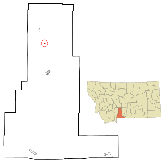
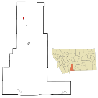
Wilsall is a census-designated place (CDP) in Park County, Montana, United States. The population was 237 at the 2000 census.

Lonepine is a census-designated place (CDP) in Sanders County, Montana, United States. The population was 137 at the 2000 census.

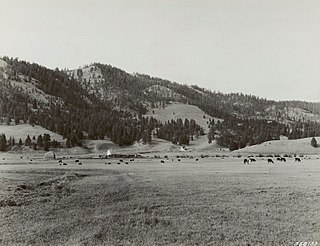
Emigrant is an unincorporated community in Park County, Montana, United States. As of the 2010 census, the ZIP Code Tabulation Area (59027) for Emigrant had a population of 372. Emigrant is located in southern Montana, on the Yellowstone River, approximately 30 miles (48 km) north of Yellowstone National Park, and 20 miles (32 km) south of Livingston.

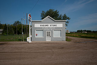
McLeod is a census designated place in eastern Ransom County, North Dakota, United States. An unincorporated community, it was designated as part of the U.S. Census Bureau's Participant Statistical Areas Program on March 31, 2010. It was not counted separately during the 2000 Census, but was included in the 2010 Census, where its population was reported to be 27.

Arvilla is an unincorporated community in central Grand Forks County, North Dakota, United States. It lies along U.S. Route 2, west of the city of Grand Forks, the county seat of Grand Forks County. Its elevation is 1,004 feet (306 m). The community was first named Orange for Orange County, New York; it was renamed Arvilla for Arvilla Estella Hersey, the wife of a local farmer. Although Arvilla is unincorporated, it has a post office, with the ZIP code of 58214. The post office was established in 1882.

Melville is an unincorporated community in northern Sweet Grass County, Montana, United States. It lies along local roads just west of U.S. Route 191, north of the city of Big Timber, the county seat of Sweet Grass County. Its elevation is 5,020 feet (1,530 m). Although Melville is unincorporated, it has a post office, with the ZIP code of 59055, which opened on 4 January 1883.
Condon is an unincorporated community and census-designated place in Missoula County, Montana, United States. Located along the Swan River and Montana Highway 83, Condon is situated between the Swan Range to the east and the Mission Mountains to the west, providing ready access to the Bob Marshall Wilderness and Mission Mountains Wilderness, respectively. Its population was 285 as of the 2020 United States census, down from 343 in 2010.
Raymond is an unincorporated hamlet in Sheridan County, Montana, United States. The community lies north of Plentywood. It is nine miles south of the Canada–US border.
Coffee Creek is an unincorporated community in Fergus County, Montana, United States. It is located along Montana Highway 81 in west central Fergus County, several miles northwest of Denton. Coffee Creek has a post office with the ZIP code 59424.
Rock is an unincorporated community in Delta County, Michigan, United States. Rock is located in Maple Ridge Township along M-35 and the Canadian National Railway, 16.5 miles (26.6 km) north-northwest of Gladstone. Rock has a post office with ZIP code 49880.
Yaak is an unincorporated community and census-designated place in Lincoln County, Montana, United States. It is located along the Yaak River, within the Kootenai National Forest. As of the 2020 census, its population was 338.

Sula is a census-designated place (CDP) in Ravalli County, Montana, United States. It is named after the community of Sula, which it encompasses, and was established about 2010, prior to that year's census. The population of the CDP was 37 at the 2010 census.
Springdale is a census-designated place and unincorporated community in Park County, Montana, United States. Its population was 42 at the 2010 census. The community is located near Interstate 90 and the Yellowstone River. Springdale has its own ZIP code, 59082.
Kila is a census-designated place and unincorporated community in Flathead County, Montana, United States. Its population was 424 as of the 2020 census. Kila has a post office with ZIP code 59920, which opened on May 27, 1901. The community is located along U.S. Route 2, 10 miles from Kalispell.
Marion is a census-designated place and unincorporated community in Flathead County, Montana, United States. Its population was 1,119 as of the 2020 census. Marion has a post office with ZIP code 59925.
Sedan is a census-designated place (CDP) in Gallatin County, Montana, United States. The population was 99 at the 2010 census. It is located on Montana Highway 86, 27 miles from Bozeman. The Zip Code 59086.


