| Mcgrory Falls | |
|---|---|
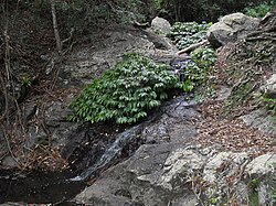 Small cascade above Mcgrory Falls | |
 Mcgrory Falls Location in Queensland | |
 | |
| Location | Bunya Mountains, Australia |
| Coordinates | 26°52′32″S152°36′06″E / 26.87556°S 152.60167°E |
| Type | Plunge |
| Total height | 50m |
| Number of drops | 1 |
| Watercourse | Saddle-tree Creek |
Mcgrory Falls is a waterfall on Saddle-tree Creek, a tributary of the Burnett River, in Queensland, Australia. [1] The waterfall is located within the Bunya Mountains National Park, in the South Burnett Region, near the village of Dandabah in the Bunya Mountains. Like other smaller waterfalls in the area, Mcgrory Falls is surrounded by dense bush and pine forest. [2]
