Melecha River

Last updated

Coordinates: 57°59′39.37″N36°25′02.19″E / 57.9942694°N 36.4172750°E / 57.9942694; 36.4172750

Geographic coordinate system Coordinate system

A geographic coordinate system is a coordinate system that enables every location on Earth to be specified by a set of numbers, letters or symbols. The coordinates are often chosen such that one of the numbers represents a vertical position and two or three of the numbers represent a horizontal position; alternatively, a geographic position may be expressed in a combined three-dimensional Cartesian vector. A common choice of coordinates is latitude, longitude and elevation. To specify a location on a plane requires a map projection.

Melecha
Russian: Мелеча
Rybinsk vdhr.svg
Country Russia
Physical characteristics
River mouth Osen
Length 95 km (59 mi) [1]
Basin features
Basin size 1,310 km2 (510 sq mi) [1]
Map of the Rybinsk Reservoir basin. The Melecha is shown on the map. Rybinsk vdhr eng.svg
Map of the Rybinsk Reservoir basin. The Melecha is shown on the map.

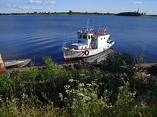
The Melecha (Russian : Мелеча) is a river in Sandovsky, Molokovsky, and Bezhetsky Districts of Tver Oblast in Russia. Together with the Mogocha River, it forms the Osen, a major right tributary of the Mologa River. It is 95 kilometres (59 mi) long, and the area of its basin is 1,310 square kilometres (510 sq mi). The principal tributary is the Belaya River (left). [1]

Russian language East Slavic language

Russian is an East Slavic language, which is official in the Russian Federation, Belarus, Kazakhstan and Kyrgyzstan, as well as being widely used throughout Eastern Europe, the Baltic states, the Caucasus and Central Asia. It was the de facto language of the Soviet Union until its dissolution on 25 December 1991. Although nearly three decades have passed since the breakup of the Soviet Union, Russian is used in official capacity or in public life in all the post-Soviet nation-states, as well as in Israel and Mongolia.

Sandovsky District District in Tver Oblast, Russia

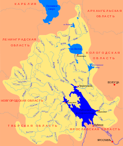
Sandovsky District is an administrative and municipal district (raion), one of the thirty-six in Tver Oblast, Russia. It is located in the northeast of the oblast and borders with Ustyuzhensky District of Vologda Oblast in the north, Vesyegonsky District in the northeast, Molokovsky District in the southeast, Maksatikhinsky District in the south, Lesnoy District in the west, and with Pestovsky District of Novgorod Oblast in the northwest. The area of the district is 1,608 square kilometers (621 sq mi). Its administrative center is the urban locality of Sandovo. Population: 6,811 ; 9,385 (2002 Census); 12,495 (1989 Census). The population of Sandovo accounts for 51.5% of the district's total population.

Molokovsky District District in Tver Oblast, Russia

Molokovsky District is an administrative and municipal district (raion), one of the thirty-six in Tver Oblast, Russia. It is located in the northeast of the oblast and borders with Sandovsky District in the north, Vesyegonsky District in the northeast, Krasnokholmsky District in the east, Bezhetsky District in the south, and with Maksatikhinsky District in the west. The area of the district is 1,182.6 square kilometers (456.6 sq mi). Its administrative center is the urban locality of Molokovo. Population: 5,235 ; 7,015 (2002 Census); 8,931 (1989 Census). The population of Molokovo accounts for 44.5% of the district's total population.

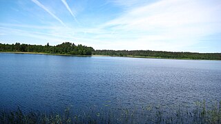
The source of the Melecha is located south of the selo of Staroye Sandovo in Sandovsky District. The river flows southwest, reaches Molokovsky District, and turns east forming the border between the districts. Further east, it departs south from the border, turns west, turns south, crosses into Bezhetsky District and joins the Mogocha to form the Osen southwest of the village of Pereuz.

The drainage basin of the Melecha includes the southeastern part of Sandovsky District, the western half of Molokovsky District, the north of Bezhetsky District, as well as minor areas in the south of Vesyegonsky District. The urban-type settlement of Molokovo lies in the drainage basin of the Melecha.

Drainage basin Area of land where precipitation collects and drains off into a common outlet

A drainage basin is any area of land where precipitation collects and drains off into a common outlet, such as into a river, bay, or other body of water. The drainage basin includes all the surface water from rain runoff, snowmelt, and nearby streams that run downslope towards the shared outlet, as well as the groundwater underneath the earth's surface. Drainage basins connect into other drainage basins at lower elevations in a hierarchical pattern, with smaller sub-drainage basins, which in turn drain into another common outlet.

Vesyegonsky District District in Tver Oblast, Russia

Vesyegonsky District is an administrative and municipal district (raion), one of the thirty-six in Tver Oblast, Russia. It is located in the northeast of the oblast and borders with Cherepovetsky District of Vologda Oblast in the northeast, Breytovsky District of Yaroslavl Oblast in the southeast, Krasnokholmsky District in the south, Molokovsky District in the southwest, Sandovsky District in the west, and with Ustyuzhensky District of Vologda Oblast in the northwest. The area of the district is 2,047 square kilometers (790 sq mi). Its administrative center is the town of Vesyegonsk. Population: 13,481 ; 16,517 (2002 Census); 19,879 (1989 Census). The population of Vesyegonsk accounts for 54.4% of the district's total population.

Molokovo, Molokovsky District, Tver Oblast Work settlement in Tver Oblast, Russia

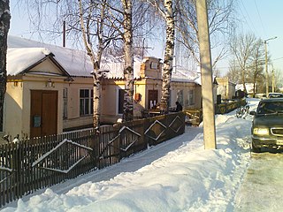
Molokovo is an urban-type settlement and the administrative center of Molokovsky District of Tver Oblast, Russia. Population: 2,331 (2010 Census); 2,572 (2002 Census); 2,804 (1989 Census).

Related Research Articles

Mologa River river in Russia

The Mologa is a river in Maksatikhinsky, Bezhetsky, Lesnoy, and Sandovsky Districts of Tver Oblast, Pestovsky District in Novgorod Oblast, and Ustyuzhensky and Cherepovetsky Districts in Vologda Oblast Russia. It is a left tributary of the Volga River. The lower course of the Mologa has been turned into the Rybinsk Reservoir. It is 456 kilometres (283 mi) long, and the area of its basin 29,700 square kilometres (11,500 sq mi). The principal tributaries of the Mologa are the Osen (right), the Volchina (left), the Kobozha (left), the Chagodoshcha (left) and the Sit.

Izhora River river in Russia, left tributary of the Neva

The Izhora, also known as the Inger River, is a left tributary of the Neva River on its run through Ingria in northwestern Russia from Lake Ladoga to Gulf of Finland. The Izhora flows through Gatchinsky and Tosnensky Districts of Leningrad Oblast as well as through Pushkinsky and Kolpinsky Districts of the federal city of Saint Petersburg. The settlement of Ust-Izhora is situated at the confluence of Izhora and Neva, halfway between Saint Petersburg and Schlisselburg. The towns of Kommunar and Kolpino are located on the Izhora as well. The river is noted as the farthest Swedish forces ever reached between the Viking Age and the Time of Troubles.

Velikaya River river in Russia, a tributary of Lake Pskovskoe

The Velikaya is a river in Novosokolnichesky, Pustoshkinsky, Sebezhsky, Opochetsky, Pushkinogorsky, Ostrovsky, Palkinsky, and Pskovsky Districts of Pskov Oblast, as well as in the city of Pskov in Russia. It is a major tributary of Lake Peipus and belongs to the basin of the Narva River. It is 430 kilometres (270 mi) long, and the area of its basin 25,200 square kilometres (9,700 sq mi). The name of the river means literally "Grand" or "Great" in Russian. The towns of Opochka, Ostrov and Pskov are located on the banks of the Velikaya. The principal tributaries of the Velikaya are the Alolya River (right), the Issa River (left), the Sorot River (right), the Sinyaya River (left), the Utroya River (left), the Kukhva River (left), the Cheryokha River (right), and the Pskova River (right).

Luga River river in Russia

The Luga River is a river in Novgorodsky and Batetsky Districts of Novgorod Oblast and Luzhsky, Volosovsky, Slantsevsky, and Kingiseppsky Districts of Leningrad Oblast of Russia. The river flows into the Luga Bay of the Gulf of Finland. It freezes up in the early December and stays under the ice until early April. The length of the Luga is 353 kilometres (219 mi), and the area of its drainage basin is 13,200 square kilometres (5,100 sq mi). Its main tributary is the Oredezh River (right). The towns of Luga and Kingisepp, as well as the urban-type settlement of Tolmachyovo are located on the banks of the Luga. The mouth of the Luga is the site of the Ust-Luga container terminal.

Kashinka River river in Russia

Kashinka is a river in Kesovogorsky and Kashinsky Districts of Tver Oblast, Russia, a left tributary of the Volga River. The length of the river is 128 kilometres (80 mi), and the area of its drainage basin is 661 square kilometres (255 sq mi). The town of Kashin and the urban-type settlement of Kesova Gora are located along the Kashinka.

Okhta River (Neva basin) river in russia

Okhta River is a river in Vsevolozhsky District of Leningrad Oblast and the eastern part of the city of Saint Petersburg, Russia. It is the largest right tributary of the Neva river. It joins the Neva 12 kilometres (7.5 mi) upstream of the Neva's mouth, within the city limits of Saint Petersburg. The length of the Okhta is 90 kilometres (56 mi), and the area of its drainage basin is 768 square kilometres (297 sq mi). Its largest tributary is the Okkervil River (left). The Rzhevsky Reservoir has been built on the Okhta. The Utkina Dacha estate is located on the banks of the Okhta close to the mouth of the Okkervil.

Medveditsa River (Volga basin) river

Medveditsa is a river in Spirovsky, Likhoslavlsky, Rameshkovsky, Kashinsky, and Kimrsky Districts of Tver Oblast, Russia, a left tributary of the Volga River. The main tributaries are the Kushalka River (left), the Ivitsa River (right), the Drezna River (left), the Rudomosh River (left), and the Yakhroma River (right). The length of the Medveditsa is 259 kilometres (161 mi), and the area of its drainage basin is 5,570 square kilometres (2,150 sq mi).

Kubena River river in Russia

The Kubena is a river in Konoshsky District of Arkhangelsk Oblast and Vozhegodsky, Syamzhensky, Kharovsky, Sokolsky, and Ust-Kubinsky Districts of Vologda Oblast in Russia. It is 368 kilometres (229 mi) long, and the area of its basin 11,000 square kilometres (4,200 sq mi). The Kubena is the principal tributary of Lake Kubenskoye and belongs to the basins of the Sukhona River and the White Sea. Its main tributaries are the Syamzhena River (left) and the Sit River (right).

The Mga is a river in Kirovsky and Tosnensky Districts of Leningrad Oblast in northwestern Russia. Mga is a left tributary of Neva River. The urban-type settlements of Mga and Pavlovo are located on the river. The length of the Mga is 93 kilometres (58 mi), and the area of its basin is 754 square kilometres (291 sq mi). The principal tributaries of the Mga are the Beryozovka (right) and the Voytolovka (left).

Kolp River river in Russia

The Kolp is a river in Boksitogorsky District of Leningrad Oblast and in Babayevsky and Kaduysky Districts of Vologda Oblast in Russia. It is a right tributary of the Suda River and belongs to the river basin of the Volga. It is 254 kilometres (158 mi) long, with a drainage basin of 3,730 square kilometres (1,440 sq mi) and an average discharge of 25.2 cubic metres per second (890 cu ft/s) measured 30 kilometres (19 mi) upstream from its mouth. Its main tributaries are the Vesyarka and the Krupen. The town of Babayevo is located by the Kolp.

Bezhetsky District District in Tver Oblast, Russia

Bezhetsky District is an administrative and municipal district (raion), one of the thirty-six in Tver Oblast, Russia. It is located in the east of the oblast and borders with Molokovsky District in the north, Krasnokholmsky District in the northwest, Sonkovsky and Kesovogorsky Districts in the east, Kashinsky District in the southeast, Rameshkovsky District in the south, and with Maksatikhinsky District in the west. The area of the district is 2,810 square kilometers (1,080 sq mi). Its administrative center is the town of Bezhetsk. Population: 36,701 ; 14,277 (2002 Census); 18,786 (1989 Census). The population of Bezhetsk accounts for 66.8% of the district's total population.

Pskova River river in Russia

The Pskova is a river in Strugo-Krasnensky and Pskovsky Districts of Pskov Oblast, as well as in the city of Pskov in Russia. It is a right tributary of the Velikaya River and belongs to the basin of the Narva River. It is 102 kilometres (63 mi) long, and the area of its basin 1,000 square kilometres (390 sq mi). The city of Pskov is located on the banks of the Pskova. The tributaries include: the Pskovitsa and the Drebyonka Rivers (left), as well as the Toroshinka and the Milyovka Rivers (right).

Alolya River river in Russia

The Alolya is a river in Opochetsky, Novorzhevsky, Bezhanitsky, and Pustoshkinsky Districts of Pskov Oblast in Russia. It is a right tributary of the Velikaya River. It is 105 kilometres (65 mi) long, and the area of its basin 860 square kilometres (330 sq mi).

Osen River river in Russia, right tributary of the Mologa

The Osen is a river in Bezhetsky District of Tver Oblast in Russia. It is a major right tributary of the Mologa River. It is 8.7 kilometres (5.4 mi) long, and the area of its basin is 3,210 square kilometres (1,240 sq mi).

Mogocha River river in Tver Oblast, Russia

The Mogocha is a river in Krasnokholmsky, Molokovsky, and Bezhetsky Districts of Tver Oblast in Russia. Together with the Melecha River, it forms the Osen, a major right tributary of the Mologa River. It is 106 kilometres (66 mi) long, and the area of its basin is 1,880 square kilometres (730 sq mi). The principal tributaries of the Mogocha are the Uyvesh River (left) and the Loyka River (right).

Volchina River river in Russia

The Volchina is a river in Vyshnevolotsky, Udomelsky, and Maksatikhinsky Districts of Tver Oblast in Russia. It is a left tributary of the Mologa River. It is 106 kilometres (66 mi) long, and the area of its basin 3,050 square kilometres (1,180 sq mi). The main tributaries are the Tifina River (left) and the Vorozhba River (right).

Tifina River river in Russia

The Tifina, also known as the Tikhvinka is a river in Bezhetsky, Rameshkovsky, Maksatikhinsky, Likhoslavlsky, and Spirovsky Districts of Tver Oblast in Russia. It is a right tributary of the Volchina River and belongs to the drainage basin of the Volga River. It is 128 kilometres (80 mi) long, and the area of its basin 1,180 square kilometres (460 sq mi). The principal tributary is the Sudomlya (left).

Osuga River (Vazuza) river in Russia

The Osuga River is a river in Oleninsky, Rzhevsky, and Zubtsovsky Districts of Tver Oblast and in Sychyovsky District of Smolensk Oblast of Russia, a left tributary of the Vazuza River in the basin of the Volga River. The Osuga is 100 kilometres (62 mi) long, and the area of its drainage basin is 1,290 square kilometres (500 sq mi).

References

  1. 1 2 3 "Река Мелеча" (in Russian). State Water Register of Russia. Retrieved 5 August 2013.