Mologa River

Last updated
Mologa River
Молога
Mologa, Starorechye.JPG
The lower course of the Mologa
Location
Country Russia
Physical characteristics
Source 
 - location Valdai Hills
Mouth Rybinsk Reservoir (Volga)
 - location Russia
 - coordinates 58°52′59″N37°4′48″E / 58.88306°N 37.08000°E / 58.88306; 37.08000 Coordinates: 58°52′59″N37°4′48″E / 58.88306°N 37.08000°E / 58.88306; 37.08000
 - elevation101 m (331 ft)
Length456 km (283 mi) [1]
Discharge 
 - average237 m3/s (8,400 cu ft/s) [1]
Basin features
Basin size29,700 km2 (11,500 sq mi) [1]
Map of the Rybinsk Reservoir basin. The Mologa is shown on the map. Rybinsk vdhr eng.svg
Map of the Rybinsk Reservoir basin. The Mologa is shown on the map.

The Mologa (Russian : Молога) is a river in Maksatikhinsky, Bezhetsky, Lesnoy, and Sandovsky Districts of Tver Oblast, Pestovsky District in Novgorod Oblast, and Ustyuzhensky and Cherepovetsky Districts in Vologda Oblast Russia. It is a left tributary of the Volga River. The lower course of the Mologa has been turned into the Rybinsk Reservoir. It is 456 kilometres (283 mi) long, and the area of its basin 29,700 square kilometres (11,500 sq mi). The principal tributaries of the Mologa are the Osen (right), the Volchina (left), the Kobozha (left), the Chagodoshcha (left) and the Sit (right, now it is a tributary of the Rybinsk Reservoir).

Russian language East Slavic language

Russian is an East Slavic language, which is official in the Russian Federation, Belarus, Kazakhstan and Kyrgyzstan, as well as being widely used throughout Eastern Europe, the Baltic states, the Caucasus and Central Asia. It was the de facto language of the Soviet Union until its dissolution on 25 December 1991. Although nearly three decades have passed since the breakup of the Soviet Union, Russian is used in official capacity or in public life in all the post-Soviet nation-states, as well as in Israel and Mongolia.

Maksatikhinsky District District in Tver Oblast, Russia

Maksatikhinsky District is an administrative and municipal district (raion), one of the thirty-six in Tver Oblast, Russia. It is located in the northeast of the oblast and borders with Lesnoy District in the north, Sandovsky and Molokovsky Districts in the northeast, Bezhetsky District in the east, Rameshkovsky and Likhoslavlsky Districts in the south, Spirovsky and Vyshnevolotsky Districts in the southwest, and with Udomelsky District in the west. The area of the district is 2,766 square kilometers (1,068 sq mi). Its administrative center is the urban locality of Maksatikha. Population: 16,723 ; 20,644 (2002 Census); 24,414 (1989 Census). The population of Maksatikha accounts for 52.3% of the district's total population.

Bezhetsky District District in Tver Oblast, Russia

Bezhetsky District is an administrative and municipal district (raion), one of the thirty-six in Tver Oblast, Russia. It is located in the east of the oblast and borders with Molokovsky District in the north, Krasnokholmsky District in the northwest, Sonkovsky and Kesovogorsky Districts in the east, Kashinsky District in the southeast, Rameshkovsky District in the south, and with Maksatikhinsky District in the west. The area of the district is 2,810 square kilometers (1,080 sq mi). Its administrative center is the town of Bezhetsk. Population: 36,701 ; 14,277 (2002 Census); 18,786 (1989 Census). The population of Bezhetsk accounts for 66.8% of the district's total population.

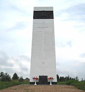
The towns of Bezhetsk, Pestovo, and Ustyuzhna, and the urban-type settlement of Maksatikha are on the banks of the Mologa River. A historic town of Mologa used to stand at the confluence of the Mologa river with the Volga, but it was submerged under water as the Rybinsk Reservoir was filled between 1939 and 1947. The town of Vesyegonsk was also previously on the banks of the Mologa, however, it was relocated when the Rybinsk Reservoir was filled, and is on the banks of the reservoir.

Pestovo, Pestovsky District, Novgorod Oblast Town in Novgorod Oblast, Russia

Pestovo is a town and the administrative center of Pestovsky District in Novgorod Oblast, Russia, located in the Valdai Hills on the Mologa River. Population: 15,903 (2010 Census); 15,990 (2002 Census); 15,941 (1989 Census).

Ustyuzhna Town in Vologda Oblast, Russia

Ustyuzhna is a town and the administrative center of Ustyuzhensky District in Vologda Oblast, Russia, located on the Mologa River, 260 kilometers (160 mi) west of Vologda, the administrative center of the oblast. Population: 9,501 (2010 Census); 10,507 (2002 Census); 10,035 (1989 Census).

Maksatikha Work settlement in Tver Oblast, Russia

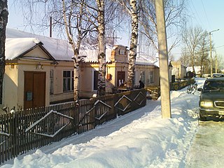
Maksatikha is an urban-type settlement and the administrative center of Maksatikhinsky District of Tver Oblast, Russia, with a population of 8,744 (2010 Census); 9,753 (2002 Census); 10,217 (1989 Census). It is located on the left bank of the Mologa River close to the mouth of the Volchina River.

The source of the Mologa is in the southeastern part of Maksatikhinsky District, in the eastern outskirts of Valdai Hills. The river flows east, enters Bezhetsky District, turns north, flows through the town of Bezhetsk, and flows into Lake Verestovo. It flows out of the lake in the western direction, reenters Maksatikhinsky District, flows through the urban-type settlement of Maksatikha and turns north. A stretch of the Mologa forms the border between Maksatikhinsky and Lesnoy Districts. The river crosses over to Lesnoy District, crosses it, flows at the border between Lesnoy and Sandovsky District and crosses into Novgorod Oblast. Downstream of the town of Pestovo the Mologa turns northeast and enters Vologda Oblast. There, it flows through the town of Ustyuzhna, accepts from the left the Kobozha and the Chagodoshcha, sharply turns southeast and flows into the Rybinsk Reservoir.

Valdai Hills mountain range

The Valdai Hills are an upland region in the north-west of central Russia running north-south, about midway between Saint Petersburg and Moscow, spanning Leningrad, Novgorod, Tver, Pskov, and Smolensk Oblasts.

The river basin of the Mologa comprises vast areas in the north of Tver Oblast, in the east of Novgorod Oblast, in the southeast of Leningrad Oblast (Boksitogorsky District), as well as the southeast of Vologda Oblast.

Leningrad Oblast First-level administrative division of Russia

Leningrad Oblast is a federal subject of Russia. It was established on August 1, 1927, although it was not until 1946 that the oblast's borders had been mostly settled in their present position. The oblast was named after the city of Leningrad. Unlike the city, the oblast retains the name of Leningrad.

Boksitogorsky District District in Leningrad Oblast, Russia

Boksitogorsky District is an administrative and municipal district (raion), one of the seventeen in Leningrad Oblast, Russia. It is located in the southeast of the oblast and borders with Tikhvinsky District in the north and west, Babayevsky District of Vologda Oblast in the east, Chagodoshchensky District of Vologda Oblast in the southeast, Khvoyninsky District of Novgorod Oblast in the south, and with Lyubytinsky District of Novgorod Oblast in the southwest. The area of the district is 7,200 square kilometers (2,800 sq mi). Its administrative center is the town of Boksitogorsk. Population : 15,695 (2010 Census); 17,698 ; 49,452 (1989 Census).

The lower course of the Mologa, downstream of the mouth of the Chagodoshcha, belongs to Tikhvinskaya water system, one of the waterways constructed in the early 19th century to connect the river basins of the Volga and the Neva. Currently, it is not used for any commercial navigation. [2]

The Tihvinskaya water system was one of the waterways connecting the Volga River with the Baltic Sea, and specifically the Mologa River with Syas River. In terms of the current administrative division of Russia, the waterway belongs to Vologda and Leningrad Oblasts.

Neva River river in Russia connecting Lake Ladoga and the Baltic Sea

The Neva is a river in northwestern Russia flowing from Lake Ladoga through the western part of Leningrad Oblast to the Neva Bay of the Gulf of Finland. Despite its modest length of 74 kilometres (46 mi), it is the fourth largest river in Europe in terms of average discharge.

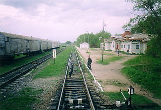
Until the 1990s, the Mologa was used for timber rafting. The timber collecting facilities were in Pestovo. [3]

Timber rafting log transportation method in which logs are tied together into rafts and drifted or pulled across a water body or down a flatter river

Timber rafting is a log transportation method in which logs are tied together into rafts and drifted or pulled across a water body or down a river. It is arguably the second cheapest method of transportation of timber, next after log driving. Both methods may be referred to as timber floating.

The river freezes up in late October through early December and stays under the ice until April or early May. [1]

Related Research Articles

Rybinsk Reservoir reservoir

Rybinsk Reservoir, informally called the Rybinsk Sea, is a water reservoir on the Volga River and its tributaries Sheksna and Mologa, formed by Rybinsk Hydroelectric Station dam, located in the Tver, Vologda, and Yaroslavl Oblasts. At the time of its construction, it was the largest man-made body of water on Earth. It is the northernmost point of the Volga. The Volga-Baltic Waterway starts from there. The principal ports are Cherepovets in Vologda Oblast and Vesyegonsk in Tver Oblast.

Vesyegonsk Town in Tver Oblast, Russia

Vesyegonsk is a town and the administrative center of Vesyegonsky District in Tver Oblast, Russia. Population: 7,329 (2010 Census); 8,662 (2002 Census); 9,574 (1989 Census).

Administratively, Tver Oblast is divided into two urban-type settlements under the federal government management, five cities and towns of oblast significance, and thirty-six districts.

Sit River river in Russia

The Sit' River (Сить) is a tributary of the Rybinsk Reservoir. The river flows for 159 kilometres (99 mi) through Sonkovsky District of Tver Oblast and Nekouzsky and Breytovsky Districts of Yaroslavl Oblasts of Russia before entering the Rybinsk Reservoir near the large village of Breitovo. Its average width varies from 40 to 50 metres. The river mouth is about 1,500 metres (4,900 ft) wide. The drainage basin occupies some 1,900 square kilometres (730 sq mi). The river is 159 kilometres (99 mi) long.

Pestovsky District is an administrative and municipal district (raion), one of the twenty-one in Novgorod Oblast, Russia. It is located in the east of the oblast and borders with Chagodoshchensky District of Vologda Oblast in the north, Ustyuzhensky District of Vologda Oblast in the northeast, Sandovsky District of Tver Oblast in the southeast, Lesnoy District of Tver Oblast in the south, Moshenskoy District in the west, and with Khvoyninsky District in the northwest. The area of the district is 2,120 square kilometers (820 sq mi). Its administrative center is the town of Pestovo. Population: 21,676 (2010 Census); 23,931 ; 25,331 (1989 Census). The population of Pestovo accounts for 73.4% of the district's total population.

Krasnokholmsky District District in Tver Oblast, Russia

Krasnokholmsky District is an administrative and municipal district (raion), one of the thirty-six in Tver Oblast, Russia. It is located in the northeast of the oblast and borders with Vesyegonsky District in the north, Breytovsky District of Yaroslavl Oblast in the northeast, Nekouzsky District, also of Yaroslavl Oblast, in the southeast, Sonkovsky District in the south, Bezhetsky District in the southwest, and with Molokovsky District in the northwest. The area of the district is 1,495 square kilometers (577 sq mi). Its administrative center is the town of Krasny Kholm. Population: 11,835 ; 14,736 (2002 Census); 18,813 (1989 Census). The population of Krasny Kholm accounts for 47.4% of the district's total population.

Lesnoy District District in Tver Oblast, Russia

Lesnoy District is an administrative and municipal district (raion), one of the thirty-six in Tver Oblast, Russia. It is located in the northeast of the oblast and borders with Pestovsky District of Novgorod Oblast in the north, Sandovsky District in the east, Maksatikhinsky District in the south, Udomelsky District in the southwest, and with Moshenskoy District of Novgorod Oblast in the northwest. The area of the district is 1,633 square kilometers (631 sq mi). Its administrative center is the rural locality of Lesnoye. Population: 5,252 ; 6,833 (2002 Census); 8,177 (1989 Census). The population of Lesnoye accounts for 31.7% of the district's total population.

Rameshkovsky District District in Tver Oblast, Russia

Rameshkovsky District is an administrative and municipal district (raion), one of the thirty-six in Tver Oblast, Russia. It is located in the eastern central part of the oblast and borders with Maksatikhinsky District in the north, Bezhetsky District in the northwest, Kashinsky District in the east, Kimrsky District in the southeast, Kalininsky District in the south, and with Likhoslavlsky District in the west. The area of the district is 2,511 square kilometers (970 sq mi). Its administrative center is the urban locality of Rameshki. Population: 14,988 ; 15,600 (2002 Census); 18,029 (1989 Census). The population of Rameshki accounts for 28.8% of the district's total population.

Sandovsky District District in Tver Oblast, Russia

Sandovsky District is an administrative and municipal district (raion), one of the thirty-six in Tver Oblast, Russia. It is located in the northeast of the oblast and borders with Ustyuzhensky District of Vologda Oblast in the north, Vesyegonsky District in the northeast, Molokovsky District in the southeast, Maksatikhinsky District in the south, Lesnoy District in the west, and with Pestovsky District of Novgorod Oblast in the northwest. The area of the district is 1,608 square kilometers (621 sq mi). Its administrative center is the urban locality of Sandovo. Population: 6,811 ; 9,385 (2002 Census); 12,495 (1989 Census). The population of Sandovo accounts for 51.5% of the district's total population.

Udomelsky District District in Tver Oblast, Russia

Udomelsky District is an administrative and municipal district (raion), one of the thirty-six in Tver Oblast, Russia. It is located in the north of the oblast and borders with Moshenskoy District of Novgorod Oblast in the north, Lesnoy District in the northeast, Maksatikhinsky District in the east, Vyshnevolotsky District in the south, Bologovsky District in the west, and with Borovichsky District of Novgorod Oblast in the west. The area of the district is 2,476.2 square kilometers (956.1 sq mi). Its administrative center is the town of Udomlya. Population: 40,292 ; 10,401 (2002 Census); 12,426 (1989 Census). The population of Udomlya accounts for 77.1% of the district's total population.

Vesyegonsky District District in Tver Oblast, Russia

Vesyegonsky District is an administrative and municipal district (raion), one of the thirty-six in Tver Oblast, Russia. It is located in the northeast of the oblast and borders with Cherepovetsky District of Vologda Oblast in the northeast, Breytovsky District of Yaroslavl Oblast in the southeast, Krasnokholmsky District in the south, Molokovsky District in the southwest, Sandovsky District in the west, and with Ustyuzhensky District of Vologda Oblast in the northwest. The area of the district is 2,047 square kilometers (790 sq mi). Its administrative center is the town of Vesyegonsk. Population: 13,481 ; 16,517 (2002 Census); 19,879 (1989 Census). The population of Vesyegonsk accounts for 54.4% of the district's total population.

Ustyuzhensky District District in Vologda Oblast, Russia

Ustyuzhensky District is an administrative and municipal district (raion), one of the twenty-six in Vologda Oblast, Russia. It is located in the southwest of the oblast and borders with Babayevsky District in the north, Kaduysky District in the northeast, Cherepovetsky District in the east, Vesyegonsky and Sandovsky Districts of Tver Oblast in the southeast, Pestovsky District of Novgorod Oblast in the southwest, and with Chagodoshchensky District in the west. The area of the district is 3,600 square kilometers (1,400 sq mi). Its administrative center is the town of Ustyuzhna. Population: 18,738 (2010 Census); 21,679 ; 22,483 (1989 Census). The population of Ustyuzhna accounts for 50.7% of the district's population.

Chagodoshcha River river in Leningrad and Vologda Oblasts, Russia

The Chagodoshcha is a river in Boksitogorsky District of Leningrad Oblast and in Chagodoshchensky, Babayevsky, and Ustyuzhensky Districts of Vologda Oblast in Russia. It is a left tributary of the Mologa River. It is 242 kilometres (150 mi) long, and the area of its basin 9,680 square kilometres (3,740 sq mi). The principal tributaries are the Lid (left), the Pes (right), and the Vnina (left).

Kobozha River river in Russia

The Kobozha is a river in Moshenskoy and Khvoyninsky Districts of Novgorod Oblast and in Chagodoshchensky and Ustyuzhensky Districts of Vologda Oblast in Russia. It is a left tributary of the Mologa River. It is 184 kilometres (114 mi) long, and the area of its basin 2,660 square kilometres (1,030 sq mi).

Osen River river in Russia, right tributary of the Mologa

The Osen is a river in Bezhetsky District of Tver Oblast in Russia. It is a major right tributary of the Mologa River. It is 8.7 kilometres (5.4 mi) long, and the area of its basin is 3,210 square kilometres (1,240 sq mi).

Volchina River river in Russia

The Volchina is a river in Vyshnevolotsky, Udomelsky, and Maksatikhinsky Districts of Tver Oblast in Russia. It is a left tributary of the Mologa River. It is 106 kilometres (66 mi) long, and the area of its basin 3,050 square kilometres (1,180 sq mi). The main tributaries are the Tifina River (left) and the Vorozhba River (right).

References

  1. 1 2 3 4 Молога (река). Great Soviet Encyclopedia.
  2. Хрусталев, М. Ю. (1999). По Тихвинской водной системе. Из истории водных коммуникаций и судоходства. Чагода: Историко-краеведческий альманах (in Russian). Vologda: Ардвисура. Retrieved 17 November 2012.
  3. Плечко, Л.А.; Сабанеева, И.П. (1973). Водные маршруты СССР. Европейская часть (in Russian). Moscow: Физкультура и спорт.